Jonesboro, Georgia
| Jonesboro, Georgia | |
|---|---|
| City | |
|
Buildings in the Jonesboro Historic District | |
 Location in Clayton County and the state of Georgia | |
 Jonesboro Location of Jonesboro in Metro Atlanta | |
| Coordinates: 33°31′28″N 84°21′15″W / 33.52444°N 84.35417°WCoordinates: 33°31′28″N 84°21′15″W / 33.52444°N 84.35417°W | |
| Country | United States |
| State | Georgia |
| County | Clayton |
| Area | |
| • Total | 2.7 sq mi (6.8 km2) |
| • Land | 2.6 sq mi (6.7 km2) |
| • Water | 0.1 sq mi (0.1 km2) |
| Elevation | 919 ft (280 m) |
| Population (2010) | |
| • Total | 4,724 |
| • Density | 1,418.1/sq mi (563.1/km2) |
| Time zone | Eastern (EST) (UTC-5) |
| • Summer (DST) | EDT (UTC-4) |
| ZIP codes | 30236-30238 |
| Area code(s) | 770/678/470 |
| FIPS code | 13-42604[1] |
| GNIS feature ID | 0332118[2] |
| Website | http://jonesboroga.com |

Jonesboro is a city in Clayton County, Georgia, United States. The population was 4,724 as of the 2010 census. The city is the county seat of Clayton County.[3]
The city's name was originally spelled Jonesborough. During the Civil War, the final skirmish in the Atlanta Campaign was fought here south of Atlanta, cutting off the city and forcing the mayor of Atlanta to surrender at Marietta in early September 1864. The final fall of Atlanta in the Battle of Jonesborough ended up being a decisive point in the nation's history, propelling Abraham Lincoln to re-election two months later, and continuing the war until the Confederacy finally surrendered the following year.
Geography
Jonesboro is located at 33°31′28″N 84°21′15″W / 33.52444°N 84.35417°W (33.524512, -84.354290).[4]
According to the United States Census Bureau, the city has a total area of 2.6 square miles (6.7 km2), of which 2.6 square miles (6.7 km2) is land and 0.1 square miles (0.26 km2) (1.89%) is water.
Infrastructure
Transit systems
MARTA and Xpress GA/Georgia RTA buses serve the city.
Demographics
| Historical population | |||
|---|---|---|---|
| Census | Pop. | %± | |
| 1870 | 531 | — | |
| 1880 | 1,048 | 97.4% | |
| 1890 | 803 | −23.4% | |
| 1900 | 877 | 9.2% | |
| 1910 | 970 | 10.6% | |
| 1920 | 1,060 | 9.3% | |
| 1930 | 1,065 | 0.5% | |
| 1940 | 1,204 | 13.1% | |
| 1950 | 1,741 | 44.6% | |
| 1960 | 3,014 | 73.1% | |
| 1970 | 4,105 | 36.2% | |
| 1980 | 4,132 | 0.7% | |
| 1990 | 3,635 | −12.0% | |
| 2000 | 3,829 | 5.3% | |
| 2010 | 4,724 | 23.4% | |
| Est. 2015 | 4,746 | [5] | 0.5% |
As of the census[1] of 2000, there were 3,829 people, 1,466 households, and 1,023 families residing in the city. The population density was 1,477.4 people per square mile (570.8/km²). There were 1,561 housing units at an average density of 602.3 per square mile (232.7/km²). The racial composition of the city was 72.79% African American, 20.63% White, 0.21% Native American, 0.73% Asian, 0.31% Pacific Islander, 3.45% from other races, and 1.88% from two or more races. Hispanic or Latino of any race were 7.55% of the population. In the past 2 years that population has doubled to about 15.86%.
There were 1,466 households out of which 34.1% had children under the age of 18 living with them, 38.6% were married couples living together, 25.6% had a female householder with no husband present, and 30.2% were non-families. 25.5% of all households were made up of individuals and 11.5% had someone living alone who was 65 years of age or older. The average household size was 2.60 and the average family size was 3.09.
In the city the population was spread out with 29.2% under the age of 18, 9.6% from 18 to 24, 29.6% from 25 to 44, 19.2% from 45 to 64, and 12.4% who were 65 years of age or older. The median age was 32 years. For every 100 females there were 84.1 males. For every 100 females age 18 and over, there were 78.1 males.
The median income for a household in the city was $31,951, and the median income for a family was $39,143. Males had a median income of $29,236 versus $25,797 for females. The per capita income for the city was $16,178. About 19.2% of families and 20.2% of the population were below the poverty line, including 33.9% of those under age 18 and 19.7% of those age 65 or over.
History
Jonesboro was founded as Leaksville in 1823. In 1846, the Macon and Western Railroad arrived into the area and the town was renamed in honor of railroad official Samuel G. Jones.[7]
Jonesboro was incorporated in 1859.[8]
Notable people
- Tashard Choice, former running back in National Football League
- Tameka Cottle, singer for R&B group Xscape
- Harry Douglas, wide receiver for the Tennessee Titans
- Toney Douglas, point guard for the Miami Heat
- Tauheed Epps : 2 Chainz, rapper
- Jesse Fuller, Afro-American blues musician
- Steve Lundquist, two-time gold medal swimmer in 1984 Olympics
- Thomas Milton Rivers, bacteriologist and virologist with the Rockefeller Institute, Rear Admiral of the U.S. Navy
- David Jones, SPC U.S. Army 2008-2013 (Afghanistan 2009-2010), Comedy and Cover musician.
- Dr. Robert W. McCullough, notable Optometrist, state Board, association President
Movies and literature
Many of the scenes from the 1977 film Smokey and the Bandit were filmed in Jonesboro. Another 1977 movie, the obscure 'In Hot Pursuit (aka The Polk County Pot Plane), was filmed in and around Jonesboro.
Tara, the fictional plantation in Margaret Mitchell's novel Gone with the Wind was supposed to be located approximately five miles outside of Jonesboro, the closest town.
"We Are Marshall" was briefly filmed at Tara Stadium in Jonesboro. The stadium was changed from green to light blue and light yellow for the scene.
Lynyrd Skynyrd's (pronounced 'lĕh-'nérd 'skin-'nérd) album cover was photographed near the corner of Mill and Main streets.
Landmark
Education
Clayton County Public Schools operates public schools.
References
- 1 2 "American FactFinder". United States Census Bureau. Retrieved 2008-01-31.
- ↑ "US Board on Geographic Names". United States Geological Survey. 2007-10-25. Retrieved 2008-01-31.
- ↑ "Find a County". National Association of Counties. Retrieved 2011-06-07.
- ↑ "US Gazetteer files: 2010, 2000, and 1990". United States Census Bureau. 2011-02-12. Retrieved 2011-04-23.
- ↑ "Annual Estimates of the Resident Population for Incorporated Places: April 1, 2010 to July 1, 2015". Retrieved July 2, 2016.
- ↑ "Census of Population and Housing". Census.gov. Retrieved June 4, 2015.
- ↑ Hellmann, Paul T. (May 13, 2013). "Historical Gazetteer of the United States". Routledge. p. 234. Retrieved 30 November 2013.
- ↑ "City History." (Archive) City of Jonesboro. Retrieved on September 21, 2012.
External links
Municipalities and communities of Clayton County, Georgia, United States | ||
|---|---|---|
| Cities | 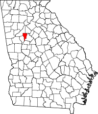 | |
| CDPs | ||
| Unincorporated communities | ||
| Footnotes | ‡This populated place also has portions in an adjacent county or counties | |

