Irondale, Georgia
| Irondale, Georgia | |
|---|---|
| Census-designated place | |
 Location in Clayton County and the state of Georgia | |
| Coordinates: 33°28′32″N 84°21′37″W / 33.47556°N 84.36028°WCoordinates: 33°28′32″N 84°21′37″W / 33.47556°N 84.36028°W | |
| Country | United States |
| State | Georgia |
| County | Clayton |
| Area | |
| • Total | 3.2 sq mi (8.3 km2) |
| • Land | 3.2 sq mi (8.2 km2) |
| • Water | 0.04 sq mi (0.1 km2) |
| Elevation | 837 ft (255 m) |
| Population (2010) | |
| • Total | 7,446 |
| • Density | 2,360/sq mi (911.3/km2) |
| Time zone | Eastern (EST) (UTC-5) |
| • Summer (DST) | EDT (UTC-4) |
| FIPS code | 13-41347[1] |
| GNIS feature ID | 1867243[2] |
Irondale is a census-designated place (CDP) in Clayton County, Georgia, United States. The population was 7,446 at the 2010 census.[3]
Geography
Irondale is located south of the center of Clayton County at 33°28′32″N 84°21′37″W / 33.47556°N 84.36028°W (33.475430, -84.360326).[4] U.S. Routes 19 and 41 form the eastern edge of the CDP and lead north 3 miles (5 km) to Jonesboro, the county seat. Downtown Atlanta is 20 miles (32 km) to the north.
According to the United States Census Bureau, the Irondale CDP has a total area of 3.2 square miles (8.3 km2), of which 3.2 square miles (8.2 km2) is land and 0.04 square miles (0.1 km2), or 1.47%, is water.[3]
Demographics
As of the census[1] of 2000, there were 7,727 people, 2,543 households, and 2,049 families residing in the CDP. The population density was 2,414.8 people per square mile (932.3/km²). There were 2,649 housing units at an average density of 827.8/sq mi (319.6/km²). The racial makeup of the CDP was 46.84% White, 47.09% African American, 0.49% Native American, 1.92% Asian, 0.01% Pacific Islander, 1.53% from other races, and 2.12% from two or more races. Hispanic or Latino of any race were 4.18% of the population.
There were 2,543 households out of which 50.9% had children under the age of 18 living with them, 57.0% were married couples living together, 18.4% had a female householder with no husband present, and 19.4% were non-families. 15.6% of all households were made up of individuals and 1.6% had someone living alone who was 65 years of age or older. The average household size was 3.04 and the average family size was 3.37.
In the CDP the population was spread out with 33.5% under the age of 18, 8.8% from 18 to 24, 38.3% from 25 to 44, 15.9% from 45 to 64, and 3.5% who were 65 years of age or older. The median age was 30 years. For every 100 females there were 91.2 males. For every 100 females age 18 and over, there were 85.5 males.
The median income for a household in the CDP was $49,386, and the median income for a family was $51,152. Males had a median income of $35,967 versus $27,577 for females. The per capita income for the CDP was $18,186. About 7.2% of families and 8.8% of the population were below the poverty line, including 13.4% of those under age 18 and 5.6% of those age 65 or over.
References
- 1 2 "American FactFinder". United States Census Bureau. Retrieved 2008-01-31.
- ↑ "US Board on Geographic Names". United States Geological Survey. 2007-10-25. Retrieved 2008-01-31.
- 1 2 "Geographic Identifiers: 2010 Demographic Profile Data (G001): Irondale CDP, Georgia". U.S. Census Bureau, American Factfinder. Retrieved July 28, 2014.
- ↑ "US Gazetteer files: 2010, 2000, and 1990". United States Census Bureau. 2011-02-12. Retrieved 2011-04-23.
Municipalities and communities of Clayton County, Georgia, United States | ||
|---|---|---|
| Cities | 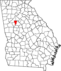 | |
| CDPs | ||
| Unincorporated communities | ||
| Footnotes | ‡This populated place also has portions in an adjacent county or counties | |