Roswell, Georgia
| Roswell, Georgia | |
|---|---|
| City | |
|
Roswell City Hall | |
 Location in Fulton County and the state of Georgia | |
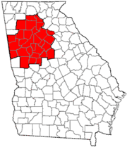
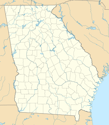 Roswell  Roswell  Roswell Location of Roswell in Metro Atlanta | |
| Coordinates: 34°01′19″N 84°21′33″W / 34.02194°N 84.35917°WCoordinates: 34°01′19″N 84°21′33″W / 34.02194°N 84.35917°W | |
| Country | United States |
| State | Georgia |
| County | Fulton |
| Incorporated | February 16, 1854 |
| Government | |
| • Mayor | Jere Wood (R) |
| Area | |
| • Total | 42.0 sq mi (108.8 km2) |
| • Land | 40.7 sq mi (105.5 km2) |
| • Water | 1.3 sq mi (3.3 km2) 3.1% |
| Elevation | 1,180 ft (350 m) |
| Population (2010)[1] | |
| • Total | 88,346 |
| • Estimate (2014) | 94,089 |
| • Density | 2,311/sq mi (892.1/km2) |
| Time zone | EST (UTC-5) |
| • Summer (DST) | EDT (UTC-4) |
| ZIP codes | 30075-30077 |
| Area code | 770/678/404 |
| FIPS code | 13-67284[2] |
| GNIS feature ID | 0332929[3] |
| Website |
www |

Roswell is a city in north Fulton County, Georgia, United States. At the 2010 census it had a population of 88,346, and in 2014 the estimated population was 94,089, making it Georgia's seventh largest city.[1][4]
History

In 1830, while on a trip to northern Georgia, Roswell King passed through the area of what is now Roswell and observed the great potential for building a cotton mill along Vickery Creek. Since the land nearby was also good for plantations, his idea was to put cotton processing near cotton production.
Toward the middle of the 1830s, King returned to build a mill that would soon become the largest in north Georgia – Roswell Mill. He brought with him 36 African slaves from his own coastal plantation, plus another 42 skilled carpenter slaves bought in Savannah to build the mills. The slaves built the mills, infrastructure, houses, mill worker apartments, and supporting buildings for the new town. The Africans brought their unique Geechee culture, language, and religious traditions from the coast to north Georgia.
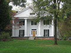
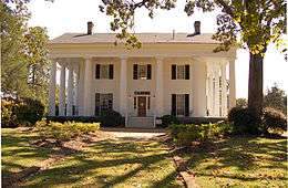
King invited investors from the coast to join him at the new location. He was also joined by Barrington King, one of his sons, who succeeded his father in the manufacturing company. Archibald Smith was one of the planters who migrated there to establish a new plantation, also bringing enslaved African Americans from the coastal areas.
Barrington Hall (the home of Barrington King), Smith Plantation (the home of Archibald Smith) and Bulloch Hall (the childhood home of President Theodore Roosevelt's mother, Mittie Bulloch) have been preserved and restored. They are now open to the public. According to the 1850 Slave Schedules, these three "founding families", together with the next three largest planters, held 192 slaves, 51% of the total 378 slaves held in Roswell District. Archibald Smith had a 300-acre (1.2 km2) cotton plantation. According to the 1850 Census, Barrington King held 70 slaves. Half of these slaves were under the age of 10. These slaves worked in Barrington's household. Barrington King "leased" or "rented" some of his adult male slaves to the Roswell Manufacturing Company, but they did not work around the mill machinery.
The Roswell area was part of Cobb County when first settled, and the county seat of Marietta was a four-hour (one-way) horseback ride to the west. Since Roswell residents desired a local government, they submitted a city charter for incorporation to the Georgia General Assembly. The charter was approved on February 16, 1854.
By the time of the Civil War, the cotton mills employed more than 400 people, mostly women. Given settlement patterns in the Piedmont region, they were likely of Scots-Irish descent. As the mill increased in production, so did the number of people living in the area.

During the Civil War, the city was captured by Union forces under the leadership of General Kenner Garrard. Under orders of General Sherman, Garrard shipped the mill workers north to prevent them from returning to work if the mills were rebuilt. This was a common tactic of Sherman to economically disrupt the South. The mill was burned, but the houses were left standing. The ruins of the mill and the 30-foot (9.1 m) dam that was built for power still remain. Most of the town's property was confiscated by Union forces. The leading families had left the town to go to safer places well before the Federal invasion, and arranged for their slaves to be taken away from advancing Federal troops, as was often the practice. Some slaves may have escaped to Union lines.
After the war, Barrington King rebuilt the mills and resumed production. While many freedmen stayed in the area to work as paid labor on plantations or in town, others migrated to Fulton County and Atlanta for new opportunities. The South suffered an agricultural depression resulting from the effects of the war and labor changes.
According to the census, the population of Cobb County decreased slightly from 14,242 in 1860, to 13,814 in 1870. The proportion of African-Americans decreased more, from 27% to 23%. During those years, nearby Fulton County more than doubled in population, from 14,427 to 33,336. The effects of dramatic African-American migration can be seen by the increase in Fulton County from 20.5% slave in 1860 to 45.7% colored (Black) in 1870.
At the end of 1931, the United States was in the midst of the Great Depression. The difficult economic conditions drove Milton County, Roswell's neighboring county to the north (note: much of what is now Roswell was part of Milton County already), to merge in its entirety with Fulton County, Roswell's neighboring county to the south. To facilitate the merger, Roswell was ceded from Cobb County to become part of Fulton County. This became effective the 9th day of May in 1932. Roswell filed all legal records, including vital statistics, real estate, and the results of torts with the county clerk of Cobb before this date; with the county clerk of Fulton, after this date.
Roswell is now one of the largest cities in the state; its population has increased most steadily in the last 15 years.
Jere Wood, a Republican, has served as mayor of Roswell since 1997.
- See also: List of Mayors of Roswell, Georgia
Geography
Roswell is located in northern Fulton County at 34°2′2″N 84°20′39″W / 34.03389°N 84.34417°W (34.033896, −84.344028).[5] It is bordered to the north by Milton, to the northeast by Alpharetta, to the east by Johns Creek, to the southeast by Peachtree Corners in Gwinnett County, to the south by Sandy Springs, to the west by unincorporated land in Cobb County, and to the northwest by the city of Mountain Park and by unincorporated land in Cherokee County. The southern boundary of the city follows the Chattahoochee River. It is the most populous city in Georgia with less than 100,000 people.
According to the United States Census Bureau, Roswell has a total area of 42.0 square miles (108.8 km2), of which 40.7 square miles (105.5 km2) is land and 1.3 square miles (3.3 km2), or 3.06%, is water.[1]
Geographic features
- Big Creek
- Bull Sluice Lake
- Chattahoochee River
- Morgan Falls Dam
- Johns Creek
- Crooked Creek
- Audery Mill Creek
Climate
| Climate data for Roswell, Georgia | |||||||||||||
|---|---|---|---|---|---|---|---|---|---|---|---|---|---|
| Month | Jan | Feb | Mar | Apr | May | Jun | Jul | Aug | Sep | Oct | Nov | Dec | Year |
| Average high °F | 49.0 | 53.8 | 62.8 | 71.5 | 78.2 | 84.6 | 87.3 | 86.7 | 81.2 | 71.8 | 62.6 | 53.0 | 70.2 |
| Average low °F | 27.0 | 29.4 | 36.4 | 44.2 | 53.0 | 60.9 | 65.1 | 64.6 | 58.6 | 45.6 | 37.3 | 30.3 | 46.0 |
| Average rainfall inches | 5.2 | 4.9 | 6.0 | 4.6 | 4.7 | 3.7 | 4.8 | 4.1 | 3.6 | 3.5 | 3.8 | 4.8 | 53.8 |
| Average high °C | 9.4 | 12.1 | 17.1 | 21.9 | 25.7 | 29.2 | 30.7 | 30.4 | 27.3 | 22.1 | 17 | 11.7 | 21.2 |
| Average low °C | −2.8 | −1.4 | 2.4 | 6.8 | 11.7 | 16.1 | 18.4 | 18.1 | 14.8 | 7.6 | 2.9 | −0.9 | 7.8 |
| Average rainfall mm | 132 | 124 | 152 | 117 | 119 | 94 | 122 | 104 | 91 | 89 | 97 | 122 | 1,367 |
| Source: [6] | |||||||||||||
Demographics
| Historical population | |||
|---|---|---|---|
| Census | Pop. | %± | |
| 1870 | 479 | — | |
| 1880 | 1,180 | 146.3% | |
| 1890 | 1,138 | −3.6% | |
| 1900 | 1,329 | 16.8% | |
| 1910 | 1,158 | −12.9% | |
| 1920 | 1,227 | 6.0% | |
| 1930 | 1,432 | 16.7% | |
| 1940 | 1,622 | 13.3% | |
| 1950 | 2,123 | 30.9% | |
| 1960 | 2,983 | 40.5% | |
| 1970 | 5,430 | 82.0% | |
| 1980 | 23,337 | 329.8% | |
| 1990 | 47,923 | 105.4% | |
| 2000 | 79,334 | 65.5% | |
| 2010 | 88,346 | 11.4% | |
| Est. 2015 | 94,501 | [7] | 7.0% |
As of 2010 Roswell had a population of 88,346. The racial and ethnic composition of the population was 74.7% White, 11.7% Black or African American, 4.0% Asian, 0.3% Native American, 0.1% Pacific Islander, 6.6% from some other race and 2.5% from two or more races. 16.6% of the population was Hispanic or Latino of any race; a majority of them were of Mexican origin (11.5% of the total population).[9]
As of the census[2] of 2000, there were 79,334 people, 30,207 households, and 20,933 families residing in the city. The population density was 2,086.5 people per square mile (805.7/km²). There were 31,300 housing units at an average density of 823.2 per square mile (317.9/km²). The racial makeup of the city was 81.51% White, 8.54% African American, 0.20% Native American, 3.74% Asian, 0.03% Pacific Islander, 4.08% from other races, and 1.90% from two or more races. Hispanic or Latino of any race were 10.61% of the population.
There were 30,207 households out of which 34.6% had children under the age of 18 living with them, 57.1% were married couples living together, 8.6% had a female householder with no husband present, and 30.7% were non-families. 23.1% of all households were made up of individuals and 4.5% had someone living alone who was 65 years of age or older. The average household size was 2.61 and the average family size was 3.07.
In the city the population was spread out with 24.4% under the age of 18, 8.2% from 18 to 24, 35.1% from 25 to 44, 24.7% from 45 to 64, and 7.5% who were 65 years of age or older. The median age was 37.2 years. For every 100 females there were 100.0 males. For every 100 females age 18 and over, there were 98.0 males.
According to a 2007 estimate, the median income for a household in the city was $73,469, and the median income for a family was $103,698. The average income for households was $106,219 and the average income for families was $123,481. Males had a median income of $72,754 versus $45,979 for females. The per capita income for the city was $40,106. About 3.2% of families and 5.0% of the population were below the poverty line, including 5.6% of those under age 18 and 0.7% of those age 65 or over.[10]
Household income (2010)[11]
| Income | Percent |
|---|---|
| under $14,999 | 3.8% |
| $15,000 – $34,999 | 3.7% |
| $35,000 – $74,999 | 14.4% |
| $75,000 – $99,999 | 17.9% |
| $100,000 – $149,999 | 24.3% |
| $150,000 – $199,999 | 6.9% |
| $200.000 + | 11.0% |
Household income (2010)[11]
| Median | $87,080 |
| Per Capita | $43,286 |
| Mean | $117,088 |
| Average Family Size | 3.23 |
| Average Household Size | 2.70 |
Roswell Median Housing Value[11]
| Year | Value |
|---|---|
| 1990 | $143,497 |
| 2000 | $207,700 |
| 2005 | $299,000 |
2000 Population by Age[11]
| Age | Percent |
|---|---|
| Under 5 | 6.8% |
| 5–9 | 7.9% |
| 10–19 | 12.7% |
| 20–29 | 9.8% |
| 30–39 | 19.4% |
| 40–49 | 17.2% |
| 50–59 | 13.9% |
| 60–69 | 5.5% |
| 70 and over | 4.4% |
| Not Known | 2.4% |
| Median Age | 37.2 |
Population by Gender (2006)[11]
| Gender | Percent |
|---|---|
| Male | 49.2% |
| Female | 50.8% |
Education[11]
| Level | Percent |
|---|---|
| Less than High School | 5.1% |
| High School Graduate | 12.8% |
| Associate degree | 6.1% |
| Bachelor's Degree | 40.3% |
| Graduate Degree | 18.8% |
Race and ethnicity[11]
| Ethnicity | Percent |
|---|---|
| American Indian, Eskimo, Aleut | 0.9% |
| Asian | 4.4% |
| Black | 12.4% |
| White | 73.9% |
| Other | 6.3% |
| Hispanic | 14.8% |
CNN named Roswell #76 for its list of the Top 100 Places to Live in the US in 2010.[12]
Named One of the Top Three Cities in the Nation to Raise Your Family. Roswell was listed third in the book, Best Places to Raise Your Family, released by Frommer's.[13]
On October 30, 2006, the City of Roswell was named the 18th Safest City in the United States by City Crime Rankings, an annual reference book of crime statistics and rankings published by Morgan Quitno Press. Roswell was selected from 371 cities in the Overall Safest 25 category.
Economy
The Consulate-General of Honduras in Atlanta is located at Suite 3 in 600 Houze Way in Roswell.[14] The city's largest employers are The Kimberly Clark Corporation, North Fulton Regional Hospital, Harry's Farmers Market, and The City Of Roswell.[15] A section of route 400 between Roswell and Atlanta is known as the high tech corridor, where many technology firms like Kimberly Clark have factories or offices.[16] As of the 2006 census one third of Roswell's 5.000 registered business were home based. The largest industries were retail, technology, food services, whole sale trade, and health care.[16]
Many Roswell residents work in nearby Atlanta.[16]
Businesses with their headquarters in Roswell including Snorg Tees,[17] Tripwire Interactive,[18] and Pharsalia Technologies.[19] Roswell's economy is large enough to recruit franchises from many popular Georgia business like Chick Fil A[20] and Heel Sew Quik[21] operate multiple locations in Roswell.[22][23]
In 2015 Roswell was ranked 224 for economic growth among small American cities.[24]
Tourism
Tourists visit the following notable places:
- Historic Roswell Visitors Center[25]
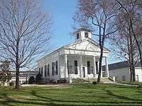
- Archibald Smith Plantation Home
- Bulloch Hall
- Barrington Hall
- Chattahoochee River National Recreation Area
- Chattahoochee Nature Center
- Faces Of War Memorial
- Primrose Cottage
- Teaching Museum North
- Atlanta Rowing Club
- Holly Hill
Parks and recreation

The Roswell Recreation and Parks department has 18 parks with 800 acres (3.2 km2) of active and passive parkland and facilities. The goals of the department are to promote a sense of community spirit and athleticism in the youth of Roswell partnering with many local middle and high schools to achieve its goals by lending practice fields and athletic coaches throughout the year.
A branch of the Chattahoochee River National Recreation Area, a component of the National Park System, is located in Roswell at Vickery Creek.
Festivals and parades
- Roswell Memorial Day Ceremony — the largest Memorial Day Ceremony in Georgia
- Roswell Roots: A Festival of Black History & Culture (February)
- Roswell Criterium Bicycle Race and Historic Roswell Kiwanis Kids Bike Safety Rodeo (May)
- Roswell Magnolia Storytelling Festival (June)
- Riverside Sounds Concert Series (May — October)
- Roswell Youth Day Parade and Festival (October)
- Keep Roswell Beautiful Duck Race (October)
- Roswell Annual Fireworks Extravaganza July 4
- Roswell Wine Festival (first Sunday in October - Sunday, October 4, 2015)[26]
Education
Primary and secondary schools
Public schools
Roswell's local public schools are part of the Fulton County School System.
Charter schools:
- Amana Academy (K-8)
Elementary schools:
- Esther Jackson Elementary School
- Hembree Springs Elementary School
- Mimosa Elementary School
- Mountain Park Elementary School
- Northwood Elementary School
- Roswell North Elementary School
- Sweet Apple Elementary School
- Hillside Elementary School
- River Eves Elementary School
Middle schools:
- Crabapple Middle School
- Elkins Pointe Middle School
- Holcomb Bridge Middle School
High schools:

Private schools
- Creative Montessori School
- Blessed Trinity Catholic High School
- Chrysalis Experiential Academy
- Cottage School
- Cross of Life Montessori School
- Eaton Academy
- Fellowship Christian School
- High Meadows School
- Queen of Angels Catholic School
- Village Montessori
- The Howard School (North Campus)
- St. Francis High School
- Jacob's Ladder Neurodevelopmental School & Therapy Center
Public libraries
Atlanta-Fulton Public Library System operates the Roswell Branch and the East Roswell Branch.[27]
Infrastructure
Major highways
Notable people
- Jerome Bettis, Pittsburgh Steeler and current NBC Sports announcer.[28]
- Jay Busbee, American author/journalist, resides in Roswell.[28]
- Emily Dolvin, aunt of Jimmy Carter (the 39th U.S. President), lived in Roswell the majority of her life and was the inaugural chairwoman of the Roswell Historical Society.
- Karen Handel, former Georgia Secretary of State, resides in Roswell.[28]
- Landon Milbourne (born 1987), basketball player for Hapoel Eilat of the Israeli Basketball Premier League[29]
- Martha Bulloch Roosevelt, the mother of Theodore Roosevelt (the 26th US President) and grandmother of Eleanor Roosevelt, came from Roswell. Bulloch Hall was her home.[30]
- Architect Neel Reid lived in Mimosa Hall and died there in 1926.[31]
- Two-time National League MVP, former Atlanta Braves baseball player Dale Murphy, lived in Roswell in the 1980s.
- In 2006, Tom Price was re-elected to a second term in the United States House of Representatives to serve as the Congressman from the 6th congressional district of Georgia, the district that encompasses most of Roswell.[32]
References
- 1 2 3 "Geographic Identifiers: 2010 Census Summary File 1 (G001), Roswell city, Georgia". American FactFinder. U.S. Census Bureau. Retrieved April 29, 2016.
- 1 2 "American FactFinder". United States Census Bureau. Retrieved 2008-01-31.
- ↑ "US Board on Geographic Names". United States Geological Survey. 2007-10-25. Retrieved 2008-01-31.
- ↑ "Annual Estimates of the Resident Population for Incorporated Places: April 1, 2010 to July 1, 2014". Retrieved June 4, 2015.
- ↑ "US Gazetteer files: 2010, 2000, and 1990". United States Census Bureau. 2011-02-12. Retrieved 2011-04-23.
- ↑ "ROSWELL, GEORGIA". weatherbase. Retrieved May 2014. Check date values in:
|access-date=(help) - ↑ "Annual Estimates of the Resident Population for Incorporated Places: April 1, 2010 to July 1, 2015". Retrieved July 2, 2016.
- ↑ "Census of Population and Housing". Census.gov. Retrieved June 4, 2015.
- ↑ 2010 general profile of demographic and housing characteristics of Roswell from the US Census
- ↑
- 1 2 3 4 5 6 7 "City of Roswell: Demographics". City of Roswell. Retrieved January 19, 2009.
- ↑ "CNNMoney.com Best Places to Live Roswell Snapshot". Retrieved September 20, 2012.
- ↑ Sperling, Bert; Peter Sander (May 8, 2006). Best Places to Raise Your Family: The Top 100 Affordable Communities in the U.S. Frommer's (1st ed.). John Wiley & Sons. ISBN 0-471-74699-1.
- ↑ "Consulates". 'Georgia Department of Economic Development. Retrieved October 26, 2008.
- ↑ "Roswell GA Top Employers". MBA Today. City Of Roswell Economic Development Division. Retrieved 17 November 2015.
- 1 2 3 "Business And Industry In Roswell GA". roswell.org. City Of Roswell. Retrieved 17 November 2015.
- ↑ "Snorg Tees". Snorg Tees. Snorg Tees. Retrieved 17 November 2015.
- ↑ "Tripwire Interactive Official Linked In Page". linked in. Tripwire Interactive. Retrieved 17 November 2015.
- ↑ Atlanta Business Chronicle. Atlanta Business Chronicle http://www.bizjournals.com/atlanta/stories/2000/07/17/daily29.html. Retrieved 17 November 2015. Missing or empty
|title=(help) - ↑ "Chick Fil A Locations". Chick Fil A. Chick Fil A. Retrieved 17 November 2015.
- ↑ "Heel Sew Quik Roswell GA Yelp". Yelp. Yelp. Retrieved 17 November 2015.
- ↑ "Dr Roof Atlanta/Roswell". Dr Roof Contact. Dr Roof. Retrieved 17 November 2015.
- ↑ "Replacement Windows And Doors". Replacement Windows And Doors Atlanta. American Choice Windows And Doors. Retrieved 17 November 2015.
- ↑ "2015 Cities With Fastest Growing Economies". Wallet Hub. Wallet Hub. Retrieved 17 November 2015.
- ↑ "Historic Roswell Visitors Center". Georgia Department of Economic Development.
- ↑ http://www.roswellwinefestival.com
- ↑ "Roswell BranchAtlanta-Fulton Public Library System. Retrieved on February 24, 2010.
- 1 2 3 Vejnoska, Jill (July 23, 2006). "The Bus now living in Atlanta". Atlanta Journal-Constitution. Archived from the original on September 28, 2007. Retrieved April 10, 2007.
- ↑
- ↑ "Official Bulloch Hall Website". Retrieved January 22, 2015.
- ↑ Craig, Robert M. (December 11, 2014). "Neel Reid (1885-1926)". Georgia Encyclopedia. Retrieved January 22, 2015.
- ↑ "Tom Price". Tom Price. July 23, 2006. Retrieved April 10, 2007.
Further reading
- Sherron D. Lawson, A Guide to the Historic Textile Mill Town of Roswell, Georgia (Roswell, Ga.: Roswell Historical Society, 1996).
- Darlene M. Walsh, ed. (1994) [1985]. Roswell: A Pictorial History (2nd ed.). Roswell, Georgia: Roswell Historical Society. ISBN 0-9615854-2-0.
External links
| Wikimedia Commons has media related to Roswell, Georgia. |
- City of Roswell official website
- The New Georgia Encyclopedia entry for Roswell, Georgia
- Roswell Convention & Visitors Bureau: Brief History of Roswell
- Roswell Memorial Day Celebration
- Roswell Recreation and Parks
- Archibald Smith Plantation House
- Bulloch Hall
- 1850 US Census Slave Schedules, Cobb Co, Georgia
- Historical Census Browser, 1860 and 1870 US Census, Cobb Co., Georgia and Fulton Co., Georgia
- Historic Roswell Convention & Visitors Bureau
- History of Roswell, Georgia
- Chattahoochee Nature Center
- Roadside Georgia's list of things to do in Roswell
- State of Georgia website info on Roswell
- Georgiainfo.com maps of Fulton County and surrounding area over the years
- Historic Roswell Square historical marker
- Roswell Presbyterian Church historical marker
- Roswell's Distinguished Men historical marker

Municipalities and communities of Fulton County, Georgia, United States | ||
|---|---|---|
| Cities | 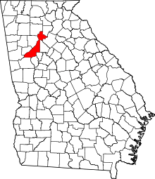 | |
| Unincorporated communities | ||
| Footnotes | ‡This populated place also has portions in an adjacent county or counties | |
|  | |||||||
|
| ||||||||
| ||||||||
Template:Georgia