Godofredo P. Ramos Airport
| Godofredo P. Ramos Airport Paeuparan it Godofredo P. Ramos (Aklanon) Hulugpaan sang Godofredo P. Ramos (Hiligaynon) Paliparang Godofredo P. Ramos (Tagalog) | |||||||||||
|---|---|---|---|---|---|---|---|---|---|---|---|
|
| |||||||||||
|
Facade of Boracay Airport Terminal. | |||||||||||
| IATA: MPH – ICAO: RPVE | |||||||||||
| Summary | |||||||||||
| Airport type | Public | ||||||||||
| Owner | Civil Aviation Authority of the Philippines | ||||||||||
| Operator | Transaire Development Holdings Corporation | ||||||||||
| Serves | Malay, Aklan | ||||||||||
| Location | Barangay Caticlan, Malay, Aklan | ||||||||||
| Elevation AMSL | 5 m / 16 ft | ||||||||||
| Coordinates | 11°55′29″N 121°57′18″E / 11.92472°N 121.95500°ECoordinates: 11°55′29″N 121°57′18″E / 11.92472°N 121.95500°E | ||||||||||
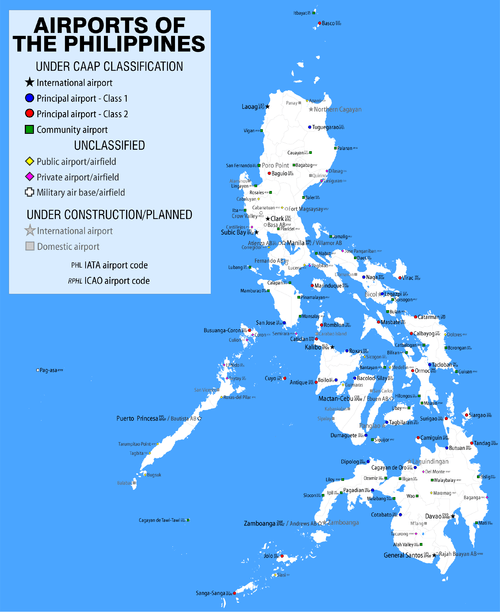
| Map | |||||||||||
.svg.png) MPH/RPVE Location in the Philippines | |||||||||||
| Runways | |||||||||||
| |||||||||||
| Statistics (2010) | |||||||||||
| |||||||||||
|
Statistics from the Civil Aviation Authority of the Philippines.[1] | |||||||||||

Godofredo P. Ramos Airport (Aklanon: Paeuparan it Godofredo P. Ramos, Hiligaynon: Hulugpaan sang Godofredo P. Ramos, Tagalog: Paliparang Godofredo P. Ramos) (IATA: MPH, ICAO: RPVE), also known as Caticlan Airport and recently, Boracay Airport by its developer Transaire, is an airport serving the general area of the municipality of Malay, located in the province of Aklan in the Philippines. It is one of the two gateways to Boracay, one of the Philippines' best-known tourist destinations. The airport is classified as a Class 2 Principal airport by the Civil Aviation Authority of the Philippines.
The airport is the seventh busiest airport in the Philippines and the third-busiest in the Western Visayas region, serving 761,961 passengers in 2008.
Since November 8, 2002, the airport has been named after the late Godofredo P. Ramos, a former member of Congress and a native of Malay. However, the name Caticlan Airport derives from its location in Barangay Caticlan in the municipality of Malay.
Future development

The National Economic and Development Authority has approved the expansion of Godofredo P. Ramos Airport, which will be undertaken by a private company called the Caticlan International Airport and Development Corporation.[2] The P2.5-billion expansion of the airport entails two stages: the construction of a new passenger terminal in the first stage, costing some P2.1 billion, and the extension of the existing runway to 2,100 meters as well as upgrading airport equipment and the existing apron, costing some P360 million.[2]
Solicited as a Build-Operate-Transfer project and financed by a 70-30 mixture of bank loan and private sector equity,[2] around 25 percent of the allocated funds would be used to clear a mountain near the airport's proximity, while an additional 18 percent would be allocated for land reclamation to accommodate an extended runway.[3]
The airport terminal was renovated in 2011 and was inaugurated on July 25, 2011 with President Benigno Aquino III leading the inauguration.[4]
The upgrading works would enable the airport not only to support jet aircraft but also to serve international destinations. Despite earlier estimates of this working being completed in 2011[3] and later between 2012 and 2014,[2] no visible progress has been made as of February 2013.
On January 1, 2014, it was reported that the San Miguel Corp. said it would complete the extension of Boracay Airport’s runway by the end of the year. The runway would be extended from 950 meters to 2,100 meters.[5]
On November 18, 2016, flag carrier Philippine Airlines landed its first Airbus A320, which marked the opening of the extended runway.[6] Cebu Pacific followed suit on November 22, 2016, landing its first A320 as flight 5J 899/900.
Incidents and accidents
- On July 19, 2005, Interisland Airlines aircraft RP-C2803, an arriving Yakovlev 40A aircraft touched down short of runway 06. A tire burst as it struck the raised lip of the runway. When removing the airplane from the runway the undercarriage collapsed, causing substantial damage to the aircraft. The aircraft was occupied by 3 crew and 20 passengers. There were no fatalities.[7]
- On November 2, 2006, Interisland Airlines aircraft RP-C2695, a Yakovlev 40A aircraft, arrived to pick up a group of tourists. On landing at runway 06, the left main gear tire burst. The aircraft started to swerve to the left, towards the apron were a DHC-7 had just started engines. The crew avoided collision with the DHC-7. After passing the apron, the Yak-40 drifted sideways entering the grass on the left side of the runway. Because of lateral forces, the right main gear collapsed. The aircraft came to rest on the edge of the runway. After three hours the airplane was towed off the runway into the grass. On arrival, the aircraft had no passengers. There were no fatalities.[8]
- On January 11, 2009, Zest Airways Flight 865, a Xian MA60 with 22 passengers three crew aboard, undershot runway 06 when it landed, swerved sharply to the left when it touched the runway after the initial impact and hit a concrete barrier seriously damaging its nose. The plane's landing gears and propellers also suffered major damage. Three people were injured. There were no fatalities.[9]
- On June 25, 2009, Zest Airways Flight 863, a Xian MA60 with 54 passengers and five crew aboard, overshot the runway when it landed at Godofredo P. Ramos Airport. The aircraft totally lost its braking capability, causing it to overshoot Runway 24. There were no injuries.[10]
Airlines and destinations
| Airlines | Destinations |
|---|---|
| Air Juan | Busuanga |
| Cebgo | Cebu, Manila |
| Cebu Pacific | Manila |
| Philippine Airlines operated by PAL Express | Clark, Cebu (both begin December 16, 2016), [11] Manila |
| SkyJet | Manila |
References
- ↑ "Passenger Statistics 2009" (PDF). May 14, 2010. Retrieved April 21, 2009.
- 1 2 3 4 New Caticlan airport terminal OK’ed, The Manila Times, January 22, 2008
- 1 2 Airport near Boracay up for P2.5-b expansion, Manila Standard Today, January 22, 2008
- ↑ http://iloilonewstoday.com/index.php/the-front-page/iloilo/2772-pnoy-opens-new-caticlan-airport-terminal
- ↑ "Caticlan runway set for upgrade". Philippine Daily Inquirer. Jan 1, 2014. Retrieved Jan 2, 2014.
- ↑ "Philippine Airlines landed its first ever A320 in the new Boracay Caticlan Airport". Mark Joseph Diamzon. Nov 18, 2016. Retrieved Nov 19, 2016.
- ↑ Accident description, Aviation Safety Network
- ↑ Accident description, Aviation Safety Network
- ↑ Accident, Aviation Safety Network
- ↑ Accident description, Aviation Safety Network
- ↑ 2016, UBM (UK) Ltd. "Philippine Airlines expands Caticlan routes from Dec 2016".
External links
| Wikimedia Commons has media related to Godofredo P. Ramos Airport. |
- Airport information for RPVE at World Aero Data. Data current as of October 2006.Source: DAFIF.
- Airport information for RPVE at Great Circle Mapper. Source: DAFIF (effective October 2006).
- Accident history for MPH at Aviation Safety Network