Juvatn
| Juvatn | |
|---|---|
| Gjuvvatnet | |
 Juvatn  Juvatn | |
| Location | Åseral, Vest-Agder |
| Coordinates | 58°49′48″N 07°30′32″E / 58.83000°N 7.50889°E / 58.83000; 7.50889 |
| Basin countries | Norway |
| Max. length | 6.2 kilometres (3.9 mi) |
| Max. width | 2.4 kilometres (1.5 mi) |
| Surface area | 8.06 km2 (3.11 sq mi) |
| Shore length1 | 23.79 kilometres (14.78 mi) |
| Surface elevation | 513 metres (1,683 ft) |
| References | NVE |
| 1 Shore length is not a well-defined measure. | |
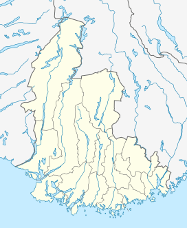
Juvatn or Gjuvvatnet is a lake in the municipality of Åseral in Vest-Agder county, Norway. The 8.06-square-kilometre (3.11 sq mi) lake lies on the river Logna in the upper part of the Mandalen valley. The lake is in the far northeastern part of the municipality, just over 1.2 kilometres (0.75 mi) south of the border with Bygland municipality in Aust-Agder county. The Bortelid ski area lies just west of the lake. There is a dam on the southern part of the lake to use the water as part of a hydro-electric power system in the region. The dam was built in 1958 as part of the Logna power system. The water ultimately flows into the river Mandalselva. The nearby lake Gyvatn lies about 8 kilometres (5.0 mi) southeast of Juvatn.[1]
See also
References
- ↑ Store norske leksikon. "Juvatn" (in Norwegian). Retrieved 2016-11-06.
This article is issued from Wikipedia - version of the 11/7/2016. The text is available under the Creative Commons Attribution/Share Alike but additional terms may apply for the media files.