Giridih district
| Giridih district गिरिडीह जिला | |
|---|---|
| District of Jharkhand | |
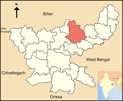 Location of Giridih district in Jharkhand | |
| Country | India |
| State | Jharkhand |
| Administrative division | North Chotanagpur division |
| Headquarters | Giridih |
| Government | |
| • Lok Sabha constituencies | 1. Kodarma, 2. Giridih |
| • Assembly seats | 6 |
| Area | |
| • Total | 4,854 km2 (1,874 sq mi) |
| Population (2011) | |
| • Total | 2,445,203[1] |
| • Urban | 06.41 |
| Demographics | |
| • Literacy | 65.12 per cent[1][2] |
| • Sex ratio | 940 |
| Website | Official website |
Giridih district (Hindi: गिरिडीह जिला) is one of the twenty-four districts of Jharkhand state, India, and Giridih is the administrative headquarters of this district. As of 2011 it is the third most populous district of Jharkhand (out of 24), after Ranchi and Dhanbad.[1]
History
Giridih district was created on 6 December 1972 by carving some parts of Hazaribagh district. In 1999 part of it became Bokaro district.[3]
It is currently a part of the Red Corridor.[4]
Geography
The district, covering an area of around 4854 km², is bounded on the north by Jamui district and Nawada district of Bihar state, on the east by the districts of Deoghar and Jamtara, on the south by Dhanbad and Bokaro, and on the west by Hazaribagh and Koderma districts.
Giridih has an average elevation of 289 metres (948 feet). Śrī Sammeta Shikharji also known as the Parasnath Hills, located in Giridih is the highest mountain peak in Jharkhand. It is a conical granite peak located 4,477 feet (1,365 metres) above the sea level.[5][6]
Giridih District is geographically divided into two natural divisions, which are the central plateau and lower plateau. The central plateau touches the western portion of the district near Bagodar block. The lower plateaus have an undulating surface and an average height of 1300 feet.[6] In the north and north-west, the lower plateaus form fairly level tablelands until they reach the ghats when they drop to about 700 feet.
Giridih is rich in mineral resources, particularly in mica and coal and has several large coal fields with one of the best qualities of metallurgical coal in India. Gawan and Tisari blocks of the district have several mica mines, and coal is found abundantly at several places throughout the district. Mica is of importance not only to Jharkhand but to India and other countries as well.[6]
Parasnath Hills are located in the district. There are two major rivers, namely, the Barakar River and the Sakri River. Barakar River passes through Birni and Pirtand blocks. Sakari river drains the areas of Deori and Gawan blocks. There are several smaller rivers, including Usri, with a major tourist attraction - Usri Falls.
Administration
Blocks/Mandals
Giridih district consists of 13 Blocks. The following are the list of the Blocks in Giridih district:
Economy
In 2006 the Indian government named Giridh one of the country's 250 most backward districts (out of a total of 640).[7] It is one of the 21 districts in Jharkhand currently receiving funds from the Backward Regions Grant Fund Programme (BRGF).[7]
Divisions
The district comprises thirteen community development blocks, namely, Bagodar, Bengabad, Birni, Deori, Dhanwar, Dumri, Gandey, Gawan, Giridih, Jamua, Pirtand, Suriya and Tisri.[8]
There are six Vidhan Sabha (legislative assembly) constituencies in this district. Dhanwar, Bagodar, Jamua and Gandey assembly constituencies are part of Kodarma constituency. Giridih and Dumri assembly constituencies are part of Giridih constituency.[9]
Demographics
According to the 2011 census Giridih district has a population of 2,445,203[1] roughly equal to the nation of Kuwait[10] or the US state of New Mexico.[11] This gives it a ranking of 182nd in India (out of a total of 640).[1] The district has a population density of 497 inhabitants per square kilometre (1,290/sq mi) . Its population growth rate over the decade 2001-2011 was 28.33%. Giridih has a sex ratio of 943 females for every 1000 males, and a literacy rate of 65.12%.[1]
Khortha, a blend of Magahi and Bengali, is the main language spoken in Giridih district. The tribal people speak Santhali.
Flora and fauna
The district has rich forest resources and have several jungles of sal trees and bamboos, and a variety of other indigenous trees. Among other common trees are bamboo, semal, Mahua, palash, kusum, kend, Asian pear and bhelwa.[6] Parasnath hills have a number of plants having medicinal use. Leopards, bears, jackals, wild pigs, and hares are the wild animals found in certain parts of the district which have thick forests.
See also
- Giridih district Kabir gyan mandir and Shanti bhawan are main spiritual place at Giridih
References
- 1 2 3 4 5 6 "District Census 2011". Census2011.co.in. 2011. Retrieved 2011-09-30.
- ↑ "District-specific Literates and Literacy Rates, 2001". Registrar General, India, Ministry of Home Affairs. Retrieved 2010-10-10.
- ↑ Law, Gwillim (2011-09-25). "Districts of India". Statoids. Retrieved 2011-10-11.
- ↑ "83 districts under the Security Related Expenditure Scheme". IntelliBriefs. 2009-12-11. Retrieved 2011-09-17.
- ↑ "Jharkhand". Encyclopædia Britannica. Retrieved 7 March 2012.
- 1 2 3 4 "Official website of the Giridih district". Retrieved 7 March 2012.
- 1 2 Ministry of Panchayati Raj (September 8, 2009). "A Note on the Backward Regions Grant Fund Programme" (PDF). National Institute of Rural Development. Retrieved September 27, 2011.
- ↑ "Giridih". Blocks. District Administration, Giridih. Retrieved 8 November 2015.
- ↑ "Election". Giridih district website.
- ↑ US Directorate of Intelligence. "Country Comparison:Population". Retrieved 2011-10-01.
Kuwait 2,595,62
- ↑ "2010 Resident Population Data". U. S. Census Bureau. Retrieved 2011-09-30.
New Mexico - 2,059,179
External links
- Official government website
- List of places in Giridih
 |
Koderma district | Nawada district, Bihar | Jamui district, Bihar | |
| Hazaribagh district | |
Deogarh district Jamtara district | ||
| ||||
| | ||||
| Bokaro district | Dhanbad district |
Coordinates: 24°10′48″N 86°19′12″E / 24.18000°N 86.32000°E
