Maithon Dam
| Maithon Dam | |
|---|---|
 | |
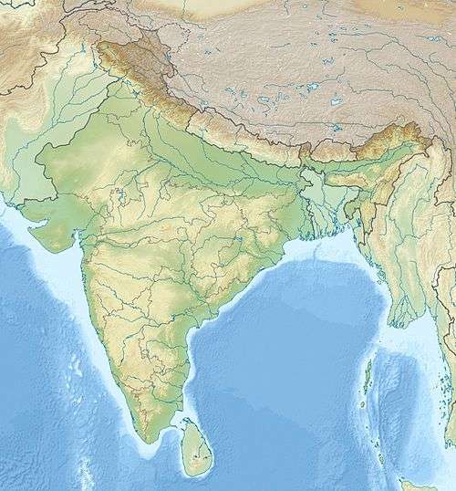 Location in Jharkhand | |
| Country | India |
| Location | Dhanbad District, Jharkhand |
| Coordinates | 23°51′1″N 86°46′40″E / 23.85028°N 86.77778°ECoordinates: 23°51′1″N 86°46′40″E / 23.85028°N 86.77778°E |
| Status | Functional |
| Opening date | 1957 |
| Owner(s) | Damodar Valley Corporation |
| Dam and spillways | |
| Impounds | Barakar River |
| Height | 165 ft (50 m) |
| Length | 15,712 ft (4,789 m) |
| Width (base) | 10.67 metres (35.0 ft) |
| Reservoir | |
| Creates | Maithon Lake |
| Surface area | 65 square kilometres (25 sq mi) |
| Power station | |
| Operator(s) | Damodar Valley Corporation |

The Maithon Dam (Hindi: मैथन बांध) is located at Maithon, 48 km from Dhanbad, in the state of Jharkhand. It is 15,712 ft (4,789 m) long and 165 ft (50 m). high.[1]
This dam was specially designed for flood control and generates 60,000 kW of electric power. There is an underground power station, the first of its kind in the whole of South East Asia. The dam is constructed on the Barakar River. The lake is spread over 65 square kilometres (25 sq mi).[1]
DVC-Damodar Valley Corporation

DVC is the first-ever multipurpose river valley project of independent India which came into being on July 7, 1948 by an act of Constituent Assembly (Act no. XIV of 1948). DVC has its command area of approx 24,235 km² spreading across the Damodar basin. The upper valley consists of two entire districts (Dhanbad and Bokaro) and eight districts partly in the state of Jharkhand. The lower valley on the other hand consists of five districts partly (Burdwan, Hooghly, Bankura, Howrah and Purulia) in the state of West Bengal.
DVC was set up with the intent of promoting and operating the schemes which may cause social and economic uplift in the valley region. The difficult but effective water management by the corporation has turned the devastating river Damodar from a "River of Sorrow" to a "River of opportunities".

Prospects and opportunities
Proficient management of water resources through dams, canals and barage, DVC facilitated irrigation as well as industrial and domestic water supply which at large benefited the region as a whole. DVC has been generating, transmitting & distributing electrical energy since 1953 and has succeeded not only in meeting the expectation of consumers but has also elevated its height in its performance.The full form of DVC is Damodar valley corporation and since it uses its main source of water from the Damodar dam it is named so.
Maithon
48 km from Dhanbad, Maithon is termed as mother’s abode. It has the biggest reservoir in DVC. Conceived on the lines of Tennessee Valley, USA it has been designed for flood control & generates 60,000 kW of electric power. It is built on the river Barakar.
It has its unique underground power station, the first of its kind in South Asia. The lake is spread over an area of 65 km². It is 15,712 ft (4,789 m). long & 165 ft (50 m) high.
The dam's mission comprises:
- flood Control
- promotion & operation of schemes for irrigation
- water supply for domestic & industrial use
- navigation & drainage
- generation, transmission & distribution of electrical energy.
History
In 1942, during the course of World War II, a flood occurred in the Damodar valley region that cut Calcutta off from the rest of the country for a period of 10 weeks. Soon the government sprang into action & called Mr. W.L.Voord, a civil engineer of Tennessee Valley Authority (TVA). He designed the plan of the dams by 1945. Finally the first dam of independent India came up on July 7, 1953 at Tilaiya. Soon Konar, Maithon & Panchet Dam followed in its footsteps in 1955, 1957 and 1959 respectively.
Operation
Damodar river is a seasonal river, basically 82% of which is filled up by rainfall in July–September. 1 June to 31 October is the filling period during which rainwater is stored and the stored rainwater is used for irrigation by the downstream areas of Burdwan, hydroelectric power generation and scores of other activities......
Maithon Hydel
Maithon Hydel Power Station (MHPS) is located on the river Barakar about 12.9 km above its confluence with the Damodar near the border of Dhanbad & Burdwan districts of the states of Jharkhand & West Bengal respectively. The unique feature of this is that it is located underground in the left bank of the river and is the first of its kind in India. The power station has a total generating capacity of 60 MW with 3 units of 20 MW each. MHPS is located at almost 100
feet below the water level,and is the first of its kind, in South East Asia.
Reservoir operation
A vast hydro meteorological station with VHF/wireless facilities exists over the Damodar catchment area. On a real time basis (hourly, 3 hourly, 6 hourly) data of river gauge, rainfall river discharge are measured and transmitted through existing communication network to the central flood station at Maithon. The Indian Meteorological Department(IMD), Kolkata, transmit the rainfall forecast for the next 24 hours for the entire Damodar Valley region to Maithon. A computer model at the Flood Forecasting Unit(FFU) at Maithon estimates the inflow into the reservoirs based on the real time data & rainfall forecast of IMD.
According to detailed guidelines contained in the "Damodar Valley Reservoir Regulation Manual", Member Secretary of DVRRC (Damodar Valley Reservoir Regulation Committee) after discussion with SE, Damodar Irrigation Circle Govt. of West Bengal, Reservoir Operation of DVC & SE, Tenughat of Govt. of Jharkhand decides day to day release of water from Maithon Dam and Panchet Dam, and issues advice for release of water through the dams.
Problems
People involved in power generation say that water should be filled up as much as possible as it would be better for power generation. People involved in flood control department says water storage should be lowered, so that in case of excessive rain a flood like situation arises then it will be a flood cushion. This is a conflicting nature, so water has to be kept at an optimum level to satisfy both parties
Dead Storage Capacity of the dam during the initial years was much more than the storage capacity now.The portion of a water storage’s capacity that is equal to the volume of water below the level of the lowest outlet (the minimum supply level),is known as th Dead Storage Capacity. This, increase has been mainly due to the sedimentation storage. Due to human & industrial activities, the storage capacity has decreased over the years. As per the design of dam given by Mr.Voord capacity depth should have been 500 ft (150 m). But due to non-acquisition of land the depth is at 495 ft (151 m). The carrying capacity of the dam as designed by Mr.Voodro was 1,000,000 cu ft/s (28,000 m3/s). But at the time of construction it was only 250,000 cu ft/s (7,100 m3/s) and at present it has a carrying capacity of less than 100,000 cu ft/s (2,800 m3/s). The cost of removing deposited silt in the dam is equal to the construction of a new dam,therefore economically not viable. If the silt is removed and stored in the banks of the dam, then during monsoon the silt would get washed off into the dam.
Maithon Dam has completed 60 years in service, and this naturally has an effect on the structures, in spite of regular maintenance by DVC.
Flood warning
Before releasing the water from dam's spillway gates, necessary warning is communicated to district authorities, affected downstream industries, municipalities and others including senior administrative officials of Burdwan, Bankura, Purulia; IOW Dept. Govt.of WB; EE, DHW, Durgapur; Member(RM); CWC, New Delhi. Whenever there is a discharge from Maithon and Panchet dams exceeding 1,132 cu ft/s (32.1 m3/s), special arrangements are broadcast through DOORDARSHAN and AIR regional news bulletins. DOORDARSHAN, Kolkata also telecasts daily weather forecasts with probable rainfall in the Damodar Valley.
Maithon Dam has completed its 60 successful years in the service to the nation but, the maintenance of the reservoir is a matter of concern. In these 60 years the depth of the reservoir has decreased, so it gets flooded very soon. So to maintain the safe level the water has to be released through dams. It has a dual impact, first it hits badly to the irrigation in Burdwan District also the power generation capacity MHPS as the capacity of the reservoir has decreased in last 60 years.
The rain water takes a lot of soil with it and the same settles down in the reservoir causing decrease in the depth. There should be some corrective action taken to make the life of Maithon Dam.
There is also a pollution threat to the town as many industries are being set up in the locality. There is also a thermal power (MPS) being built in the locality. These are a lot of water-consuming industries and will consume water from the river Barakar itself. This is going to create pollution as well as water crisis in the area. The underground water level has already decreased over the years which further strains the water resources.
References
| Wikivoyage has a travel guide for Maithon. |