Counties of Romania
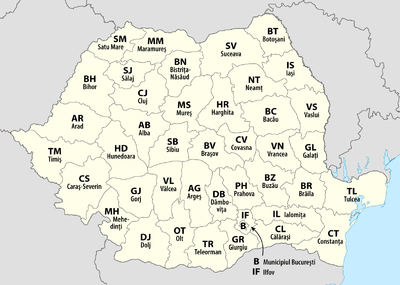
A total of 41 counties (Romanian: județe), along with the municipality of Bucharest, constitute the official administrative divisions of Romania. They represent the country's NUTS-3 (Nomenclature of Territorial Units for Statistics – Level 3) statistical subdivisions within the European Union and each of them serves as the local level of government within its borders. Most counties are named after a major river, while some are named after notable cities within them, such as the county seat.
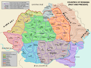
The earliest organization into județe of the Principalities of Wallachia and Moldavia (where they were termed ținuturi) dates back to at least the late 14th century. For most of the time since modern Romania was formed in 1859, the administrative division system has been similar to the French departments one. The system has been changed several times since then, and the number of counties has varied over time, from the 71 județe that existed before World War II to only 39 after 1968. The current format has largely been in place since 1968 as only small changes have been made since then, the last of which was in 1997.
According to 2011 census data from the National Institute of Statistics, the average population of Romania's 41 counties is about 445,000, with Iași County as the most populous (772,000) and Covasna County (210,000) the least. The average county's land area is 5,809 square kilometres (2,243 sq mi), with Timiș County (8,697 square kilometres (3,358 sq mi)) the largest and Ilfov County (1,583 square kilometres (611 sq mi)) the smallest. The municipality of Bucharest, which has the same administrative level as that of a county, is both more populous and much smaller than any county, with 1,883,425 people and 228 square kilometres (88 sq mi).
History

The earliest organization into județe (for Wallachia), and ținuturi (for Moldavia), dates back at least to the late 14th century.[note 1][1][2][3] Inspired from the organization of the late Byzantine Empire, each județ was ruled by a jude (or pârcălab for a ținut), a person officially appointed with administrative and judicial functions.[3][4] Transylvania was divided into royal counties headed by comes (royal counts) with administrative and judicial functions.[3]
After modern Romania was formed in 1859 through the union of Wallachia and the rump of Moldavia, the administrative division was modernized using the French administrative system as a model, with județ as the basic administrative unit.[5][6] Aside from the 1950–1968 period, this system has remained in place until today. Since 1864, for each județ there exists a prefect, a subordinate of the Ministry of Internal Affairs and representative of the government inside the county; he is also the head of local administration for areas not delegated to local authorities.[5][6] Until 1948, each județ was further divided into several plăși, each administered by a pretor.[7]
After the adoption of a new Constitution in 1923, the traditional local administrative systems of the newly acquired regions of Transylvania, Bukovina and Bessarabia were made uniform in 1925 with that of the Romanian Old Kingdom. County borders were kept largely intact, with few adjustments, and the total number of counties was raised to 71; this lasted until the beginning of World War II.[6]
In 1938, King Carol II modified the law on the administration of the Romanian territory according to the fascist model.[8] Ten ținuturi (approx. translation "lands") were created, ruled by Rezidenți Regali (Royal Residents), appointed directly by the Monarch. The ținuturi represented another layer of administration between counties and the country, as the county borders were not erased.[5][9]
Due to the territorial changes during World War II, this style of administration did not last, and the administration at the județ level was reintroduced after the war.[5] Between 1941–1944, Romania administered the territory between the Dniester and Southern Bug rivers known as Transnistria, which consisted of 13 separate counties.[10]
After taking over the administration of the country in 1945, the Communist Party changed the administrative model to that of the Soviet Union (regions and raions) in 1950, but changed it back in 1968.[11] Nevertheless, the county borders set then were quite different from those present during the interbellum, as only 39 counties were formed from the 56 remaining after the war.[12]
In 1981, Giurgiu and Călărași were split from Ialomița and the former county of Ilfov,[12] while in 1997, Ilfov County, which had been a dependency of the municipality of Bucharest for nearly two decades, was reinstated.[13][14] The county borders set in 1968 are still largely in place today, but the functions of different authorities have changed due to administrative reforms in the 1990s.[5][6]
At present, Romania is divided into 41 counties and one municipality (Bucharest); these are assigned as the NUTS-3 geocode statistical subdivision scheme of Romania within the European Union.[15] Each of the counties is further divided into cities (some of which have municipality status) and communes. The prefect and his administration have executive prerogatives within the county limits, while limited legislative powers are assigned to a County Council elected every four years during local elections.[16] The territorial districts of the Romanian judicial system overlap with county borders, thus avoiding further complication in the separation of powers on the government.[5]
Current list
| County |
County seat |
Name origin [note 2][17] |
Development region |
ISO code [note 3] |
Postal code [note 4][18] |
Area code [note 5][19] |
NUTS code [note 6][20] |
Population (2011)[21] |
Area [22] |
Map |
|---|---|---|---|---|---|---|---|---|---|---|
| Alba |
Alba Iulia |
Alba River | Center | AB | 51 | 58 | RO121 | 342,376 | 6,242 km2 (2,410 sq mi) |  |
| Arad |
Arad |
county seat | West | AR | 31 | 57 | RO421 | 430,629 | 7,754 km2 (2,994 sq mi) |  |
| Argeș |
Pitești |
Argeș River | South-Muntenia | AG | 11 | 48 | RO311 | 612,431 | 6,862 km2 (2,649 sq mi) |  |
| Bacău |
Bacău |
county seat | North-East | BC | 60 | 34 | RO211 | 616,168 | 6,621 km2 (2,556 sq mi) |  |
| Bihor |
Oradea |
Biharia commune | North-West | BH | 41 | 59 | RO111 | 575,398 | 7,544 km2 (2,913 sq mi) | 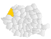 |
| Bistrița-Năsăud |
Bistrița |
Bistrița River and Năsăud city | North-West | BN | 42 | 63 | RO112 | 286,225 | 5,355 km2 (2,068 sq mi) |  |
| Botoșani |
Botoșani |
county seat | North-East | BT | 71 | 31 | RO212 | 412,626 | 4,986 km2 (1,925 sq mi) |  |
| Brașov |
Brașov |
county seat | Center | BV | 50 | 68 | RO122 | 549,217 | 5,363 km2 (2,071 sq mi) | 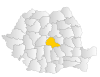 |
| Brăila |
Brăila |
county seat | South-East | BR | 81 | 39 | RO221 | 321,212 | 4,766 km2 (1,840 sq mi) |  |
| Bucharest |
(Municipality of Bucharest) [note 7] |
last name Bucur[23] | Bucharest-Ilfov | B | 01–06 [note 8] |
1x [note 9] |
RO321 | 1,883,425 | 228 km2 (88 sq mi) | 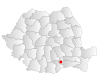 |
| Buzău |
Buzău |
Buzău River | South-East | BZ | 12 | 38 | RO222 | 451,069 | 6,103 km2 (2,356 sq mi) |  |
| Caraș-Severin |
Reșița |
defunct Caraș and Severin Counties | West | CS | 32 | 55 | RO422 | 295,579 | 8,514 km2 (3,287 sq mi) |  |
| Călărași |
Călărași |
county seat | South-Muntenia | CL | 91 | 42 | RO312 | 306,691 | 5,088 km2 (1,964 sq mi) | 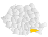 |
| Cluj |
Cluj-Napoca |
county seat | North-West | CJ | 40 | 64 | RO113 | 691,106 | 6,674 km2 (2,577 sq mi) | 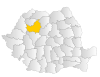 |
| Constanța |
Constanța |
county seat | South-East | CT | 90 | 41 | RO223 | 684,082 | 7,071 km2 (2,730 sq mi) | 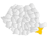 |
| Covasna |
Sfântu Gheorghe |
Covasna River | Center | CV | 52 | 67 | RO123 | 210,177 | 3,710 km2 (1,430 sq mi) | 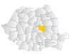 |
| Dâmbovița |
Târgoviște |
Dâmbovița River | South-Muntenia | DB | 13 | 45 | RO313 | 518,745 | 4,054 km2 (1,565 sq mi) | 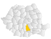 |
| Dolj |
Craiova |
Jiu River[note 10] | South-West Oltenia | DJ | 20 | 51 | RO411 | 660,544 | 7,414 km2 (2,863 sq mi) | 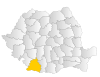 |
| Galați |
Galați |
county seat | South-East | GL | 80 | 36 | RO224 | 536,167 | 4,466 km2 (1,724 sq mi) |  |
| Giurgiu |
Giurgiu |
county seat | South-Muntenia | GR | 08 | 46 | RO314 | 281,422 | 3,526 km2 (1,361 sq mi) | 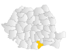 |
| Gorj |
Târgu Jiu |
Jiu River[note 11] | South-West Oltenia | GJ | 21 | 53 | RO412 | 341,594 | 5,602 km2 (2,163 sq mi) | 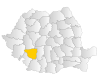 |
| Harghita |
Miercurea Ciuc |
Harghita Mountains | Center | HR | 53 | 66 | RO124 | 310,867 | 6,639 km2 (2,563 sq mi) |  |
| Hunedoara |
Deva |
Hunedoara city | West | HD | 33 | 54 | RO423 | 418,565 | 7,063 km2 (2,727 sq mi) | 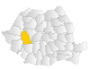 |
| Ialomița |
Slobozia |
Ialomița River | South-Muntenia | IL | 92 | 43 | RO315 | 274,148 | 4,453 km2 (1,719 sq mi) | 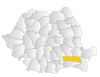 |
| Iași |
Iași |
county seat | North-East | IS | 70 | 32 | RO213 | 772,348 | 5,476 km2 (2,114 sq mi) |  |
| Ilfov |
Buftea |
Ilfov River | Bucharest-Ilfov | IF | 07 | 1x [note 9] |
RO322 | 388,738 | 1,583 km2 (611 sq mi) | 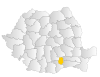 |
| Maramureș |
Baia Mare |
Maramureș historical region | North-West | MM | 43 | 62 | RO114 | 478,659 | 6,304 km2 (2,434 sq mi) |  |
| Mehedinți |
Drobeta-Turnu Severin |
Mehadia commune | South-West Oltenia | MH | 22 | 52 | RO413 | 265,390 | 4,933 km2 (1,905 sq mi) |  |
| Mureș |
Târgu Mureș |
Mureș River | Center | MS | 54 | 65 | RO125 | 550,846 | 6,714 km2 (2,592 sq mi) | 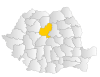 |
| Neamț |
Piatra Neamț |
Neamț River | North-East | NT | 61 | 33 | RO214 | 470,766 | 5,896 km2 (2,276 sq mi) | 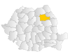 |
| Olt |
Slatina |
Olt River | South-West Oltenia | OT | 23 | 49 | RO414 | 436,400 | 5,498 km2 (2,123 sq mi) |  |
| Prahova |
Ploiești |
Prahova River | South-Muntenia | PH | 10 | 44 | RO316 | 762,886 | 4,716 km2 (1,821 sq mi) | 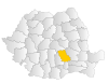 |
| Satu Mare |
Satu Mare |
county seat | North-West | SM | 44 | 61 | RO115 | 344,360 | 4,418 km2 (1,706 sq mi) | 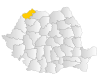 |
| Sălaj |
Zalău |
Sălaj River | North-West | SJ | 45 | 60 | RO116 | 224,384 | 3,864 km2 (1,492 sq mi) | 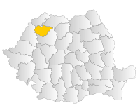 |
| Sibiu |
Sibiu |
county seat | Center | SB | 55 | 69 | RO126 | 397,322 | 5,432 km2 (2,097 sq mi) | 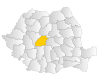 |
| Suceava |
Suceava |
Suceava River | North-East | SV | 72 | 30 | RO215 | 634,810 | 8,553 km2 (3,302 sq mi) | 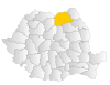 |
| Teleorman |
Alexandria |
Teleorman River | South-Muntenia | TR | 14 | 47 | RO317 | 380,123 | 5,790 km2 (2,240 sq mi) |  |
| Timiș |
Timișoara |
Timiș River | West | TM | 30 | 56 | RO424 | 683,540 | 8,697 km2 (3,358 sq mi) | 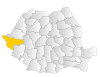 |
| Tulcea |
Tulcea |
county seat | South-East | TL | 82 | 40 | RO225 | 213,083 | 8,499 km2 (3,281 sq mi) | 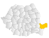 |
| Vaslui |
Vaslui |
Vaslui River | North-East | VS | 73 | 35 | RO216 | 395,499 | 5,318 km2 (2,053 sq mi) | 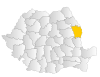 |
| Vâlcea |
Râmnicu Vâlcea |
medieval county of Vîlcea[1][note 12] | South-West Oltenia | VL | 24 | 50 | RO415 | 371,714 | 5,765 km2 (2,226 sq mi) |  |
| Vrancea |
Focșani |
medieval county of Vrancha[24][note 13] | South-East | VN | 62 | 37 | RO226 | 340,310 | 4,857 km2 (1,875 sq mi) | 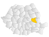 |
See also
 |
| This article is part of a series on the politics and government of Romania |
|
- Communes of Romania
- List of Romania county name etymologies
- Former administrative divisions of Romania
- List of Romanian counties by population
- List of cities and towns in Romania
- List of Romanian counties by foreign trade
- Municipiu
Notes
- ↑ Județ originates from the Latin judicium and ținut probably from the Latin tenutum.
- ↑ Most of the names of the present counties originate from one of the larger rivers that flow through the county. In a number of cases, the name of the county seat or another large city in the county is the same as that river.
- ↑ These are the ISO 3166-2:RO codes which coincide with the license plate ones; they are also used as usual abbreviations, such as in mailing addresses.
- ↑ The postal code format is of the type xxyzw, with xx being the numbers associated with the county; the digits y, z, and w indicate the city, the street, part of the street, or even the building of the address.
- ↑ Landline phone numbers are of the type +40-abb-xxx-xxx, where 40 is the country code, bb is the area code, and a is a digit indicating the operator: 2 for the former national operator, Romtelecom, and 3 for the other ground telephone networks. Mobile phone numbers, however, only start with the digit 7 (for a) and do not follow county borders.
- ↑ The development region code follows the format ROxyz, where x is the macroregion number, y represents the development region and is either 1 or 2, and z is the county number within the region.
- ↑ Bucharest is not a county, but a municipality that has an identical administrative status to all the other 41 counties.
- ↑ Due to Bucharest's significantly larger population, it has a different postal code for each of its six sectors.
- 1 2 Bucharest and Ilfov county have the same code. Due to their large population, phone numbers have only the suffix "1" (unlike two-digit suffixes for counties) followed by seven digits (only six digits for anywhere else).
- ↑ Dolj is a shortened form of Dolu (Slavic for "valley") Jiu, in reference to the county's location in the lower part of Jiu river.
- ↑ Gorj is a shortened form of Gora (Slavic for "mountain") Jiu, in reference to the county's location in the upper part of Jiu river.
- ↑ Vâlcea is the Romanian word for a narrow valley.
- ↑ Vran is a substratum word believed to mean "forest" or "mountain".
References
- 1 2 "Primele atestari documentare ale judetului Valcea (First Historical Mentions of Vâlcea County)" (in Romanian). National Institute of Statistics (Romania). Retrieved 2010-01-23.
- ↑ Cornel Șomâcu (2009-09-09). "De la sat la județ în istoria Olteniei (From Village to County in the History of Oltenia)" (in Romanian). Vertical. ISSN 1841-6063. Retrieved 2010-08-22.
- 1 2 3 Cosmin Dariescu (2008). "21: Organizarea administrativ-teritorială a Țării Românești și a Moldovei în evul mediu (21: Administrative Divisions in Wallachia and Moldavia in the Middle Ages)". Istoria statului și dreptului românesc din antichitate până la Marea Unire (History of Romanian State and Law from Antiquity until the Unification) (in Romanian). C.H. Beck. pp. 47–51. ISBN 978-973-115-337-7.
- ↑ Cosmin Dariescu (2008). "16: Domnia în Țările Române medievale (16: Rulers in the Romanian Principalities in the Middle Ages)". Istoria statului și dreptului românesc din antichitate până la Marea Unire (History of Romanian State and Law from Antiquity until the Unification) (in Romanian). C.H. Beck. pp. 35–39. ISBN 978-973-115-337-7.
- 1 2 3 4 5 6 "Scurtă privire istorică (Short View on History)" (in Romanian). Instituția Prefectului județul Argeș. Archived from the original on 2012-05-20. Retrieved 2010-01-22.
- 1 2 3 4 2003–2005 National Human Development Report: Local Governance in Romania (PDF) (Report). United Nations Development Programme. p. 35.
- ↑ Valeriu Nicolescu. "Un ținut de legendă, județul Buzău (A legendary Land, Buzau County)" (in Romanian). Buzau.com. Retrieved 2010-01-22.
- ↑ Günther H. Tontsch (2000). "Juristische Literatur zur rumänischen Verwaltungsgeschichte im 19. und 20. Jahrhundert (Law Literature on the Romanian Administrative History in the 19th and 20th Centuries)". Jahrbuch für Europäische Verwaltungsgeschichte (Yearbook of European Administrative History) (in German). 12. Baden-Baden: Nomos Verlag. p. 285. ISSN 0937-7107.
- ↑ Ioan Scurtu; Theodora Stănescu-Stanciu; Georgiana Margareta Scurtu (2002). "8.7. Decret-lege pentru reforma electorală (Law Decree for electoral reform)". Istoria românilor între anii 1918–1940 (The History of the Romanians in 1918–1940) (in Romanian). University of Bucharest.
- ↑ Anatol Petrenci (2006). Basarabia în timpul celui de-al doilea război mondial: 1939–1945 (Bessarabia During the Second World War: 1939–1945) (in Romanian). Chișinău, Moldova: Ed. Prut Internațional. ISBN 978-9975-69-049-2.
- ↑ "Istoria Banatului – În linii mari (History of Banat – A Quick View)" (in Romanian). Vestul.ro. 2008-09-10. Retrieved 2010-10-22.
- 1 2 Petre Mihai Bacanu (2010-03-11). "Cum ar trebui să arate harta redesenată a României? (How Should Romania's Redrawn Map Look Like?)" (in Romanian). România Liberă. Retrieved 2010-08-29.
- ↑ "Prezentarea Judetului Ilfov (Overview of Ilfov County)" (PDF) (in Romanian). National Institute of Statistics (Romania). Retrieved 2010-08-01.
- ↑ "Istoria Ilfov (History of Ilfov)" (in Romanian). Camera de Comert si Industrie a Judetului Ilfov. Retrieved 2010-08-23.
- ↑ "Nomenclature of territorial units for statistics – Introduction". Eurostat. Retrieved 2010-08-22.
- ↑ "CEMR – Members – Romania". Council of European Municipalities and Regions. Retrieved 2010-08-22.
- ↑ "Istoria numelor județelor din România. De unde provine denumirea regiunii în care locuiți" (in Romanian). Retrieved 2013-01-30.
- ↑ "Postal code search" (in Romanian). Compania Nationala Posta Romania SA. Retrieved 2010-08-22.
- ↑ "List of the county prefixes in Romania" (in Romanian). National Regulatory Authority for Communications and Information Technology (Romania). 2005-04-26. Retrieved 2010-08-22.
- ↑ "Publications Office, European Union, EU". Simap – Information about European public procurement. Retrieved 2010-08-29.
- ↑
Population at the Censuses of 1948, 1956, 1966, 1977, 1992, 2002 and 2011 – By Localities and Counties (XLS) (Report) (in Romanian). National Institute of Statistics (Romania). 2013-07-04. pp. 1–2. Retrieved 2013-07-06. - ↑ Romanian Statistical Yearbook 2008 – Geography, Meteorology, and Environment (PDF) (Report) (in Romanian). National Institute of Statistics (Romania). 2007-07-01. p. 18. Retrieved 2010-08-29.
- ↑ "DEX online – Search: "bucura"". Romanian Etymological Dictionary 1958–1966 (in Romanian). Dexonline.ro. Retrieved 2010-08-23.
- ↑ "Județul Vrancea (Vrancea County)" (in Romanian). National Institute of Statistics (Romania). Retrieved 2010-08-23.
External links
- Blog of the Romanian Royalty House showing various maps with the previous administrative divisions of Romania.
- Current and historical divisions of Romania at Statoids.com
- "Geopolitical Entities and Their Codes (FIPS codes)". National Institute of Standards and Technology. Retrieved 2010-08-23.
Romania articles | |||||||
|---|---|---|---|---|---|---|---|
| History | |||||||
| Geography | |||||||
| Politics | |||||||
| Economy | |||||||
| Society |
| ||||||
| |||||||