Châteaufort, Yvelines
| Châteaufort | ||
|---|---|---|
|
Town hall | ||
| ||
 Châteaufort | ||
|
Location within Île-de-France region 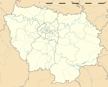 Châteaufort | ||
| Coordinates: 48°43′56″N 2°05′32″E / 48.7322°N 2.0922°ECoordinates: 48°43′56″N 2°05′32″E / 48.7322°N 2.0922°E | ||
| Country | France | |
| Region | Île-de-France | |
| Department | Yvelines | |
| Arrondissement | Versailles | |
| Canton | Versailles-Sud | |
| Government | ||
| • Mayor (2001–2008) | Patrice Pannetier | |
| Area1 | 4.88 km2 (1.88 sq mi) | |
| Population (2006)2 | 1,461 | |
| • Density | 300/km2 (780/sq mi) | |
| Time zone | CET (UTC+1) | |
| • Summer (DST) | CEST (UTC+2) | |
| INSEE/Postal code | 78143 / 78117 | |
| Elevation |
86–164 m (282–538 ft) (avg. 150 m or 490 ft) | |
|
1 French Land Register data, which excludes lakes, ponds, glaciers > 1 km² (0.386 sq mi or 247 acres) and river estuaries. 2 Population without double counting: residents of multiple communes (e.g., students and military personnel) only counted once. | ||

.svg.png)
Châteaufort (French pronunciation: [ʃɑtofɔːʁ]) is a commune in the Yvelines department in the Île-de-France in north-central France. It is located 9 km (5.6 mi) south of Versailles, and 27 km (17 mi) southwest of Paris.
Châteaufort inhabitants are named Castelfortain.

The commune is named after the existence of three fortified castles during the Middle Ages; indeed, château fort means "fortified castle" in French.
On August 19, 1913, ahead of the Châteaufort aerodrome, the French aviator Adolphe Pégoud became the first man to jump from a plane using a parachute. The jump was made from a Blériot plane 200 m above the ground.
See also
References
| Wikimedia Commons has media related to Châteaufort, Yvelines. |