Carpinteria, California
| City of Carpinteria | |
|---|---|
| City | |
|
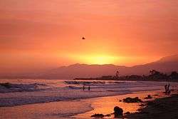
Sunset on the beach (end of Linden Ave) | |
 Location in Santa Barbara County and the state of California | |
 City of Carpinteria Location in the United States | |
| Coordinates: 34°23′57″N 119°30′59″W / 34.39917°N 119.51639°WCoordinates: 34°23′57″N 119°30′59″W / 34.39917°N 119.51639°W | |
| Country |
|
| State |
|
| County | Santa Barbara |
| Incorporated | September 28, 1965[1] |
| Named for | The carpentry shops in the former Chumash settlement of Mishopshno ("Correspondence"[2]) |
| Government | |
| • Mayor | Gregg Carty[3] |
| • State senator | Hannah-Beth Jackson (D)[4] |
| • Assemblymember | Monique Limón (D)[4] |
| • U. S. rep. | Lois Capps (D)[5] |
| Area[6] | |
| • Total | 9.272 sq mi (24.012 km2) |
| • Land | 2.586 sq mi (6.697 km2) |
| • Water | 6.686 sq mi (17.315 km2) 72.11% |
| Elevation[7] | 33 ft (10 m) |
| Population (April 1, 2010)[8] | |
| • Total | 13,040 |
| • Estimate (2013)[8] | 13,532 |
| • Density | 1,400/sq mi (540/km2) |
| Time zone | Pacific (UTC-8) |
| • Summer (DST) | PDT (UTC-7) |
| ZIP codes | 93013-93014 |
| Area code | 805 |
| FIPS code | 06-11446 |
| GNIS feature IDs | 1652684, 2409990 |
| GATV | Channel 18[9] |
| Website |
www |
Carpinteria /kɑːrpᵻntəˈriːə/ is a small oceanside city located in southeastern Santa Barbara County, California, east of Santa Barbara and northwest of Ventura. The population was 13,040 at the 2010 census.
Carpinteria Beach is known for its gentle slope and calm waves in selected sandy areas but also good surfing swells in some of the more rocky areas.[10] Seals and sea lions can be seen in the area December through May at the rookery [11] in the nearby Carpinteria Bluffs,[12] as well as an occasional gray whale. Tidepools contain starfish, sea anemones, crabs, snails, octopuses and sea urchins. A marathon-length round trip north of the rookery along the beach to Stearns Wharf in Santa Barbara is possible, though passable only during low tide. A popular campground is located adjacent to the beach. There is bird watching at Carpinteria Salt Marsh Reserve, established in 1977 and administered by the Natural Reserve System of the University of California.[13] The Waldholme Torrey Pine, largest known Torrey pine tree on earth, is located in downtown Carpinteria.
Since 1987, the California Avocado Festival has been held in Carpinteria on the first weekend of October. The Santa Barbara Polo Club, one of the main equestrian polo fields in the country, is located in Carpinteria. The city is also home to Hollandia Produce, an organic produce company with 70 employees. lynda.com, an online software training company ranked as one of the fastest-growing private companies in the U.S. (according to Inc. magazine's 2010 500|5000 company listing) had its headquarters in Carpinteria. The company was purchased by LinkedIn in 2015 for $1.5 billion.[14]
History
In 1769, the Spanish Portola expedition came west along the beach from the previous night's encampment at Rincon. The explorers found a large native village on the point of land where Carpinteria Pier is today. The party camped nearby on August 17. Fray Juan Crespi, a Franciscan missionary travelling with the expedition, noted that "Not far from the town we saw some springs of pitch. The Indians have many canoes, and at the time were building one, for which reason the soldiers named this town La Carpinteria" (the carpentry shop).[15]
The Chumash people used the naturally occurring surface asphalt to seal their canoes, known as Tomols. Petroleum seeps are still visible along the beach bluffs at Tar Pits Park on the campground beach of Carpinteria State Beach. The three closest drilling platforms visible from the shore are within the Carpinteria Offshore Oil Field, the 50th-largest field in California.[16]
Geography
Carpinteria is located several miles east of the city of Santa Barbara(the coast runs east to west in this section of California). Nearby is the unincorporated community of Summerland.
According to the United States Census Bureau, the city has a total area of 9.2 square miles (24 km2), of which 2.6 square miles (6.7 km2) is land and 6.7 square miles (17 km2) (72.11%) is water.
The city is located almost entirely on a coastal plain in between the Santa Ynez Mountains and the Pacific Ocean. Immediately to the north of Carpinteria lie foothills and then the Santa Ynez Mountains. Between the foothills and the populated area of the city is an agricultural zone. The mountains provide a scenic backdrop to town, covered in chaparral and displaying prominent sandstone outcrops. Because of the well-ventilated nature of the air basin, ozone concentrations are low while air quality is high.
Carpinteria Beach is known for its gentle slope and calm waves in selected sandy areas but also good surfing swells in some of the more rocky areas.[10]
Wildlife
Seals and sea lions can be seen in the area December through May at the rookery [11] in the nearby Carpinteria Bluffs,[12] as well as an occasional gray whale. Tidepools contain starfish, sea anemones, crabs, snails, octopuses and sea urchins. A marathon-length round trip north of the rookery along the beach to Stearns Wharf in Santa Barbara is possible, though passable only during low tide. A popular campground is located adjacent to the beach. There is bird watching at Carpinteria Salt Marsh Reserve, established in 1977 and administered by the Natural Reserve System of the University of California.[13] The Waldholme Torrey Pine, largest known Torrey pine tree on earth, is located in downtown Carpinteria.
Raccoons, skunks, and foxes are common in yards. In the wild, coyotes and bobcats roam around, preying on other smaller mammals. Mountain lions are larger than their canine and feline counterparts, but submit to the apex predator, the American Black Bear.
Climate
This region experiences warm (but not hot) and dry summers, with no average monthly temperatures above 71.6 °F. According to the Köppen Climate Classification system, Carpinteria has a warm-summer Mediterranean climate, abbreviated "Csb" on climate maps.[17]
| Climate data for Carpinteria, California | |||||||||||||
|---|---|---|---|---|---|---|---|---|---|---|---|---|---|
| Month | Jan | Feb | Mar | Apr | May | Jun | Jul | Aug | Sep | Oct | Nov | Dec | Year |
| Average high °C (°F) | 18 (65) |
19 (66) |
19 (67) |
21 (69) |
21 (70) |
22 (72) |
24 (76) |
25 (77) |
25 (77) |
23 (74) |
22 (71) |
19 (66) |
22 (71) |
| Average low °C (°F) | 6 (43) |
7 (45) |
8 (46) |
9 (48) |
11 (51) |
12 (54) |
14 (57) |
14 (58) |
13 (56) |
11 (52) |
8 (47) |
6 (43) |
10 (50) |
| Average precipitation cm (inches) | 10 (4) |
9.9 (3.9) |
7.4 (2.9) |
3 (1.2) |
1 (0.4) |
0.3 (0.1) |
0 (0) |
0 (0) |
0.5 (0.2) |
1.8 (0.7) |
3.8 (1.5) |
7.1 (2.8) |
45.2 (17.8) |
| Source: Weatherbase [18] | |||||||||||||
Demographics


| Historical population | |||
|---|---|---|---|
| Census | Pop. | %± | |
| 1950 | 2,864 | — | |
| 1960 | 4,998 | 74.5% | |
| 1970 | 6,982 | 39.7% | |
| 1980 | 10,835 | 55.2% | |
| 1990 | 13,747 | 26.9% | |
| 2000 | 14,194 | 3.3% | |
| 2010 | 13,040 | −8.1% | |
| Est. 2015 | 13,727 | [19] | 5.3% |
2010
The 2010 United States Census[21] reported that Carpinteria had a population of 13,040. The population density was 1,406.5 people per square mile (543.1/km²). The racial makeup of Carpinteria was 9,348 (71.7%) White, Hispanic or Latino of any race were 6,351 persons (48.7%), 109 (0.8%) African American, 144 (1.1%) Native American, 296 (2.3%) Asian, 15 (0.1%) Pacific Islander, 2,599 (19.9%) from other races, and 529 (4.1%) from two or more races.
The Census reported that 13,021 people (99.9% of the population) lived in households, 19 (0.1%) lived in non-institutionalized group quarters, and 0 (0%) were institutionalized.
There were 4,759 households, out of which 1,510 (31.7%) had children under the age of 18 living in them, 2,305 (48.4%) were married couples living together, 597 (12.5%) had a female householder with no husband present, 239 (5.0%) had a male householder with no wife present. There were 293 (6.2%) unmarried opposite-sex partnerships, and 28 (0.6%) same-sex married couples or partnerships. 1,203 households (25.3%) were made up of individuals and 525 (11.0%) had someone living alone who was 65 years of age or older. The average household size was 2.74. There were 3,141 families (66.0% of all households); the average family size was 3.23.
The population was spread out with 2,791 people (21.4%) under the age of 18, 1,267 people (9.7%) aged 18 to 24, 3,466 people (26.6%) aged 25 to 44, 3,717 people (28.5%) aged 45 to 64, and 1,799 people (13.8%) who were 65 years of age or older. The median age was 39.5 years. For every 100 females there were 97.2 males. For every 100 females age 18 and over, there were 95.3 males.
There were 5,429 housing units at an average density of 585.6 per square mile (226.1/km²), of which 2,347 (49.3%) were owner-occupied, and 2,412 (50.7%) were occupied by renters. The homeowner vacancy rate was 1.8%; the rental vacancy rate was 6.5%. 6,130 people (47.0% of the population) lived in owner-occupied housing units and 6,891 people (52.8%) lived in rental housing units.
2000
As of the census[22] of 2000, there were 14,194 persons, 4,989 households, and 3,332 families residing in the city. The population density was 5,250.8 people per square mile (2,029.8/km²). There were 5,464 housing units at an average density of 2,021.3 per square mile (781.4/km²). The racial makeup of the city was 73.40% White, 0.59% African American, 0.99% Native American, 2.38% Asian, 0.18% Pacific Islander, 18.09% from other races, and 4.37% from two or more races. Hispanic or Latino of any race were 43.50% of the population.
There were 4,989 households out of which 33.3% had children under the age of 18 living with them, 51.6% were married couples living together, 10.5% had a female householder with no husband present, and 33.2% were non-families. 25.5% of all households were made up of individuals and 10.5% had someone living alone who was 65 years of age or older. The average household size was 2.82 and the average family size was 3.38.
In the city the population was spread out with 25.6% under the age of 18, 9.2% from 18 to 24, 30.7% from 25 to 44, 22.1% from 45 to 64, and 12.4% who were 65 years of age or older. The median age was 36 years. For every 100 females there were 100.8 males. For every 100 females age 18 and over, there were 97.8 males.
The median income for a household in the city was $47,729, and the median income for a family was $54,849. Males had a median income of $35,679 versus $30,736 for females. The per capita income for the city was $21,563. About 7.1% of families and 10.4% of the population were below the poverty line, including 12.5% of those under age 18 and 7.7% of those age 65 or over.
Economy
Top employers
According to the City's 2011 Comprehensive Annual Financial Report,[23] the top employers in the city are:
| # | Employer | # of Employees |
|---|---|---|
| 1 | NuSil | 354 |
| 2 | Carpinteria Unified School District | 272 |
| 3 | Dako | 230 |
| 4 | Clipper Windpower | 200 |
| 5 | CKE Restaurants | 170 |
| 6 | AGIA | 158 |
| 7 | Lynda.com | 155 |
| 8 | TE Connectivity | 150 |
| 9 | Helix Medical | 146 |
| 10 | PlanMember Services | 93 |
Transportation
The Carpinteria Amtrak Station is an Amtrak rail station stop located on Linden Avenue by the beach. It is served by Amtrak's Pacific Surfliner from San Luis Obispo to San Diego.
Carpinteria MTD provides local bus service. VISTA provides commuter bus service to Ventura, Santa Barbara, and Los Angeles.
Arts and culture
Carpinteria hosts an annual California Avocado Festival, with a history extending back to 1986.[24] Over 80,000 persons attend the three-day festival which takes place during the first weekend of October on Linden Avenue. The festival offers avocado products and locally made goods.
Media
The city has a weekly newspaper called The Coastal View.
Education
The city of Carpinteria is served by the Carpinteria Unified School District. It includes one high school, one middle (junior high) school, and four public elementary schools, one of which is an alternative school of choice (K-5). The district also has an alternative high school. Other schools include: Howard Carden School, a private preK - 7 elementary school, Carpinteria Christian School, a Baptist K-8 school, Cate School, a private preparatory school and Pacifica Graduate Institute, home of the Joseph Campbell and Marija Gimbutas Library. This graduate school offers master's and PhD programs in depth psychology and mythology.
The Carpinteria Unified School District,[25] which also includes the community of Summerland, and some outlying areas, includes the following:
- Carpinteria Middle (5351 Carpinteria Ave)
- Canalino Elementary (1480 Linden Ave)
- Aliso Elementary (4545 Carpinteria Ave)
- Carpinteria Family School (1480 Linden Ave)
- Summerland Elementary (135 Valencia Road)
- Carpinteria Senior High (4810 Foothill Rd)
- Rincon High (4698 Foothill Rd)
- Foothill Alternative High (4698 Foothill Rd)
Students at elementary schools prepared two web sites about Carpinteria for the year 2000[26] and 2001[27] International Schools CyberFair competitions.[28]
Notable people
- Jacob M. Appel, writer (b. 1973)
- David Binney, alto saxophonist, composer, producer
- Maxwell Caulfield, actor
- Stan Cornyn, recording executive[29]
- Kevin Costner, actor
- Susan Flannery, actress
- Chris Gocong, football player
- Dennis Miller, comedian, talk show host[30]
- Alan Thicke, actor, songwriter, game and talk show host
- Robert Zemeckis, film director[31]
Notable locations
- Carpinteria Valley Museum of History
- Carpinteria State Beach
- Carpinteria Tar Pits
- Franklin Trail Hiking trail in Carpinteria providing access to the Santa Ynez Mountains and the Los Padres National Forest.[32]
- Wardholme Torrey Pine, largest known Torrey Pine on earth.
References
- ↑ "California Cities by Incorporation Date". California Association of Local Agency Formation Commissions. Archived from the original (Word) on November 3, 2014. Retrieved August 25, 2014.
- ↑ McCall, Lynne; Perry, Rosalind (2002). California’s Chumash Indians : a project of the Santa Barbara Museum of Natural History Education Center (Revised ed.). San Luis Obispo, Calif: EZ Nature Books. ISBN 0936784156.
- ↑ "Government Structure". City of Carpinteria. Retrieved January 7, 2015.
- 1 2 "Statewide Database". UC Regents. Retrieved December 8, 2014.
- ↑ "California's 24th Congressional District - Representatives & District Map". Civic Impulse, LLC. Retrieved September 29, 2014.
- ↑ "2010 Census Gazetteer Files – Places – California". United States Census Bureau. Retrieved March 26, 2015.
- ↑ "Carpinteria". Geographic Names Information System. United States Geological Survey. Retrieved January 7, 2015.
- 1 2 "Carpinteria (city) QuickFacts". United States Census Bureau. Retrieved March 25, 2015.
- ↑ "City of Carpinteria > Doing Business in Carpinteria > Business Assistance and Financing". Retrieved March 12, 2016.
- 1 2 "Rincon - Indicator Surf Forecast and Surf Reports (CAL - Ventura, USA)". Retrieved March 12, 2016.
- 1 2 "Carpinteria Seal Rookery, and Clifftop Walk". Retrieved March 12, 2016.
- 1 2 "Carpinteria Bluffs". Archived from the original on March 17, 2016. Retrieved March 12, 2016.
- 1 2 "Carpinteria Salt Marsh Reserve - University of California Natural Reserve System". Retrieved March 12, 2016.
- ↑ "Linkedin - Pacific Coast Business Times". Retrieved March 12, 2016.
- ↑ Bolton, Herbert E. (1927). Fray Juan Crespi: Missionary Explorer on the Pacific Coast, 1769-1774. HathiTrust Digital Library. p. 162. Retrieved April 2014. Check date values in:
|access-date=(help) - ↑ "2008 Report of the state oil & gas supervisor" (PDF). Department of Oil, Gas, and Geothermal Resources. California Department of Conservation ("DOGGR 2009"). 2009. Retrieved February 11, 2010. p. 63.
- ↑ "Carpinteria, California Köppen Climate Classification (Weatherbase)". Weatherbase. Retrieved March 12, 2016.
- ↑ "Weatherbase.com". Weatherbase. 2013. Retrieved on October 18, 2013.
- ↑ "Annual Estimates of the Resident Population for Incorporated Places: April 1, 2010 to July 1, 2015". Retrieved July 2, 2016.
- ↑ "Census of Population and Housing". Census.gov. Archived from the original on May 11, 2015. Retrieved June 4, 2015.
- ↑ "2010 Census Interactive Population Search: CA - Carpinteria city". U.S. Census Bureau. Retrieved July 12, 2014.
- ↑ "American FactFinder". United States Census Bureau. Archived from the original on September 11, 2013. Retrieved 2008-01-31.
- ↑ City of Carpinteria CAFR Archived September 11, 2011, at the Wayback Machine.
- ↑ "California Avocado Festival in Carpinteria, California near downtown Santa Barbara nestled between the Pacific Ocean and Santa Ynez Mountains.". Retrieved March 12, 2016.
- ↑ "Carpinteria Unified School District". Retrieved March 12, 2016.
- ↑ http://www.socalsail.com/cyberfair/ Carpinteria Valley Leaders
- ↑ http://www.lindenavenue.com/ Linden Avenue
- ↑ "Global SchoolNet: International CyberFair". Retrieved March 12, 2016.
- ↑ "King of the liner notes, recording executive Stan Cornyn dies 81". Los Angeles Times. May 14, 2015.
- ↑ "House sale is in the cards for Dennis Miller". Los Angeles Times. January 10, 2015.
- ↑ "Director Robert Zemeckis walks 'The Walk' as a quixotic filmmaker". Los Angeles Times. September 24, 2015.
- ↑ "Franklin Trail - Trail Project". Retrieved March 12, 2016.
External links
| Wikimedia Commons has media related to Carpinteria, California. |
| Wikivoyage has a travel guide for Carpinteria. |
Municipalities and communities of Santa Barbara County, California, United States | ||
|---|---|---|
| Cities | 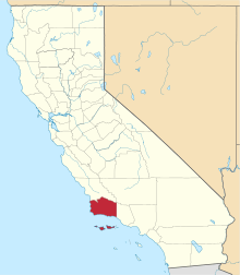 | |
| CDPs | ||
| Unincorporated communities | ||
| Indian reservation | ||
| Ghost towns | ||