Mission Canyon, California
| Mission Canyon | |
|---|---|
| Census designated place | |
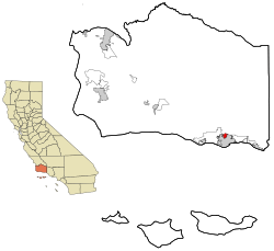 Location in Santa Barbara County and the state of California | |
| Coordinates: 34°26′59″N 119°42′59″W / 34.44972°N 119.71639°WCoordinates: 34°26′59″N 119°42′59″W / 34.44972°N 119.71639°W | |
| Country |
|
| State |
|
| County | Santa Barbara |
| Government | |
| • State senator | Hannah-Beth Jackson (D)[1] |
| • Assemblymember | Monique Limón (D)[1] |
| • U. S. rep. | Lois Capps (D)[2] |
| Area[3] | |
| • Total | 1.547 sq mi (4.008 km2) |
| • Land | 1.517 sq mi (3.930 km2) |
| • Water | 0.030 sq mi (0.078 km2) 1.94% |
| Elevation[4] | 633 ft (193 m) |
| Population (April 1, 2010) | |
| • Total | 2,381 |
| • Density | 1,500/sq mi (590/km2) |
| Time zone | Pacific (UTC-8) |
| • Summer (DST) | PDT (UTC-7) |
| ZIP code | 93105 |
| Area code | 805 |
| FIPS code | 06-48147 |
| GNIS feature ID | 1853400 |
Mission Canyon is a census-designated place and an unincorporated suburb of Santa Barbara, California, in Santa Barbara County, United States. The population was 2,381 at the 2010 census, down from 2,610 at the 2000 census.
Mission Canyon is directly north — on the mountain side — of the city of Santa Barbara, and derives its name from the Mission Santa Barbara which is built between Mission Canyon and the center of the city. The canyon itself is one of the most dramatic in the Santa Ynez Mountains, with the locally highest peak (La Cumbre Peak, 3985') at the top of the watershed, and rugged sandstone formations, partially covered with chaparral, on both sides of the creek.
State Route 192 (Foothill Road) bisects the southern portion of the area, running from east to west, and Mission Canyon Road passes through the area from north to south. Another major north-south artery is Tunnel Road, which leads to the trailhead for several popular hiking trails that start at the northern extremity of the urbanized area; these trails lead up into the mountains.
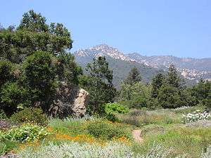
The Santa Barbara Botanic Garden is located in Mission Canyon.
Geography
The approximate center of Mission Canyon is located at 34°26′59″N 119°42′59″W / 34.44972°N 119.71639°W (34.449797, -119.716315).[5]
According to the United States Census Bureau, the CDP has a total area of 1.5 square miles (3.9 km2), of which 1.5 square miles (3.9 km2) are land and 0.03 square miles (0.078 km2) (1.94%) is water.
Climate
This region experiences warm (but not hot) and dry summers, with no average monthly temperatures above 71.6 °F. According to the Köppen Climate Classification system, Mission Canyon has a warm-summer Mediterranean climate, abbreviated "Csb" on climate maps.[6]
Demographics
2010
The 2010 United States Census[7] reported that Mission Canyon had a population of 2,381. The population density was 1,538.8 people per square mile (594.1/km²). The racial makeup of Mission Canyon was 2,193 (92.1%) White, 14 (0.6%) African American, 17 (0.7%) Native American, 40 (1.7%) Asian, 11 (0.5%) Pacific Islander, 35 (1.5%) from other races, and 71 (3.0%) from two or more races. Hispanic or Latino of any race were 198 persons (8.3%).
The Census reported that 2,372 people (99.6% of the population) lived in households, 0 (0%) lived in non-institutionalized group quarters, and 9 (0.4%) were institutionalized.
There were 1,020 households, out of which 230 (22.5%) had children under the age of 18 living in them, 547 (53.6%) were opposite-sex married couples living together, 59 (5.8%) had a female householder with no husband present, 20 (2.0%) had a male householder with no wife present. There were 59 (5.8%) unmarried opposite-sex partnerships, and 14 (1.4%) same-sex married couples or partnerships. 264 households (25.9%) were made up of individuals and 97 (9.5%) had someone living alone who was 65 years of age or older. The average household size was 2.33. There were 626 families (61.4% of all households); the average family size was 2.70.
The population was spread out with 368 people (15.5%) under the age of 18, 100 people (4.2%) aged 18 to 24, 458 people (19.2%) aged 25 to 44, 973 people (40.9%) aged 45 to 64, and 482 people (20.2%) who were 65 years of age or older. The median age was 51.3 years. For every 100 females there were 95.5 males. For every 100 females age 18 and over, there were 97.0 males.
There were 1,075 housing units at an average density of 694.7 per square mile (268.2/km²), of which 782 (76.7%) were owner-occupied, and 238 (23.3%) were occupied by renters. The homeowner vacancy rate was 0.8%; the rental vacancy rate was 4.4%. 1,828 people (76.8% of the population) lived in owner-occupied housing units and 544 people (22.8%) lived in rental housing units.
2000
As of the census[8] of 2000, there were 2,610 people, 1,065 households, and 689 families residing in the CDP. The population density was 1,663.6 people per square mile (641.9/km²). There were 1,115 housing units at an average density of 710.7 per square mile (274.2/km²). The racial makeup of the CDP was 93.64% White, 0.42% African American, 0.15% Native American, 1.30% Asian, 0.04% Pacific Islander, 2.18% from other races, and 2.26% from two or more races. Hispanic or Latino of any race were 6.63% of the population.
There were 1,065 households out of which 23.5% had children under the age of 18 living with them, 52.6% were married couples living together, 8.1% had a female householder with no husband present, and 35.3% were non-families. 22.3% of all households were made up of individuals and 6.1% had someone living alone who was 65 years of age or older. The average household size was 2.44 and the average family size was 2.73.
In the CDP the population was spread out with 16.9% under the age of 18, 5.0% from 18 to 24, 27.8% from 25 to 44, 35.4% from 45 to 64, and 14.9% who were 65 years of age or older. The median age was 45 years. For every 100 females there were 93.2 males. For every 100 females age 18 and over, there were 93.4 males.
The median income for a household in the CDP was $79,338, and the median income for a family was $103,442. Males had a median income of $57,222 versus $41,131 for females. The per capita income for the CDP was $43,422. About 1.0% of families and 6.8% of the population were below the poverty line, including 1.6% of those under age 18 and 7.4% of those age 65 or over.
References
- 1 2 "Statewide Database". UC Regents. Retrieved December 8, 2014.
- ↑ "California's 24th Congressional District - Representatives & District Map". Civic Impulse, LLC. Retrieved September 29, 2014.
- ↑ "2010 Census U.S. Gazetteer Files – Places – California". United States Census Bureau.
- ↑ "Mission Canyon". Geographic Names Information System. United States Geological Survey. Retrieved April 17, 2015.
- ↑ "US Gazetteer files: 2010, 2000, and 1990". United States Census Bureau. 2011-02-12. Retrieved 2011-04-23.
- ↑ Climate Summary for Mission Canyon, California
- ↑ "2010 Census Interactive Population Search: CA - Mission Canyon CDP". U.S. Census Bureau. Retrieved July 12, 2014.
- ↑ "American FactFinder". United States Census Bureau. Retrieved 2008-01-31.
Municipalities and communities of Santa Barbara County, California, United States | ||
|---|---|---|
| Cities | 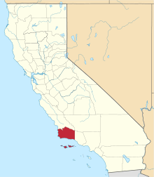 | |
| CDPs | ||
| Unincorporated communities | ||
| Indian reservation | ||
| Ghost towns | ||