Ventucopa, California
Ventucopa is an unincorporated community in the southeastern Cuyama Valley, within eastern Santa Barbara County, California.
The ZIP Code is 93252, and the community is inside area code 661.
Geography
The community is on the southern Maricopa Highway section of State Route 33, near an upper southern fork of the seasonally-dry Cuyama River. It is about 30 miles (48 km) southeast of Cuyama which is in the western Cuyama Valley.
The name Ventucopa is a portmanteau of the cities of Ventura and Maricopa, which are located along Highway 33 to the south and north, respectively.
Access
Because of how the county borders were drawn in relation to the valley and the Cuyama River, the community is ground transportation isolated from the rest of Santa Barbara County. Travel to other communities within the county requires crossing through either Ventura County (south) via the southern Maricopa Highway section of State Route 33 and Ojai to 101, or San Luis Obispo County (north) via the western Cuyama Highway−State Route 166 and Santa Maria to 101. Access from the San Joaquin Valley and Interstate 5 to the north in Kern County is via the eastern Maricopa Highway section of State Route 166.
See also
- Cuyama Valley topics
References
Coordinates: 34°49′53″N 119°28′08″W / 34.83139°N 119.46889°W
Municipalities and communities of Santa Barbara County, California, United States | ||
|---|---|---|
| Cities | 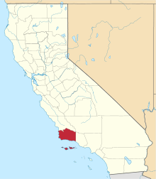 | |
| CDPs | ||
| Unincorporated communities | ||
| Indian reservation | ||
| Ghost towns | ||