Bloomville, New York
| Bloomville, New York | |
|---|---|
| Census-designated place | |
 Bloomville | |
| Coordinates: 42°20′0″N 74°48′27″W / 42.33333°N 74.80750°WCoordinates: 42°20′0″N 74°48′27″W / 42.33333°N 74.80750°W[1] | |
| Country | United States |
| State | New York |
| County | Delaware County |
| Town | Kortright |
| Area[2] | |
| • Total | 1.3 sq mi (3.4 km2) |
| • Land | 1.3 sq mi (3.4 km2) |
| • Water | 0 sq mi (0 km2) |
| Elevation | 1,455 ft (443 m) |
| Population (2010)[2] | |
| • Total | 213 |
| • Density | 162/sq mi (62.5/km2) |
| Time zone | Eastern (EST) (UTC-5) |
| • Summer (DST) | EDT (UTC-4) |
| ZIP code | 13739 |
| Area code | 607 |
| FIPS code[2] | 36-07025 |
| GNIS feature ID[1] | 944294 |
Bloomville is a hamlet and census-designated place (CDP) in the town of Kortright, Delaware County, New York, United States. The population was 213 at the 2010 census.[2]
Bloomville is located north of the Catskill Mountains. Like many communities in the Catskills, its population is split between farmers and second home owners.
Geography
Bloomville is located in the southwest corner of the town of Kortright, on the north side of the valley of the West Branch Delaware River. New York State Route 10 passes through the hamlet, leading southwest 7 miles (11 km) to Delhi, the county seat, and northeast 12 miles (19 km) to Stamford.
According to the United States Census Bureau, the Bloomville CDP has a total area of 1.3 square miles (3.4 km2), all land.[2]
The west end of the Catskill Scenic Trail, a rail-trail following the route of the former Ulster and Delaware Railroad, is in Bloomville. There is a parking lot just across Route 10 from the trailhead.
Culture
Bloomville is part of a developing Catskills culinary scene. A new restaurant, Table on Ten, was recently featured in Conde Nast Traveler and other upscale publications.[3]
References
- 1 2 "Bloomville". Geographic Names Information System. United States Geological Survey. Retrieved November 10, 2015.
- 1 2 3 4 5 "Geographic Identifiers: 2010 Demographic Profile Data (G001): Bloomville CDP, New York". U.S. Census Bureau, American Factfinder. Retrieved November 10, 2015.
- ↑ "The Catskills Are New York's New Culinary Retreat". Condé Nast Traveler.
Municipalities and communities of Delaware County, New York, United States | ||
|---|---|---|
| Towns | 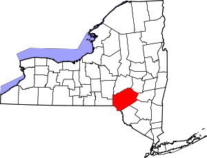 | |
| Villages | ||
| CDPs | ||
| Hamlets | ||
| Footnotes | ‡This populated place also has portions in an adjacent county or counties | |