Hancock (village), New York
| Hancock, New York | |
|---|---|
| Village | |
|
Hancock Town Square | |
| Motto: Gateway to the Upper Delaware | |
 Hancock Location within the state of New York | |
| Coordinates: 41°57′17″N 75°17′0″W / 41.95472°N 75.28333°WCoordinates: 41°57′17″N 75°17′0″W / 41.95472°N 75.28333°W | |
| Country | United States |
| State | New York |
| County | Delaware |
| Town | Hancock |
| Area | |
| • Total | 1.64 sq mi (4.25 km2) |
| • Land | 1.50 sq mi (3.89 km2) |
| • Water | 0.14 sq mi (0.36 km2) |
| Elevation | 922 ft (281 m) |
| Population (2010) | |
| • Total | 1,031 |
| • Density | 687/sq mi (265.1/km2) |
| Time zone | Eastern (EST) (UTC-5) |
| • Summer (DST) | EDT (UTC-4) |
| ZIP code | 13783 |
| Area code(s) | 607 |
| FIPS code | 36-31940 |
| GNIS feature ID | 0952148 |
| Website |
villageofhancock |

Hancock is a village in Delaware County, New York, United States. The population was 1,031 at the 2010 census.[1] The village is in the west part of the town of Hancock at the junction of NY Routes 17 and 97.
Hancock is located at the confluence of the East and West branches of the Delaware River.
Hancock owes its former importance mainly to the Erie Railroad from 1848. The Erie merged into the Erie Lackawanna Railway in 1960. The railroad still exists as the Southern Tier Line of the Norfolk Southern Railway, leased to the Central New York Railroad, but sees only a few freight trains weekly.
The Scranton Branch of the New York, Ontario and Western Railway bridged the West Branch of the Delaware River just west of the village; this railway's main activity in the area was at Cadosia junction, a few miles up the East Branch of the Delaware River. Though the O&W ceased operations on March 29, 1957, the bridge was not removed until the 1970s.
Geography
Hancock is situated at the convergence of the East and West Branch of the Delaware River and borders Pennsylvania. The village is located at 41°57′17″N 75°16′59″W / 41.95472°N 75.28306°W (41.954764, -75.283326).[2] Hancock is 43 miles (69 km) east of Binghamton with easy access via New York State Route 17. To many, Hancock is considered part of the Southern Tier region, while others regard it a part of the Catskills region. Nevertheless, since it is farther from New York City than Roscoe, it is always considered as Upstate New York.
According to the United States Census Bureau, the village has a total area of 1.7 square miles (4.3 km2), of which 1.5 square miles (3.9 km2) is land and 0.2 square miles (0.4 km2), or 8.57%, is water.[1]
Demographics
| Historical population | |||
|---|---|---|---|
| Census | Pop. | %± | |
| 1880 | 686 | — | |
| 1890 | 1,279 | 86.4% | |
| 1900 | 1,283 | 0.3% | |
| 1910 | 1,329 | 3.6% | |
| 1920 | 1,326 | −0.2% | |
| 1930 | 1,427 | 7.6% | |
| 1940 | 1,581 | 10.8% | |
| 1950 | 1,560 | −1.3% | |
| 1960 | 1,830 | 17.3% | |
| 1970 | 1,688 | −7.8% | |
| 1980 | 1,526 | −9.6% | |
| 1990 | 1,330 | −12.8% | |
| 2000 | 1,189 | −10.6% | |
| 2010 | 1,031 | −13.3% | |
| Est. 2015 | 976 | [3] | −5.3% |
As of the census[5] of 2000, there were 1,189 people, 505 households, and 311 families residing in the village. The population density was 755.4 people per square mile (292.4/km²). There were 594 housing units at an average density of 377.4 per square mile (146.1/km²). The racial makeup of the village was 96.89% White, 0.42% Black or African American, 0.42% Native American, 0.17% Asian, 0.42% from other races, and 1.68% from two or more races. Hispanic or Latino of any race were 3.28% of the population.
There were 505 households out of which 25.0% had children under the age of 18 living with them, 45.9% were married couples living together, 11.3% had a female householder with no husband present, and 38.4% were non-families. 34.5% of all households were made up of individuals and 20.0% had someone living alone who was 65 years of age or older. The average household size was 2.35 and the average family size was 2.95.
In the village the population was spread out with 22.5% under the age of 18, 6.0% from 18 to 24, 22.9% from 25 to 44, 24.2% from 45 to 64, and 24.4% who were 65 years of age or older. The median age was 44 years. For every 100 females there were 88.1 males. For every 100 females age 18 and over, there were 84.2 males.
The median income for a household in the village was $27,419, and the median income for a family was $36,083. Males had a median income of $27,455 versus $17,188 for females. The per capita income for the village was $16,616. About 7.9% of families and 15.6% of the population were below the poverty line, including 23.7% of those under age 18 and 15.7% of those age 65 or over.
Current status
A group called Hancock Partners is heading up an effort to revitalize the town and village by spurring new growth in an attempt to attract new residents, retain the younger demographic, increase tourism, and generally improve the quality of life in the area. A tourism plan was created in 2007 by the SUNY College of Environmental Science and Forestry to serve as a guidepost for this effort.
Every year the Bear Creek Sportsman holds an event on Labor Day weekend, which raises over $300,000 for the fire department and new health clinic.
References
- 1 2 "Geographic Identifiers: 2010 Demographic Profile Data (G001): Hancock village, New York". U.S. Census Bureau, American Factfinder. Retrieved November 9, 2015.
- ↑ "US Gazetteer files: 2010, 2000, and 1990". United States Census Bureau. 2011-02-12. Retrieved 2011-04-23.
- ↑ "Annual Estimates of the Resident Population for Incorporated Places: April 1, 2010 to July 1, 2015". Retrieved July 2, 2016.
- ↑ "Census of Population and Housing". Census.gov. Retrieved June 4, 2015.
- ↑ "American FactFinder". United States Census Bureau. Retrieved 2008-01-31.
External links
- Village of Hancock official website
- Hancock Area Chamber of Commerce
- Town/Village of Hancock (from Delaware County website)
- Hancock Partners
- Tourism plan
Schools
Publications
- The Hancock Herald, serving Hancock and the surrounding area since 1873
Municipalities and communities of Delaware County, New York, United States | ||
|---|---|---|
| Towns | 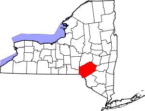 | |
| Villages | ||
| CDPs | ||
| Hamlets | ||
| Footnotes | ‡This populated place also has portions in an adjacent county or counties | |