Banks Township, Carbon County, Pennsylvania
| Banks | |
|---|---|
| township | |
|
Victory Bible Church in Junedale | |
 Location of Banks Township in Carbon County | |
 Banks  Banks Location of Banks Township in Pennsylvania | |
| Coordinates: 40°55′45″N 75°55′22″W / 40.92917°N 75.92278°WCoordinates: 40°55′45″N 75°55′22″W / 40.92917°N 75.92278°W | |
| Country | United States |
| State | Pennsylvania |
| County | Carbon |
| Area | |
| • Total | 11.6 sq mi (30 km2) |
| • Land | 11.6 sq mi (30 km2) |
| • Water | 0.0 sq mi (0 km2) |
| Elevation | 1,600 ft (500 m) |
| Population (2010) | |
| • Total | 1,262 |
| • Density | 110/sq mi (42/km2) |
| Time zone | EST (UTC-5) |
| • Summer (DST) | EDT (UTC-4) |
| Area code(s) | 570 |

Banks Township is a township in Carbon County, Pennsylvania, United States. The population was 1,262 at the 2010 census.[1]
Geography
Banks Township is located in western Carbon County and is bordered by Luzerne County to the north and Schuylkill County to the west. Its southern border approximately follows the crest of Spring Mountain. The township surrounds the borough of Beaver Meadows but is separate from it. Its villages include Audenried, Coxes, Junedale, and Tresckow.
Pennsylvania Route 93 passes through the township and Beaver Meadows, leading northwest 3 miles (5 km) to Hazleton and southeast 12 miles (19 km) to Jim Thorpe, the Carbon County seat.
According to the United States Census Bureau, the township has a total area of 11.6 square miles (30.1 km2), all of it land.[1] Most of it is drained by Black Creek east into the Lehigh River, except for the Audenried area which is drained west by Catawissa Creek into the Susquehanna River.
Neighboring municipalities
- Lausanne Township (east)
- Weatherly (east)
- Packer Township (south)
- Kline Township, Schuylkill County (west)
- McAdoo, Schuylkill County (west)
- Hazle Township, Luzerne County (north)
Banks Township surrounds the borough of Beaver Meadows.
Demographics
As of the census[2] of 2000, there were 1,359 people, 570 households, and 384 families residing in the township. The population density was 123.6 people per square mile (47.7/km²). There were 620 housing units at an average density of 56.4/sq mi (21.8/km²). The racial makeup of the township was 98.90% White, 0.37% African American, 0.29% Native American, 0.07% Asian, 0.15% Pacific Islander, and 0.22% from two or more races. Hispanic or Latino of any race were 0.81% of the population.
There were 570 households, out of which 24.0% had children under the age of 18 living with them, 50.4% were married couples living together, 12.3% had a female householder with no husband present, and 32.6% were non-families. 30.2% of all households were made up of individuals, and 16.1% had someone living alone who was 65 years of age or older. The average household size was 2.34 and the average family size was 2.89.
In the township the population was spread out, with 20.1% under the age of 18, 5.5% from 18 to 24, 28.0% from 25 to 44, 24.1% from 45 to 64, and 22.3% who were 65 years of age or older. The median age was 43 years. For every 100 females there were 88.2 males. For every 100 females age 18 and over, there were 84.4 males.
The median income for a household in the township was $32,083, and the median income for a family was $40,000. Males had a median income of $31,534 versus $26,157 for females. The per capita income for the township was $16,186. About 7.6% of families and 9.1% of the population were below the poverty line, including 13.8% of those under age 18 and 9.3% of those age 65 or over.
-

Post Office in Tresckow
References
- 1 2 "Geographic Identifiers: 2010 Demographic Profile Data (G001): Banks township, Carbon County, Pennsylvania". U.S. Census Bureau, American Factfinder. Retrieved April 3, 2015.
- ↑ "American FactFinder". United States Census Bureau. Archived from the original on September 11, 2013. Retrieved 2008-01-31.
Municipalities and communities of Carbon County, Pennsylvania, United States | ||
|---|---|---|
| Boroughs | 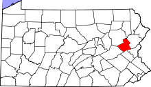 | |
| Townships | ||
| CDPs | ||
| Unincorporated communities | ||
| Footnotes | ‡This populated place also has portions in an adjacent county or counties | |