Beaver Meadows, Pennsylvania
| Beaver Meadows, Pennsylvania | |
| Borough | |
 Gazebo on Church St. | |
| Country | United States |
|---|---|
| State | Pennsylvania |
| County | Carbon |
| Elevation | 1,598 ft (487.1 m) [1] |
| Coordinates | 40°55′42″N 75°54′46″W / 40.92833°N 75.91278°WCoordinates: 40°55′42″N 75°54′46″W / 40.92833°N 75.91278°W |
| Area | 0.3 sq mi (0.8 km2) |
| - land | 0.3 sq mi (1 km2) |
| - water | 0.0 sq mi (0 km2), 0% |
| Population | 869 (2010) |
| Density | 3,342.3/sq mi (1,290.5/km2) |
| Timezone | EST (UTC-5) |
| - summer (DST) | EDT (UTC-4) |
| ZIP code | 18216 |
| Area code | 570 |
 Location of Beaver Meadows in Carbon County
| |
 Location of Beaver Meadows in Pennsylvania
| |
 Location of Pennsylvania in the United States
| |
Beaver Meadows is a borough in Carbon County, Pennsylvania, United States. The population was 869 at the 2010 census.[2]
Geography
Beaver Meadows is located in western Carbon County at 40°55′42″N 75°54′46″W / 40.92833°N 75.91278°W (40.928438, -75.912787).[3] Pennsylvania Route 93 passes through the borough, leading northwest 4 miles (6 km) to Hazleton and southeast 9 miles (14 km) to U.S. Route 209 in Nesquehoning. Weatherly is 4 miles (6 km) to the east via Spring Mountain Road.
According to the United States Census Bureau, the borough has a total area of 0.26 square miles (0.67 km2), all of it land.[2]
Beaver Meadow is situated at an elevation of 1,598 feet (487 m) above sea level in the valley of Beaver Creek, north of Spring Mountain, part of the Ridge-and-Valley Appalachians.
Demographics
| Historical population | |||
|---|---|---|---|
| Census | Pop. | %± | |
| 1880 | 502 | — | |
| 1900 | 1,378 | — | |
| 1910 | 1,530 | 11.0% | |
| 1920 | 1,709 | 11.7% | |
| 1930 | 1,890 | 10.6% | |
| 1940 | 2,030 | 7.4% | |
| 1950 | 1,723 | −15.1% | |
| 1960 | 1,392 | −19.2% | |
| 1970 | 1,274 | −8.5% | |
| 1980 | 1,078 | −15.4% | |
| 1990 | 985 | −8.6% | |
| 2000 | 968 | −1.7% | |
| 2010 | 869 | −10.2% | |
| Est. 2015 | 842 | [4] | −3.1% |
| Sources:[5][6][7] | |||
As of the census[6] of 2000, there were 968 people, 404 households, and 258 families residing in the borough. The population density was 3,746.4 people per square mile (1,437.5/km²). There were 458 housing units at an average density of 1,772.6 per square mile (680.1/km²). The racial makeup of the borough was 99.38% White, 0.10% Native American, 0.21% Asian, 0.21% from other races, and 0.10% from two or more races. Hispanic or Latino of any race were 1.24% of the population.
There were 404 households, out of which 24.8% had children under the age of 18 living with them, 46.0% were married couples living together, 10.4% had a female householder with no husband present, and 36.1% were non-families. 33.2% of all households were made up of individuals, and 17.1% had someone living alone who was 65 years of age or older. The average household size was 2.39 and the average family size was 3.04.
In the borough the population was spread out, with 22.3% under the age of 18, 6.6% from 18 to 24, 28.8% from 25 to 44, 20.0% from 45 to 64, and 22.2% who were 65 years of age or older. The median age was 40 years. For every 100 females there were 100.4 males. For every 100 females age 18 and over, there were 102.7 males.
The median income for a household in the borough was $31,058, and the median income for a family was $42,500. Males had a median income of $30,000 versus $20,417 for females. The per capita income for the borough was $17,296. About 4.4% of families and 7.6% of the population were below the poverty line, including 6.0% of those under age 18 and 15.6% of those age 65 or over.
Notable people
- Norm Larker, Major League Baseball player from 1958 to 1963. He died in Long Beach, California at the age of 76.
References
- ↑ "Borough of Beaver Meadows". Geographic Names Information System. United States Geological Survey. August 2, 1979. Retrieved 2008-02-05.
- 1 2 "Geographic Identifiers: 2010 Demographic Profile Data (G001): Beaver Meadows borough, Pennsylvania". U.S. Census Bureau, American Factfinder. Retrieved April 1, 2015.
- ↑ "US Gazetteer files: 2010, 2000, and 1990". United States Census Bureau. 2011-02-12. Retrieved 2011-04-23.
- ↑ "Annual Estimates of the Resident Population for Incorporated Places: April 1, 2010 to July 1, 2015". Retrieved July 2, 2016.
- ↑ "Census of Population and Housing". U.S. Census Bureau. Archived from the original on 11 May 2015. Retrieved 11 December 2013.
- 1 2 "American FactFinder". United States Census Bureau. Archived from the original on 2013-09-11. Retrieved 2008-01-31.
- ↑ "Incorporated Places and Minor Civil Divisions Datasets: Subcounty Resident Population Estimates: April 1, 2010 to July 1, 2012". Population Estimates. U.S. Census Bureau. Archived from the original on 17 June 2013. Retrieved 11 December 2013.
Municipalities and communities of Carbon County, Pennsylvania, United States | ||
|---|---|---|
| Boroughs | 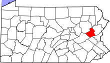 | |
| Townships | ||
| CDPs | ||
| Unincorporated communities | ||
| Footnotes | ‡This populated place also has portions in an adjacent county or counties | |