McAdoo, Pennsylvania
| McAdoo, Pennsylvania | |
|---|---|
| Borough | |
|
St. Mary's Ukrainian Catholic Church. | |
 McAdoo, Pennsylvania | |
| Coordinates: 40°54′03″N 75°59′31″W / 40.90083°N 75.99194°WCoordinates: 40°54′03″N 75°59′31″W / 40.90083°N 75.99194°W | |
| Country | United States |
| State | Pennsylvania |
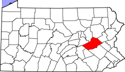
| County | Schuylkill |
| Incorporated | 1896 |
| Government | |
| • Type | Borough Council |
| • Mayor | Steve Holly |
| Area | |
| • Total | 0.3 sq mi (0.8 km2) |
| Population (2010) | |
| • Total | 2,300 |
| • Density | 6,916.7/sq mi (2,670.6/km2) |
| Time zone | Eastern (EST) (UTC-5) |
| • Summer (DST) | EDT (UTC-4) |
| Zip code | 18237 |
| Area code(s) | 570 Exchange: 929 |
| [1] | |

McAdoo is a borough and coal town in Schuylkill County, Pennsylvania, United States, 5 miles (8.0 km) south of Hazleton and 7 miles north of Tamaqua. McAdoo contains the picturesque Silver Brook Meadow. In the past, anthracite coal mining and a shirt factory, The McAdoo Manufacturing Company, provided gainful employment to the populace. The population was 2,300 at the 2010 census.
Geography
According to the United States Census Bureau, the borough has a total area of 0.3 square miles (0.78 km2), all of it land. McAdoo's elevation is 1700 feet above sea level. It is on the crest of Broad Mountain and straddles the divide between the Delaware and Susquehanna watersheds. Route 309 is the main north-to-south thoroughfare.
Demographics
| Historical population | |||
|---|---|---|---|
| Census | Pop. | %± | |
| 1900 | 2,122 | — | |
| 1910 | 3,389 | 59.7% | |
| 1920 | 4,674 | 37.9% | |
| 1930 | 5,239 | 12.1% | |
| 1940 | 5,127 | −2.1% | |
| 1950 | 4,260 | −16.9% | |
| 1960 | 3,560 | −16.4% | |
| 1970 | 3,326 | −6.6% | |
| 1980 | 2,940 | −11.6% | |
| 1990 | 2,459 | −16.4% | |
| 2000 | 2,274 | −7.5% | |
| 2010 | 2,300 | 1.1% | |
| Est. 2015 | 2,205 | [2] | −4.1% |
| Sources:[3][4][5] | |||
As of the census[4] of 2000, there were 2,274 people, 1,034 households, and 617 families residing in the borough. The population density was 6,916.7 people per square mile (2,660.6/km²). There were 1,211 housing units at an average density of 3,683.4 per square mile (1,416.9/km²). The racial makeup of the borough was 99.47% White, 0.09% African American, 0.04% Native American, 0.04% Asian, 0.31% from other races, and 0.04% from two or more races. Hispanic or Latino of any race were 0.66% of the population.
The most common ancestries in McAdoo is Polish (15.5%), Italian (14.1%), Slovak (10.6%), Irish (7.8%), and Greek (5.0%)
There were 1,034 households out of which 23.8% had children under the age of 18 living with them, 42.5% were married couples living together, 12.0% had a female householder with no husband present, and 40.3% were non-families. 37.1% of all households were made up of individuals and 20.9% had someone living alone who was 65 years of age or older. The average household size was 2.19 and the average family size was 2.89.
In the borough the population was spread out with 20.6% under the age of 18, 6.1% from 18 to 24, 28.4% from 25 to 44, 21.5% from 45 to 64, and 23.3% who were 65 years of age or older. The median age was 41 years. For every 100 females there were 91.1 males. For every 100 females age 18 and over, there were 87.0 males.
The median income for a household in the borough was $25,721, and the median income for a family was $31,625. Males had a median income of $28,281 versus $21,096 for females. The per capita income for the borough was $14,723. About 9.1% of families and 14.5% of the population were below the poverty line, including 24.7% of those under age 18 and 12.6% of those age 65 or over.
Gallery
 S. Kennedy Dr. (PA 309) in McAdoo.
 McAdoo Fire Co., Old Bldg.
 St. Patrick's Catholic School.
 St. Michael's Bysantine Catholic Church.
 St. Mary's Slovak Catholic Church.
Education
The Hazleton Area School District operates public schools, including the McAdoo-Kelayres Elementary-Middle School in McAdoo, which also serves Kelayres. All McAdoo residents are zoned to the Hazleton Area High School in Hazle Township.[6]
References
- ↑ "US Gazetteer files: 2010, 2000, and 1990". United States Census Bureau. 2011-02-12. Retrieved 2011-04-23.
- ↑ "Annual Estimates of the Resident Population for Incorporated Places: April 1, 2010 to July 1, 2015". Retrieved July 2, 2016.
- ↑ "Census of Population and Housing". U.S. Census Bureau. Archived from the original on May 11, 2015. Retrieved 11 December 2013.
- 1 2 "American FactFinder". United States Census Bureau. Archived from the original on September 11, 2013. Retrieved 2008-01-31.
- ↑ "Incorporated Places and Minor Civil Divisions Datasets: Subcounty Resident Population Estimates: April 1, 2010 to July 1, 2012". Population Estimates. U.S. Census Bureau. Archived from the original on June 17, 2013. Retrieved 11 December 2013.
- ↑ "Locate Us." Hazleton Area School District. Retrieved on July 18, 2016.
| Wikimedia Commons has media related to McAdoo, Pennsylvania. |