Aubry Township, Johnson County, Kansas
| Aubry Township | |
|---|---|
| Township | |
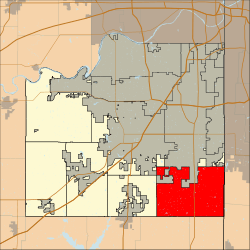 Location in Johnson County | |
| Coordinates: 38°46′55″N 94°41′11″W / 38.78194°N 94.68639°WCoordinates: 38°46′55″N 94°41′11″W / 38.78194°N 94.68639°W | |
| Country | United States |
| State | Kansas |
| County | Johnson |
| Area | |
| • Total | 48.85 sq mi (126.52 km2) |
| • Land | 48.7 sq mi (126.13 km2) |
| • Water | 0.15 sq mi (0.4 km2) 0.32% |
| Elevation | 1,063 ft (324 m) |
| Population (2000) | |
| • Total | 5,440 |
| • Density | 111.7/sq mi (43.1/km2) |
| ZIP codes | 66013, 66062, 66083, 66085 |
| GNIS feature ID | 0479425 |
Aubry Township is one of seven townships in Johnson County, Kansas, USA. As of the 2000 census, its population was 5,440.[1]
Aubry Township was organized in 1858.[2]
Geography
According to the United States Census Bureau, Aubry Township covers an area of 48.85 square miles (126.52 square kilometers); of this, 48.7 square miles (126.13 square kilometers, 99.69 percent) is land and 0.15 square miles (0.4 square kilometers, 0.32 percent) is water.
The south edge of the city of Overland Park is within this township geographically but is a separate entity.
Unincorporated towns
- Aubry at 38°46′15″N 94°40′16″W / 38.770842°N 94.671068°W
- Stilwell at 38°46′09″N 94°39′23″W / 38.769176°N 94.656345°W
(This list is based on USGS data and may include former settlements.)
Adjacent townships
- Oxford Township (north)
- Wea Township, Miami County (south)
- Ten Mile Township, Miami County (southwest)
- Spring Hill Township (west)
- Olathe Township (northwest)
Cemeteries
The township contains these two cemeteries: Aubry and Woodland.
Major highways
Airports and landing strips
- Hillside Airport
- Mission Road Landing Strip
School districts
- Blue Valley Unified School District 229
- Spring Hill Unified School District 230
Political districts
- Kansas's 3rd congressional district
- State House District 27
- State Senate District 37
References
- United States Census Bureau 2007 TIGER/Line Shapefiles
- "Township of Aubry". Geographic Names Information System. United States Geological Survey. Retrieved 2014-01-04.
- United States National Atlas
- ↑ United States Census Bureau American FactFinder
- ↑ History of the State of Kansas: Containing a Full Account of Its Growth from an Uninhabited Territory to a Wealthy and Important State. A. T. Andreas. 1883. p. 645.
External links
Municipalities and communities of Johnson County, Kansas, United States | ||
|---|---|---|
| Cities | 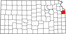 | |
| Unincorporated communities | ||
| Townships | ||
| Footnotes | ‡This populated place also has portions in an adjacent county or counties | |
This article is issued from Wikipedia - version of the 10/10/2016. The text is available under the Creative Commons Attribution/Share Alike but additional terms may apply for the media files.