Zagorica pri Velikem Gabru
| Zagorica pri Velikem Gabru | |
|---|---|
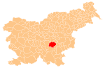
 Zagorica pri Velikem Gabru Location in Slovenia | |
| Coordinates: 45°55′17.67″N 14°53′24.07″E / 45.9215750°N 14.8900194°ECoordinates: 45°55′17.67″N 14°53′24.07″E / 45.9215750°N 14.8900194°E | |
| Country |
|
| Traditional region | Lower Carniola |
| Statistical region | Southeast Slovenia |
| Municipality | Trebnje |
| Area | |
| • Total | 2.89 km2 (1.12 sq mi) |
| Elevation | 316.7 m (1,039.0 ft) |
| Population (2002) | |
| • Total | 229 |
| [1] | |
Zagorica pri Velikem Gabru (pronounced [zaɡɔˈɾiːtsa pɾi ˈʋeːlikɛm ˈɡaːbɾu]; German: Sagoritza[2]) is a village in the Municipality of Trebnje in eastern Slovenia. It lies just south of the A2 motorway in the historical region of Lower Carniola. The municipality is now included in the Southeast Slovenia Statistical Region.[3]
Name
The name of the settlement was changed from Zagorica to Zagorica pri Velikem Gabru in 1953.[4] In the past the German name was Sagoritza.[2]
Cultural heritage
During the construction of the motorway an archaeological site with Eneolithic, La Tène–period, Roman-period and early medieval settlement layers was discivered in the area.[5]
References
- ↑ Statistical Office of the Republic of Slovenia
- 1 2 Leksikon občin kraljestev in dežel zastopanih v državnem zboru, vol. 6: Kranjsko. 1906. Vienna: C. Kr. Dvorna in Državna Tiskarna, p. 104.
- ↑ Trebnje municipal site
- ↑ Spremembe naselij 1948–95. 1996. Database. Ljubljana: Geografski inštitut ZRC SAZU, DZS.
- ↑ "EŠD 15513". Registry of Immovable Cultural Heritage (in Slovenian). Ministry of Culture of the Republic of Slovenia. Retrieved 9 February 2011.
External links
This article is issued from Wikipedia - version of the 1/3/2016. The text is available under the Creative Commons Attribution/Share Alike but additional terms may apply for the media files.