Veliki Gaber
| Veliki Gaber | |
|---|---|
| Village | |
|
Postcard of Veliki Gaber | |
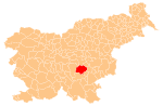
 Veliki Gaber Location in Slovenia | |
| Coordinates: 45°56′17.65″N 14°54′32.66″E / 45.9382361°N 14.9090722°ECoordinates: 45°56′17.65″N 14°54′32.66″E / 45.9382361°N 14.9090722°E | |
| Country |
|
| Traditional region | Lower Carniola |
| Statistical region | Southeast Slovenia |
| Municipality | Trebnje |
| Area | |
| • Total | 1.34 km2 (0.52 sq mi) |
| Elevation | 347.9 m (1,141.4 ft) |
| Population (2002) | |
| • Total | 315 |
| [1] | |
.jpg)
Veliki Gaber (pronounced [ˈʋeːliki ˈɡaːbəɾ]; German: Großgaber[2]) is a village in the Municipality of Trebnje in eastern Slovenia. It lies just north of the Slovenian A2 motorway east of Ivančna Gorica. The area is part of the historical Lower Carniola region. The municipality is now included in the Southeast Slovenia Statistical Region.[3]
The local parish church is dedicated to Saint Ulrich (Slovene: sveti Urh) and belongs to the Roman Catholic Diocese of Novo Mesto. It was built in 1910 on the site of a 17th-century predecessor.[4]
References
- ↑ Statistical Office of the Republic of Slovenia
- ↑ Leksikon občin kraljestev in dežel zastopanih v državnem zboru, vol. 6: Kranjsko. 1906. Vienna: C. Kr. Dvorna in Državna Tiskarna, p. 98.
- ↑ Trebnje municipal site
- ↑ Slovenian Ministry of Culture register of national heritage reference number ešd 2650
External links
This article is issued from Wikipedia - version of the 3/1/2016. The text is available under the Creative Commons Attribution/Share Alike but additional terms may apply for the media files.