Dolga Njiva pri Šentlovrencu
| Dolga Njiva pri Šentlovrencu | |
|---|---|
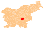
 Dolga Njiva pri Šentlovrencu Location in Slovenia | |
| Coordinates: 45°57′8.25″N 14°56′8.24″E / 45.9522917°N 14.9356222°ECoordinates: 45°57′8.25″N 14°56′8.24″E / 45.9522917°N 14.9356222°E | |
| Country |
|
| Traditional region | Lower Carniola |
| Statistical region | Southeast Slovenia |
| Municipality | Trebnje |
| Area | |
| • Total | 1.42 km2 (0.55 sq mi) |
| Elevation | 331 m (1,086 ft) |
| Population (2002) | |
| • Total | 65 |
| [1] | |
Dolga Njiva pri Šentlovrencu (pronounced [ˈdoːu̯ɡa ˈnjiːʋa pɾi ʃɛnˈtloːu̯ɾɛntsu] or pronounced [ˈdoːu̯ɡa ˈnjiːva pɾi ʃənˈtloːu̯ɾɛntsu]) is a small village north of Šentlovrenc in the Municipality of Trebnje in eastern Slovenia. The area is part of the historical Lower Carniola region. The municipality is now included in the Southeast Slovenia Statistical Region.[2]
Name
The name of the settlement was changed from Dolga Njiva to Dolga Njiva pri Šentlovrencu in 1953.[3]
Church
A small church in the settlement is dedicated to the Finding of the Holy Cross and belongs to the Parish of Šentlovrenc. It is a medieval building and contains fragments of 16th-century frescos in the nave.[4]
References
- ↑ Statistical Office of the Republic of Slovenia
- ↑ Trebnje municipal site
- ↑ Spremembe naselij 1948–95. 1996. Database. Ljubljana: Geografski inštitut ZRC SAZU, DZS.
- ↑ Slovenian Ministry of Culture register of national heritage reference number ešd 2469
External links
This article is issued from Wikipedia - version of the 1/3/2016. The text is available under the Creative Commons Attribution/Share Alike but additional terms may apply for the media files.