Rožni Vrh, Trebnje
| Rožni Vrh | |
|---|---|
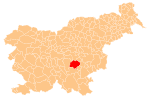
 Rožni Vrh Location in Slovenia | |
| Coordinates: 45°54′40.6″N 14°59′30.73″E / 45.911278°N 14.9918694°ECoordinates: 45°54′40.6″N 14°59′30.73″E / 45.911278°N 14.9918694°E | |
| Country |
|
| Traditional region | Lower Carniola |
| Statistical region | Southeast Slovenia |
| Municipality | Trebnje |
| Area | |
| • Total | 0.33 km2 (0.13 sq mi) |
| Elevation | 292.6 m (960.0 ft) |
| Population (2002) | |
| • Total | 68 |
| [1] | |
Rožni Vrh (pronounced [ˈɾoːʒni ˈʋəɾx]) is a small settlement on the left bank of the Temenica River, just west of Trebnje in eastern Slovenia. The area is part of the historical region of Lower Carniola. The Municipality of Trebnje is now included in the Southeast Slovenia Statistical Region.[2]
References
- ↑ Statistical Office of the Republic of Slovenia Archived November 18, 2008, at the Wayback Machine.
- ↑ Trebnje municipal site
External links
This article is issued from Wikipedia - version of the 11/14/2016. The text is available under the Creative Commons Attribution/Share Alike but additional terms may apply for the media files.