Walton (village), New York
| Walton, New York | |
|---|---|
| Village | |
| Nickname(s): A Lit Place | |
 Walton Location within the state of New York | |
| Coordinates: 42°10′11″N 75°7′49″W / 42.16972°N 75.13028°WCoordinates: 42°10′11″N 75°7′49″W / 42.16972°N 75.13028°W | |
| Country | United States |
| State | New York |
| County | Delaware |
| Town | Walton |
| Area | |
| • Total | 1.60 sq mi (4.15 km2) |
| • Land | 1.54 sq mi (3.99 km2) |
| • Water | 0.06 sq mi (0.15 km2) |
| Elevation | 1,207 ft (368 m) |
| Population (2010) | |
| • Total | 3,088 |
| • Density | 2,004/sq mi (773.7/km2) |
| Time zone | Eastern (EST) (UTC-5) |
| • Summer (DST) | EDT (UTC-4) |
| ZIP code | 13856 |
| Area code(s) | 607 Exchange: 865 |
| FIPS code | 36-78036[1] |
| GNIS feature ID | 0970747[2] |
| Website |
villageofwalton |
Walton is a village in the town of Walton in Delaware County, New York, United States. As of the 2010 census, the village population was 3,088.[3]
Walton is the home of the annual Delaware County Fair, which is typically held in August.[4]
There are three primary and secondary schools in Walton: Townsend Elementary School, Mack Middle School, and O'Neill High School.[5]
History
The Christ Episcopal Church, First Congregational Church of Walton, Gardiner Place Historic District, U.S. Post Office, and the Walton Grange 1454-Former Armory, all listed on the National Register of Historic Places, are located in the village.[6][7]
Walton is the birthplace of William B. Ogden (born 15 June 1805), the first mayor of Chicago and a founder of the Chicago & Northwestern Railroad line.[8][9]
Walton has suffered from major flooding in 1996 and 2006.[10][11]
Geography
The village is located at the center of the town of Walton, along the West Branch Delaware River. New York State Route 10 passes through the village, leading northeast 16 miles (26 km) to Delhi and southwest 27 miles (43 km) to Deposit. New York State Route 206 joins NY 10 in the village center and leads northwest 23 miles (37 km) to Bainbridge and southeast 10 miles (16 km) to Downsville.
According to the United States Census Bureau, the village of Walton has a total area of 1.6 square miles (4.2 km2), of which 1.5 square miles (4.0 km2) is land and 0.1 square miles (0.2 km2), or 3.73%, is water.[3]
Demographics
| Historical population | |||
|---|---|---|---|
| Census | Pop. | %± | |
| 1870 | 866 | — | |
| 1880 | 1,389 | 60.4% | |
| 1890 | 2,299 | 65.5% | |
| 1900 | 2,811 | 22.3% | |
| 1910 | 3,103 | 10.4% | |
| 1920 | 3,598 | 16.0% | |
| 1930 | 3,496 | −2.8% | |
| 1940 | 3,697 | 5.7% | |
| 1950 | 3,947 | 6.8% | |
| 1960 | 3,855 | −2.3% | |
| 1970 | 3,744 | −2.9% | |
| 1980 | 3,329 | −11.1% | |
| 1990 | 3,326 | −0.1% | |
| 2000 | 3,070 | −7.7% | |
| 2010 | 3,088 | 0.6% | |
| Est. 2015 | 2,930 | [12] | −5.1% |
As of the census[1] of 2000, there were 3,070 people, 1,366 households, and 818 families residing in the village. The population density was 1,945.2 people per square mile (750.2/km2). There were 1,514 housing units at an average density of 959.3 per square mile (370.0/km2). The racial makeup of the village was 97.92% White, 0.33% Black or African American, 0.39% Native American, 0.33% Asian, 0.13% from other races, and 0.91% from two or more races. Hispanic or Latino of any race were 1.37% of the population.
There were 1,366 households out of which 28.6% had children under the age of 18 living with them, 42.2% were married couples living together, 13.8% had a female householder with no husband present, and 40.1% were non-families. 34.9% of all households were made up of individuals and 16.2% had someone living alone who was 65 years of age or older. The average household size was 2.22 and the average family size was 2.83.
In the village the population was spread out with 24.2% under the age of 18, 6.7% from 18 to 24, 26.1% from 25 to 44, 23.5% from 45 to 64, and 19.4% who were 65 years of age or older. The median age was 41 years. For every 100 females there were 87.5 males. For every 100 females age 18 and over, there were 83.8 males.
The median income for a household in the village was $26,550, and the median income for a family was $40,122. Males had a median income of $26,744 versus $19,839 for females. The per capita income for the village was $16,269. About 8.0% of families and 12.4% of the population were below the poverty line, including 11.0% of those under age 18 and 11.1% of those age 65 or over.
Media
- Newspaper: The Walton Reporter, published since 1881
- Radio: WDLA-AM 1270 & WDLA-FM 92.1
- Cable: Simmons / Time Warner Cable TV of Walton
- The Boulder, Colorado jam band/ bluegrass/ grassroots genre band String Cheese Incident mentions Walton in the song "100 Year Flood". The entire song is written in reference to the devastation of the flood in 1996.
- Debra Sundstrom was featured in an episode of Deadline: Crime with Tamron Hall titled "Harvesting Murder" after a double murder-suicide that involved her husband sealed in a 55-gallon barrel.
Notable people
- Joel Tyler Headley was a 19th-century author, historian, newspaper editor, and New York politician who was born in Walton.
- Debra Sundstrom, prime suspect in two murders, is known locally as the pumpkin killer.[14] A local hard cider producer, Awestruck Ciders, created a product called Hometown Homicider in reference to the murder.[15]
- William B. Ogden was born in Walton. The local library is named in his honor.[16]
- William Walton, nephew of William Walton (merchant), was the owner of a 22,000 acre parcel of land which composes most of Walton. Parts of this parcel were sold off to his friends as the village was settled. The town and village are both named after him.[17][18]
References
- 1 2 "American FactFinder". United States Census Bureau. Retrieved 2008-01-31.
- ↑ "US Board on Geographic Names". United States Geological Survey. 2007-10-25. Retrieved 2008-01-31.
- 1 2 "Geographic Identifiers: 2010 Demographic Profile Data (G001): Walton village, New York". U.S. Census Bureau, American Factfinder. Retrieved November 10, 2015.
- ↑ http://delawarecountyfair.org/
- ↑ http://www.waltoncsd.org/
- ↑ National Park Service (2009-03-13). "National Register Information System". National Register of Historic Places. National Park Service.
- ↑ "National Register of Historic Places". Weekly List of Actions Taken on Properties: 7/27/15 through 7/31/15. National Park Service. 2015-08-07.
- ↑ Downard, William L. "William Butler Ogden and the Growth of Chicago," Journal of the Illinois State Historical Society, Spring 1982 (vol. 75, no. 1) pp. 47-60. http://dig.lib.niu.edu/ISHS/ishs-1982spring/ishs-1982spring.html
- ↑ Harpster, Jack. (2009) The Railroad Tycoon Who Built Chicago: A Biography of William B. Ogden. Carbondale, Ill.: Southern Illinois University Press http://ogdenbooks.jackharpster.com/william_ogden.htm
- ↑ http://www.nytimes.com/1996/01/22/nyregion/flooding-after-storm-impact-2-neighboring-towns-angry-river-sudden-death-for.html
- ↑ http://townofwalton.org/tag/flood-2006/
- ↑ "Annual Estimates of the Resident Population for Incorporated Places: April 1, 2010 to July 1, 2015". Retrieved July 2, 2016.
- ↑ "Census of Population and Housing". Census.gov. Retrieved June 4, 2015.
- ↑ http://www.watershedpost.com/2013/murder-mountains-troubling-case-debra-sundstrom
- ↑ http://www.thedieline.com/blog/2015/10/28/awestruck-hometown-homicider
- ↑ http://libraries.4cls.org/walton/
- ↑ http://townofwalton.org/about/history/
- ↑ http://www.nysoclib.org/collection/ledger/people/walton_william
External links
Municipalities and communities of Delaware County, New York, United States | ||
|---|---|---|
| Towns | 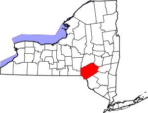 | |
| Villages | ||
| CDPs | ||
| Hamlets | ||
| Footnotes | ‡This populated place also has portions in an adjacent county or counties | |