Umm ash Shauf
| Umm al-Shawf | |
|---|---|
 Umm al-Shawf | |
| Arabic | أُم الشوف |
| Also spelled | Umm al Shauf |
| Subdistrict | Haifa |
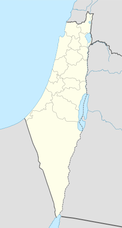
| Coordinates | 32°33′12.05″N 35°02′55.3″E / 32.5533472°N 35.048694°ECoordinates: 32°33′12.05″N 35°02′55.3″E / 32.5533472°N 35.048694°E |
| Palestine grid | 154/217 |
| Population | 480 (1945[1]) |
| Area | 7,426[1] dunams |
| Date of depopulation | May 12–14, 1948[2] |
| Cause(s) of depopulation | Military assault by Yishuv forces |
| Current localities | Givat Nili[3] |
Umm al-Shawf or Umm ash Shauf (Arabic: أُم الشوف, Umm esh Shauf) was a Palestinian Arab village located 29.5 km south of Haifa, on the sloping section of Wadi al-Marah. It was depopulated as a result of a military assault between May 12–14, just before the outbreak of the 1948 Arab-Israeli war.
References
Bibliography
- Barron, J. B., ed. (1923). Palestine: Report and General Abstracts of the Census of 1922. Government of Palestine.
- Conder, Claude Reignier; Kitchener, H. H. (1882). The Survey of Western Palestine: Memoirs of the Topography, Orography, Hydrography, and Archaeology. 2. London: Committee of the Palestine Exploration Fund. (p.43)
- Hadawi, Sami (1970). Village Statistics of 1945: A Classification of Land and Area ownership in Palestine. Palestine Liberation Organization Research Center.
- Khalidi, Walid (1992). All That Remains: The Palestinian Villages Occupied and Depopulated by Israel in 1948. Washington D.C.: Institute for Palestine Studies. ISBN 0-88728-224-5.
- Mills, E., ed. (1932). Census of Palestine 1931. Population of Villages, Towns and Administrative Areas. Jerusalem: Government of Palestine.
- Morris, Benny (2004). The Birth of the Palestinian Refugee Problem Revisited. Cambridge University Press. ISBN 978-0-521-00967-6.
- Palmer, E. H. (1881). The Survey of Western Palestine: Arabic and English Name Lists Collected During the Survey by Lieutenants Conder and Kitchener, R. E. Transliterated and Explained by E.H. Palmer. Committee of the Palestine Exploration Fund.(p. 154)
External links
- Welcome To Umm al-Shawf
- Survey of Western Palestine, Map 8: IAA, Wikimedia commons
This article is issued from Wikipedia - version of the 8/12/2016. The text is available under the Creative Commons Attribution/Share Alike but additional terms may apply for the media files.