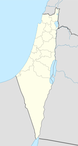
Khirbat Al-Burj
| Khirbat Al-Burj | |
|---|---|
 | |
 Khirbat Al-Burj | |
| Name meaning | The little tower[1] |
| Also spelled | Burj Binyamina |
| Subdistrict | Haifa |
| Coordinates | 32°30′41.25″N 34°56′34.35″E / 32.5114583°N 34.9428750°ECoordinates: 32°30′41.25″N 34°56′34.35″E / 32.5114583°N 34.9428750°E |
| Palestine grid | 144/212 |
| Current localities | Binyamina |
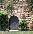
Khirbat Al-Burj was a formerly a Palestinian village, depopulated in 1948.[2] Presently, Khirbat Al-Burj or Burj Binyamina is a structure in the Sharon Plain 1 km south of Binyamina is named. The structure is recognized to be from the Ottoman period.
Modern History
In 1882, the Palestine Exploration Fund's Survey of Western Palestine (SWP) described it: "Walls and foundations without any indication of date."[3] On October 26, 1898, German Kaiser Wilhelm II stayed at the Burj khan (caravanserei) building during his visit to the Holy Land.[4] Turkish owner, Sidki Pasha, brother of Jamal Pasha, sold 4,000 dunams of the Burj farmland to I.C.A. in 1903.[5] The serious drawback was that most of the land was an uncultivable swamp.[6] Rothschild turned the land over to Binyamina's holdings.[6] Initially a group of farmers from Zichron Ya'akov stayed at the khan, due to distance to their settlement during the week. The group was called Burja’im. Subsequently, Binyamina was founded.[4] A letter from early 1920s describes establishment of Binyamina: "The 'Zichronim' [ people of Zichron Ya'akov ] owners of Burj farm decided to establish a Moshavah in this farm, in order to settle their sons there… "[7]

Burj became Binyamina in 1922.[5] In the 1931 census Khirbat Al-Burj was listed under Binyamina.[8] The ownership of the village land was determined in 1934 according to the Land Settlement Ordinances.[9] By the time of the 1945 village survey, there were 5,291 dunums, 15 of which were owned by Arabs, 4,933 owned by Jews, and 343 were public.[10][11] In the 1945 Index Gazetteer, Khirbat Al-Burj was listed as a "village unit" but "no population".[12] According to Khalidi, Khirbat Al-Burj was a Palestinian village which was depopulated by Israelis in 1948.[2] The redsand (hamra) soils from Binyamina to Gedera, west of the coastal plain, were not cultivated till 20th century.[13] Khalidi also says the "village" was "known for its citrus crops" and situated on "rolling terrain".[12] The original economy of Binyamina was citrus-based.[14] According to Frantzman, the 1:20,000 map shows "a large structure, akin to a khan with no indication that it was populated".[12]
Archeological excavations
During June 2009, archeological excavations in the courtyard of the building Burj from the Ottoman period exposed a small building that dated to the Byzantine period (5th–7th centuries CE).[4] The surviving parts of the structure include a fortified structure with gun ports (the southwestern end of the center wing) and a sequence of vaults (the northern wing).[4]
Gallery


See also
- Tel Burga - archeological site 1 km east of Binyamina, just outside the village land of Khirbat Al-Burj.[15]
References
- ↑ Palmer, 1881, p. 145
- 1 2 Khalidi, 1992, p. 156
- ↑ Conder and Kitchener, 1882, SWP II, p. 52
- 1 2 3 4 Masarwa, 2011, Benyamina, Burj Benyamina
- 1 2 Ramat Hanadiv excavations: final report of the 1984-1998 seasons, by Yizhar Hirschfeld, Adrian J. Boas, p. 664
- 1 2 Avneri, 1984, p. 107
- ↑ Document Regarding the Establishment of Binyamina, early 1920s
- ↑ E. Mills, ed. (1932). Census of Palestine 1931. Population of Villages, Towns and Administrative Areas (PDF). Jerusalem: Government of Palestine. p. 88.
- ↑ The Palestine Gazette, Supplement 2 to Issue 475, November 8, 1934, p. 953.
- ↑ Government of Palestine, Department of Statistics. Village Statistics, April, 1945. Quoted in Hadawi, 1970, p. 48
- ↑ Department of Statistics, 1945, p. 14
- 1 2 3 "The Arab settlement of Late Ottoman and Mandatory Palestine: New Village Formation and Settlement Fixation, 1871-1948", Seth J. Frantzman, p.71-72
- ↑ The Jewish people in the first century : historical geography, political history, social, cultural and religious life and institutions. Vol. 2, by Samuel Safrai; M Stern, page 640
- ↑ Jewish National Fund (1949). Jewish Villages in Israel. Jerusalem: Hamadpis Liphshitz Press. p. 24.
- ↑ Survey of Palestine, map Caesarea 1:20,000, 1942. map 14-21.1942
Bibliography
| Wikimedia Commons has media related to Burj Binyamina. |
- Avneri, Arieh L. (1984). The Claim of Dispossession: Jewish Land-settlement and the Arabs, 1878-1948. Transaction Publishers. ISBN 0-87855-964-7.
- Conder, Claude Reignier; Kitchener, H. H. (1882). The Survey of Western Palestine: Memoirs of the Topography, Orography, Hydrography, and Archaeology. 2. London: Committee of the Palestine Exploration Fund.
- Department of Statistics (1945). Village Statistics, April, 1945. Government of Palestine.
- Hadawi, Sami (1970). Village Statistics of 1945: A Classification of Land and Area ownership in Palestine. Palestine Liberation Organization Research Center.
- Khalidi, Walid (1992). All That Remains: The Palestinian Villages Occupied and Depopulated by Israel in 1948. Washington D.C.: Institute for Palestine Studies. ISBN 0-88728-224-5.
- Masarwa, Durar (2011-08-18). "Benyamina, Burj Benyamina" (123). Hadashot Arkheologiyot – Excavations and Surveys in Israel.
- Mills, E., ed. (1932). Census of Palestine 1931. Population of Villages, Towns and Administrative Areas. Jerusalem: Government of Palestine.
- Palmer, E. H. (1881). The Survey of Western Palestine: Arabic and English Name Lists Collected During the Survey by Lieutenants Conder and Kitchener, R. E. Transliterated and Explained by E.H. Palmer. Committee of the Palestine Exploration Fund.
External links
- Welcome To al-Burj, Khirbat
- Survey of Western Palestine, Map 8: IAA, Wikimedia commons