Tauriac-de-Naucelle
| Tauriac-de-Naucelle | |
|---|---|
|
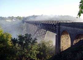
Viaur rail viaduct | |
 Tauriac-de-Naucelle | |
|
Location within Occitanie region  Tauriac-de-Naucelle | |
| Coordinates: 44°09′20″N 2°20′14″E / 44.1556°N 2.3372°ECoordinates: 44°09′20″N 2°20′14″E / 44.1556°N 2.3372°E | |
| Country | France |
| Region | Occitanie |
| Department | Aveyron |
| Arrondissement | Rodez |
| Canton | Naucelle |
| Intercommunality | Naucellois |
| Government | |
| • Mayor (2008–2014) | Joël Mouysset |
| Area1 | 21.59 km2 (8.34 sq mi) |
| Population (2008)2 | 382 |
| • Density | 18/km2 (46/sq mi) |
| Time zone | CET (UTC+1) |
| • Summer (DST) | CEST (UTC+2) |
| INSEE/Postal code | 12276 / 12800 |
| Elevation |
293–505 m (961–1,657 ft) (avg. 450 m or 1,480 ft) |
|
1 French Land Register data, which excludes lakes, ponds, glaciers > 1 km² (0.386 sq mi or 247 acres) and river estuaries. 2 Population without double counting: residents of multiple communes (e.g., students and military personnel) only counted once. | |
Tauriac-de-Naucelle is a commune in the Aveyron department in southern France.
Population
| Historical population | ||
|---|---|---|
| Year | Pop. | ±% |
| 1962 | 527 | — |
| 1968 | 570 | +8.2% |
| 1975 | 523 | −8.2% |
| 1982 | 452 | −13.6% |
| 1990 | 365 | −19.2% |
| 1999 | 354 | −3.0% |
| 2008 | 382 | +7.9% |
See also
References
| Wikimedia Commons has media related to Tauriac-de-Naucelle. |
This article is issued from Wikipedia - version of the 2/23/2013. The text is available under the Creative Commons Attribution/Share Alike but additional terms may apply for the media files.