La Cavalerie
| La Cavalerie | |
|---|---|
|
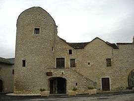
Restored ramparts | |
 La Cavalerie | |
|
Location within Occitanie region  La Cavalerie | |
| Coordinates: 44°00′35″N 3°09′36″E / 44.0097°N 3.16°ECoordinates: 44°00′35″N 3°09′36″E / 44.0097°N 3.16°E | |
| Country | France |
| Region | Occitanie |
| Department | Aveyron |
| Arrondissement | Millau |
| Canton | Nant |
| Intercommunality | Larzac Dourbie |
| Government | |
| • Mayor (2008–2014) | Robert Muret |
| Area1 | 40.56 km2 (15.66 sq mi) |
| Population (2008)2 | 1,021 |
| • Density | 25/km2 (65/sq mi) |
| Time zone | CET (UTC+1) |
| • Summer (DST) | CEST (UTC+2) |
| INSEE/Postal code | 12063 / 12230 |
| Elevation |
764–892 m (2,507–2,927 ft) (avg. 800 m or 2,600 ft) |
|
1 French Land Register data, which excludes lakes, ponds, glaciers > 1 km² (0.386 sq mi or 247 acres) and river estuaries. 2 Population without double counting: residents of multiple communes (e.g., students and military personnel) only counted once. | |
La Cavalerie is a commune in the Aveyron department in southern France. During the 1970s it became the focal point of peasant resistance to the proposed extension of the Larzac military training base, just to the north.
Population
| Historical population | ||
|---|---|---|
| Year | Pop. | ±% |
| 1968 | 734 | — |
| 1975 | 748 | +1.9% |
| 1982 | 900 | +20.3% |
| 1990 | 701 | −22.1% |
| 1999 | 813 | +16.0% |
| 2008 | 1,021 | +25.6% |
See also
References
| Wikimedia Commons has media related to La Cavalerie. |
This article is issued from Wikipedia - version of the 2/21/2013. The text is available under the Creative Commons Attribution/Share Alike but additional terms may apply for the media files.