Susa, Cundinamarca
| Susa | ||
|---|---|---|
| Municipality and town | ||
| ||
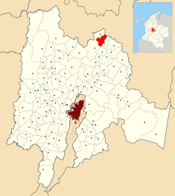 Location of the municipality and town inside Cundinamarca Department of Colombia | ||
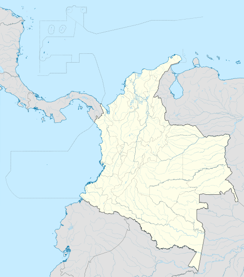 Susa Location in Colombia | ||
| Coordinates: 5°30′0″N 73°50′0″W / 5.50000°N 73.83333°WCoordinates: 5°30′0″N 73°50′0″W / 5.50000°N 73.83333°W | ||
| Country |
| |
| Department |
| |
| Province | Ubaté Province | |
| Founded | 21 February 1600 | |
| Government | ||
| • Mayor |
Oscar Eduardo Rocha Ramírez (2016-2019) | |
| Area | ||
| • Municipality and town | 86 km2 (33 sq mi) | |
| • Urban | 1.2 km2 (0.5 sq mi) | |
| Elevation | 2,655 m (8,711 ft) | |
| Population (2015) | ||
| • Municipality and town | 12,302 | |
| • Density | 140/km2 (370/sq mi) | |
| • Urban | 6,315 | |
| Time zone | Colombia Standard Time (UTC-5) | |
| Website | Official website | |
.svg.png)
Susa is a town and municipality in the Ubaté Province, part of the Cundinamarca Department, Colombia. The town centre is located at an altitude of 2,655 metres (8,711 ft) on the Altiplano Cundiboyacense at 130 kilometres (81 mi) from the capital Bogotá. Susa borders Simijaca, Fúquene, San Miguel de Sema and Lake Fúquene.[1]
Etymology
In the Chibcha language of the Muisca, susa means "white reed" or "soft reed".[1]
History
The area of Susa before the Spanish conquest was part of the Muisca Confederation. Initially loyal to the zaque of Hunza, Susa changed rule around 1490 when it was submitted by zipa Saguamanchica.[2]
Modern Susa was founded on February 21, 1600.[1]
Economy
The main economical activity in Simijaca is agriculture, with maize, potatoes, tomatoes and strawberries as the most important agricultural products.[1]
References
Bibliography
- Restrepo Arcila, Roberto Arturo. 2002. Sabiduría, poder y comprensión: América se repiensa desde sus orígenes - Wisdom, power and understanding: America thinks again about its origins, 1-199. Siglo del Hombre. Accessed 2016-07-08.
| Wikimedia Commons has media related to Susa, Cundinamarca. |
