Chía, Cundinamarca
| Chía | |||
|---|---|---|---|
|
Park in Chía | |||
| |||
| Nickname(s): City of the Moon | |||
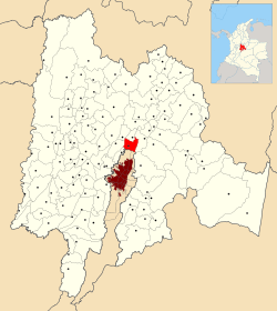 Location of the town and municipality of Chia in Cundinamarca Department. | |||
 Chía Location of the town and municipality of Chia in Cundinamarca Department. | |||
| Coordinates: 4°51′N 74°03′E / 4.850°N 74.050°E | |||
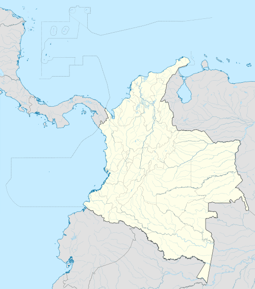
| Country | Colombia | ||
| Department | Cundinamarca | ||
| Province | Central Savanna | ||
| Founded | 24 March 1537 | ||
| Founded by | Gonzalo Jiménez de Quesada | ||
| Government | |||
| • Mayor |
Leonardo Donoso Ruíz (2016-2019) | ||
| Area | |||
| • City | 80 km2 (30 sq mi) | ||
| • Urban | 79 km2 (31 sq mi) | ||
| Elevation | 2,564 m (8,412 ft) | ||
| Population (2016) | |||
| • City | 129,652 | ||
| • Density | 1,600/km2 (4,200/sq mi) | ||
| • Urban | 101,724 | ||
| Demonym(s) | Chiense or Chiano | ||
| Website | Official website | ||


Chía is a town and municipality in the Cundinamarca department of Colombia, located to the north of Bogotá on the main road to Zipaquira. Its history dates back to the pre-Columbian era.
Due to its proximity to Bogotá, Chía has effectively become a suburb of the capital. It is also home of the Universidad de la Sabana.
Etymology
Chía comes from the Chibcha language and means "Moon" or "month". It was the name of the Moon goddess of the Muisca; Chía.[1]
History
Chía was inhabited first by indigenous groups during the Herrera Period and later by the Muisca, as an important settlement in the pre-Columbian era. It was a ceremonial center of worship to the Moon goddess Chía. On March 24, 1537 the Spanish, under the command of Gonzalo Jiménez de Quesada, took possession of the town.
In 1781, during the Revolt of the Comuneros, the march of the insurgents towards Bogotá stopped near Chía in order to cross the Bogotá River, in what is now known as the Bridge of the Commoners (Spanish: Puente del Común). At that site the viceroy signed a series of concessions to the rebels. However, once the rebel group had dispersed, the viceroy declared the concessions invalid for having been signed "under pressure". It is widely believed that eventually Bogota will merge with Chia, if the city continues expanding (as it happened with Bosa and Soacha).
Borders
- North with Cajicá and Sopó
- South with Bogotá localities Usaquén and Suba
- West with Tabio and Tenjo
- Southwest with Cota
- East with Sopó
Other information
- Market Day: Sunday
- Median temperature: 14 °C
- DANE Code: 25175
Sites of interest
- Marroquín Castle
- Hacienda Yerbabuena
- Puente del Común
- Chía Mall (Centro-Chía)
- Andrés Carne de Res
- Iglesia la Valvanera
Sports facilities
- Coliseo de la Luna (8,000 spectators), playing ground for the basketball team Cóndores de Cundinamarca
- Sports unit "Rio Frio"
- Olympic village
- BMX Track "Iván de Jesús Barrientos"
Gallery
 Football pitch
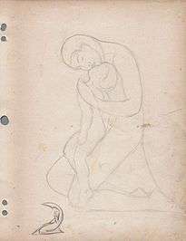 Interpretation of Moon goddess Chía
 Puente del Común
References
- ↑ (Spanish) Etymology Chía
External links
| Wikimedia Commons has media related to Chía, Cundinamarca. |
- (Spanish) : FOTW: Flag and Coat of Arms of Chia
Coordinates: 4°51′N 74°03′W / 4.850°N 74.050°W
