Girardot, Cundinamarca
| Girardot, Cundinamarca | |||
|---|---|---|---|
 | |||
| |||
 Localization in Cundinamarca, in Colombia | |||
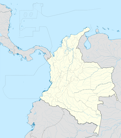 Location in Colombia | |||
| Coordinates: 4°18′18″N 74°48′06″W / 4.30500°N 74.80167°WCoordinates: 4°18′18″N 74°48′06″W / 4.30500°N 74.80167°W | |||
| Country |
| ||
| Departamento |
| ||
| Province | Upper Magdalena Province | ||
| Named for | ("Girardot") | ||
| Government | |||
| • Type | Mayor–council | ||
| • Mayor | Diego Johany Escobar Guinea (L) | ||
| • Council | Girardot City Council | ||
| Area[1][2][3] | |||
| • town | 130.32 km2 (50.32 sq mi) | ||
| • Urban[lower-alpha 1] | 22.6019 km2 (8.7266 sq mi) | ||
| • Rural[lower-alpha 2] | 107.7181 km2 (41.5902 sq mi) | ||
| • Metro[4] | 1,320.99 km2 (510.04 sq mi) | ||
| Elevation[1] | 326 m (1,070 ft) | ||
| Lowest elevation | 289 m (948 ft) | ||
| Population (2005 Census)[1][5] | |||
| • town | 97,834 | ||
| • Estimate (2011) | 102,492 | ||
| • Rank | 59th Colombia | ||
| • Density | 750/km2 (1,900/sq mi) | ||
| • Urban | 98,904 | ||
| • Urban density | 4,400/km2 (11,000/sq mi) | ||
| • Rural | 3,588 | ||
| • Rural density | 33/km2 (86/sq mi) | ||
| Demonym(s) | Girardoteño | ||
| Time zone | COT (UTC-5) | ||
| • Summer (DST) | COT (UTC-5) | ||
| Postal code | 252430-252439 | ||
| Area code(s) | 57 + 1 | ||
| Website | Official website | ||
.svg.png)

Girardot is a municipality and town of Colombia in the department of Cundinamarca. It is the second most important city of Cundinamarca according its production. It is home to a number of recreational and vacational spots, mainly visited by people from Bogotá, as it is located at less than three hours drive from the city but enjoys a tropical climate (compared to the cold and rainy climate of Bogotá).
Geography
The municipality lies on a plain, framed by the foothills of the Cordillera Oriental, without notable topographic features, with some areas of difficult access in the mountainous area on the border with Nariño called Alonso Vera cordillera.[1]
Hydrography
Girardot has drainage basins and watersheds. The upper basin of the Magdalena River becomes the water resources of greater magnitude in a vast area of the country and the Bogotá River downstream. The basins located in the municipality are called El Cobre, Chicalá, Miraflores, El Gallo and ditches that collect rainwater from the top of the city, have shallow valleys and extension, unlike the micro basins Coyal, Zanja Honda, Quebrada Portachuelo and Yegüera that are deep and greater extent.[1]
Climate
The Köppen Climate Classification subtype for Giradot's climate is "Aw" (Tropical Wet and Dry Climate), with generally hot conditions throughout the course of the year.[6] Average temperature is 28 °C, with maximum of 38 °C and minimum of 23 °C. It has a bimodal pluviometric regimen with an average precipitation of 1167 mm per year.[1]
The dry periods are on the months of January and February; June, July and August; and September and December. Rainy months are in the months of March, April and May, and October and November.
The warmest month, on average, is August with an average temperature of 86.0 °F (30 °C). The coolest month on average is May, with an average temperature of 81.0 °F (27.2 °C).[6]
| Climate data for Girardot | |||||||||||||
|---|---|---|---|---|---|---|---|---|---|---|---|---|---|
| Month | Jan | Feb | Mar | Apr | May | Jun | Jul | Aug | Sep | Oct | Nov | Dec | Year |
| Average high °C (°F) | 33 (91) |
33 (91) |
33 (91) |
33 (91) |
31 (88) |
32 (90) |
34 (93) |
35 (95) |
35 (95) |
32 (90) |
32 (90) |
32 (90) |
32.9 (91.3) |
| Average low °C (°F) | 23 (73) |
23 (73) |
23 (73) |
23 (73) |
23 (73) |
23 (73) |
23 (73) |
24 (75) |
24 (75) |
23 (73) |
22 (72) |
23 (73) |
23.1 (73.3) |
| Average rainfall mm (inches) | 40 (1.57) |
50 (1.97) |
130 (5.12) |
130 (5.12) |
150 (5.91) |
60 (2.36) |
30 (1.18) |
40 (1.57) |
60 (2.36) |
130 (5.12) |
270 (10.63) |
50 (1.97) |
1,140 (44.88) |
| Average rainy days (≥ 1 mm) | 3 | 3 | 7 | 7 | 8 | 4 | 2 | 3 | 4 | 7 | 12 | 3 | 63 |
| Source: Weatherbase | |||||||||||||
Location
 |
Nariño, Cundinamarca, Tocaima | | ||
| Coello, Tolima, Nariño, Cundinamarca | |
Ricaurte, Cundinamarca | ||
| ||||
| | ||||
| Flandes |
Economy
Girardot is an important city in the department of Cundinamarca, due to its decentralized and autonomous economy, and because of its reputation as an excellent tourist destination. The main economy of Girardot is based on tourism. It has many resorts, hotels and clubs, such as Peñalisa, El Peñon, El Bachue, and the Hotel Tocarema. Because it is only a short drive from Bogotá (about 2 hours), it is a popular weekend hangout.
Born in Girardot
- Juan Alfredo Pinto Saavedra, former Colombian ambassador to India
- Marta Gomez, singer and songwriter
- Charlie Zaa, singer.
- Gustavo Bolivar,author, screenwriter and journalist.
References
- 1 2 3 4 5 6 Girardot (August 2011). "IUP" (PDF). Retrieved 23 July 2015.
- ↑ Girardot Council (9 June 2002). POT 029 2000 (PDF) (I ed.). Girardot: Girardot Council. Retrieved 23 July 2015.
- ↑ Girardot Council (9 December 2011). OTP 24 2011. Girardot: Girardot Council. p. 39. Retrieved 24 July 2015.
- ↑ Congress of the Republic of Colombia (23 October 2013). Project Sol Metropolitan Area Summary. Bogotá: Congress of Colombia. Retrieved 25 July 2015.
- ↑ Adjusted Population municipality at 30 June 2005, on Censo 2005. Sistema de Consulta de Información Censal. Departamento Administrativo Nacional de Estadística. Colombia. Consultado el 21 de julio de 2009.
- 1 2 Climate Summary for Girardot, Colombia
Notes
| Wikimedia Commons has media related to Girardot. |