Springdale, Washington
| Springdale | |
|---|---|
| Town | |
| Springdale, Washington | |
 Location of Springdale, Washington | |
| Coordinates: 48°3′26″N 117°44′37″W / 48.05722°N 117.74361°WCoordinates: 48°3′26″N 117°44′37″W / 48.05722°N 117.74361°W | |
| Country | United States |
| State | Washington |
| County | Stevens |
| Area[1] | |
| • Total | 1.14 sq mi (2.95 km2) |
| • Land | 1.14 sq mi (2.95 km2) |
| • Water | 0 sq mi (0 km2) |
| Elevation | 2,057 ft (627 m) |
| Population (2010)[2] | |
| • Total | 285 |
| • Estimate (2015)[3] | 275 |
| • Density | 250.0/sq mi (96.5/km2) |
| Time zone | Pacific (PST) (UTC-8) |
| • Summer (DST) | PDT (UTC-7) |
| ZIP code | 99173 |
| Area code | 509 |
| FIPS code | 53-67210 |
| GNIS feature ID | 1526423[4] |
Springdale is a town in Stevens County, Washington, United States. The population was 285 at the 2010 census.[5]
History
Springdale was originally called Squire City.[6] The present site of Springdale was a wilderness until about 1886, when Mr. John Shriner and Mr. Charles O. Squire arrived at about the same time. Squire erected the first sawmill in 1887.[6] Once Mr. Squire finalized his homestead,[7] he platted the area on 29 November 1889, which he called Squire City. He became the first postmaster in December 1889, while the town was still called Squire City.[8]
Mark P. Sheffer was the first merchant. He brought in material by horse-drawn freight wagons prior to the arrival on the railroad.[6]
In 1889, the Spokane Falls & Northern Railroad (SF&NRR) was completed to the area and the depot was called Springdale.[6] Springdale was the lunch stop between Spokane and Northport on the SF&NRR.[9] By 1892, the community was named Springdale.
Springdale was officially incorporated on February 9, 1903.[10]
The Springdale Reformer, started by Elmer Burrows, was published from 1907 to 1923.[11]
The entire business section of Springdale was destroyed by fire, 9 July 1908.
Geography
Springdale is located at 48°3′26″N 117°44′37″W / 48.05722°N 117.74361°W (48.057151, -117.743749).[12]
According to the United States Census Bureau, the town has a total area of 1.14 square miles (2.95 km2), all of it land.[1]
Demographics
| Historical population | |||
|---|---|---|---|
| Census | Pop. | %± | |
| 1910 | 251 | — | |
| 1920 | 184 | −26.7% | |
| 1930 | 215 | 16.8% | |
| 1940 | 227 | 5.6% | |
| 1950 | 268 | 18.1% | |
| 1960 | 254 | −5.2% | |
| 1970 | 215 | −15.4% | |
| 1980 | 281 | 30.7% | |
| 1990 | 260 | −7.5% | |
| 2000 | 283 | 8.8% | |
| 2010 | 285 | 0.7% | |
| Est. 2015 | 275 | [13] | −3.5% |
| U.S. Decennial Census[14] 2015 Estimate[3] | |||
2010 census
As of the census[2] of 2010, there were 285 people, 105 households, and 75 families residing in the town. The population density was 250.0 inhabitants per square mile (96.5/km2). There were 118 housing units at an average density of 103.5 per square mile (40.0/km2). The racial makeup of the town was 88.4% White, 1.4% African American, 4.6% Native American, 1.1% from other races, and 4.6% from two or more races. Hispanic or Latino of any race were 6.0% of the population.
There were 105 households of which 37.1% had children under the age of 18 living with them, 47.6% were married couples living together, 16.2% had a female householder with no husband present, 7.6% had a male householder with no wife present, and 28.6% were non-families. 17.1% of all households were made up of individuals and 8.6% had someone living alone who was 65 years of age or older. The average household size was 2.71 and the average family size was 3.12.
The median age in the town was 37.9 years. 27% of residents were under the age of 18; 8.2% were between the ages of 18 and 24; 24.3% were from 25 to 44; 23.5% were from 45 to 64; and 17.2% were 65 years of age or older. The gender makeup of the town was 56.1% male and 43.9% female.
2000 census
As of the census of 2000, there were 283 people, 100 households, and 74 families residing in the town. The population density was 279.7 people per square mile (108.2/km²). There were 109 housing units at an average density of 107.7 per square mile (41.7/km²). The racial makeup of the town was 93.99% White, 0.71% African American, 0.71% Native American, 0.71% Pacific Islander, 0.35% from other races, and 3.53% from two or more races. Hispanic or Latino of any race were 3.18% of the population.
There were 100 households out of which 39.0% had children under the age of 18 living with them, 46.0% were married couples living together, 23.0% had a female householder with no husband present, and 26.0% were non-families. 23.0% of all households were made up of individuals and 12.0% had someone living alone who was 65 years of age or older. The average household size was 2.77 and the average family size was 3.23.
In the town the age distribution of the population shows 35.0% under the age of 18, 6.0% from 18 to 24, 24.0% from 25 to 44, 23.0% from 45 to 64, and 12.0% who were 65 years of age or older. The median age was 34 years. For every 100 females there were 116.0 males. For every 100 females age 18 and over, there were 102.2 males.
The median income for a household in the town was $28,333, and the median income for a family was $27,188. Males had a median income of $31,875 versus $16,563 for females. The per capita income for the town was $10,412. About 24.7% of families and 34.1% of the population were below the poverty line, including 45.1% of those under the age of eighteen and 5.9% of those sixty-five or over.
Notable people
- Lucian Pulvermacher – Anti-Pope Pius XIII
References
- 1 2 "US Gazetteer files 2010". United States Census Bureau. Retrieved 2012-12-19.
- 1 2 "American FactFinder". United States Census Bureau. Retrieved 2012-12-19.
- 1 2 "Population Estimates". United States Census Bureau. Retrieved July 14, 2016.
- ↑ "US Board on Geographic Names". United States Geological Survey. 2007-10-25. Retrieved 2008-01-31.
- ↑ "2010 Census Redistricting Data (Public Law 94-171) Summary File". American FactFinder. United States Census Bureau. Retrieved 17 September 2012.
- 1 2 3 4 History of Springdale as compiled by Mrs. B. V. Fleming and Mrs. C. O. Snapp)
- ↑ http://www.glorecords.blm.gov record WASPAA 013344
- ↑ FamilySearch.com Washington State Postmaster Indexes, Prior to 1965, Stevens County, page 423
- ↑ Map of the Spokane Falls & Northern Railway 15 August 1890
- ↑ http://www.mrsc.org/cityprofiles/cityprofile.aspx?id=219
- ↑ Washington State Library Newspapers http://www.sos.wa.gov/library
- ↑ "US Gazetteer files: 2010, 2000, and 1990". United States Census Bureau. 2011-02-12. Retrieved 2011-04-23.
- ↑ "Annual Estimates of the Resident Population for Incorporated Places: April 1, 2010 to July 1, 2015". Retrieved July 2, 2016.
- ↑ United States Census Bureau. "Census of Population and Housing". Retrieved October 4, 2013.
Municipalities and communities of Stevens County, Washington, United States | ||
|---|---|---|
| Cities | 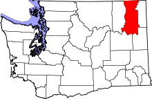 | |
| Towns | ||
| CDPs | ||
| Other unincorporated communities | ||
| Ghost towns | ||