Rice, Washington
| Rice, Washington | |
|---|---|
| Unincorporated community | |
 Rice, Washington | |
| Coordinates: 48°25′44″N 118°10′13″W / 48.42889°N 118.17028°WCoordinates: 48°25′44″N 118°10′13″W / 48.42889°N 118.17028°W | |
| Country | United States |
| State | Washington |
| County | Stevens |
| Elevation | 1,732 ft (528 m) |
| Population (2010) | |
| • Total | 40 |
| Time zone | Pacific (PST) (UTC-8) |
| • Summer (DST) | PDT (UTC-7) |
| ZIP code | 99167 |
| Area code(s) | 509 |
| GNIS feature ID | 1525025[1] |
Rice is an unincorporated community in Stevens County, Washington, United States. Rice is located along the Columbia River at Washington State Route 25 and Orin-Rice Road 13.5 miles (21.7 km) south-southwest of Kettle Falls. Rice has a post office with ZIP code 99167.[2]
References
Municipalities and communities of Stevens County, Washington, United States | ||
|---|---|---|
| Cities | 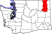 | |
| Towns | ||
| CDPs | ||
| Other unincorporated communities | ||
| Ghost towns | ||
This article is issued from Wikipedia - version of the 7/14/2015. The text is available under the Creative Commons Attribution/Share Alike but additional terms may apply for the media files.