Kettle Falls, Washington
| Kettle Falls | |
|---|---|
| City | |
| Kettle Falls, Washington | |
|
Welcome sign at the northern end of the city | |
 Location of Kettle Falls, Washington | |
| Coordinates: 48°36′21″N 118°3′35″W / 48.60583°N 118.05972°WCoordinates: 48°36′21″N 118°3′35″W / 48.60583°N 118.05972°W | |
| Country | United States |
| State | Washington |
| County | Stevens |
| Area[1] | |
| • Total | 1.07 sq mi (2.77 km2) |
| • Land | 1.07 sq mi (2.77 km2) |
| • Water | 0 sq mi (0 km2) |
| Elevation | 1,631 ft (497 m) |
| Population (2010)[2] | |
| • Total | 1,595 |
| • Estimate (2015)[3] | 1,597 |
| • Density | 1,490.7/sq mi (575.6/km2) |
| Time zone | Pacific (PST) (UTC-8) |
| • Summer (DST) | PDT (UTC-7) |
| ZIP codes | 69696 |
| Area code | 509 |
| FIPS code | 53-35485 |
| GNIS feature ID | 1530955[4] |
| Website | City of Kettle Falls |

Kettle Falls is a city in Stevens County, Washington, United States, named for the nearby Kettle Falls on the Columbia River, an ancient and important fishing site for Native Americans. The population of the city was 1,595 at the 2010 census a 4.5% increase over the 2000 census.[5]
Geography
The original Kettle Falls was officially incorporated on December 17, 1891 on the bank of the Columbia. After it was flooded by the Grand Coulee Dam in 1940, city planners relocated the town at a community called Meyers Falls, near the railroad lines, helping to ensure its success as a trans-shipment point for the logging, agriculture, and paper industries. This is its present location, eight miles northwest of Colville and roughly 80 miles northwest of Spokane. It is 30 miles (48 km) south of the Canada–US border at Laurier and adjacent to Lake Roosevelt, the reservoir of the Columbia River. According to the United States Census Bureau, the city has a total area of 1.07 square miles (2.77 km2), all of it land.[1]
Demographics
| Historical population | |||
|---|---|---|---|
| Census | Pop. | %± | |
| 1900 | 297 | — | |
| 1910 | 377 | 26.9% | |
| 1920 | 276 | −26.8% | |
| 1930 | 414 | 50.0% | |
| 1940 | 560 | 35.3% | |
| 1950 | 714 | 27.5% | |
| 1960 | 905 | 26.8% | |
| 1970 | 893 | −1.3% | |
| 1980 | 1,087 | 21.7% | |
| 1990 | 1,272 | 17.0% | |
| 2000 | 1,527 | 20.0% | |
| 2010 | 1,595 | 4.5% | |
| Est. 2015 | 1,597 | [6] | 0.1% |
| U.S. Decennial Census[7] 2015 Estimate[3] | |||
2010 census
As of the census[2] of 2010, there were 1,595 people, 676 households, and 419 families residing in the city. The population density was 1,490.7 inhabitants per square mile (575.6/km2). There were 726 housing units at an average density of 678.5 per square mile (262.0/km2). The racial makeup of the city was 90.9% European Ancestry, 0.1% African American, 2.0% Native American, 0.4% Asian, 0.1% Pacific Islander, 0.6% from other races, and 5.9% from two or more races. Hispanic or Latino of any race were 1.7% of the population.
There were 676 households of which 31.2% had children under the age of 18 living with them, 44.7% were married couples living together, 12.3% had a female householder with no husband/wife present, 5.0% had a male householder with no wife/husband present, and 38.0% were non-families. 31.7% of all households were made up of individuals and 13.8% had someone living alone who was 65 years of age or older. The average household size was 2.35 and the average family size was 2.95.
The median age in the city was 38.6 years. 26.6% of residents were under the age of 18; 7.6% were between the ages of 18 and 24; 23.9% were from 25 to 44; 25.4% were from 45 to 64; and 16.3% were 65 years of age or older. The gender makeup of the city was 47.6% male and 52.4% female.
2000 census
As of the census of 2000, there were 1,527 people, 632 households, and 398 families residing in the city. The population density was 1,631.1 people per square mile (627.2/km²). There were 686 housing units at an average density of 732.8 per square mile (281.8/km²). The racial makeup of the city was 91.29% European Ancestry, 0.07% African American, 3.86% Native American, 0.20% Asian, 0.07% Pacific Islander, 0.65% from other races, and 3.86% from two or more races. Hispanic or Latino of any race were 2.75% of the population.
There were 632 households out of which 33.7% had children under the age of 18 living with them, 47.2% were married couples living together, 11.2% had a female householder with no husband present, and 37.0% were non-families. 31.8% of all households were made up of individuals and 14.4% had someone living alone who was 65 years of age or older. The average household size was 2.42 and the average family size was 3.05.
In the city the age distribution of the population shows 29.4% under the age of 18, 8.3% from 18 to 24, 25.9% from 25 to 44, 20.5% from 45 to 64, and 15.8% who were 65 years of age or older. The median age was 34 years. For every 100 females there were 95.8 males. For every 100 females age 18 and over, there were 92.2 males.
The median income for a household in the city was $27,031, and the median income for a family was $34,375. Males had a median income of $33,750 versus $23,750 for females. The per capita income for the city was $13,614. About 15.1% of families and 21.1% of the population were below the poverty line, including 26.0% of those under age 18 and 12.9% of those age 65 or over.
Notable residents
- Carolyn Suzanne Sapp, Miss America 1992 and Miss Hawaii 1991.
- Cathy McMorris Rodgers, U.S. Representative for Washington's 5th congressional district, since 2005
- James Darling, NFL Football player. 1997 to 2006.
Cougar attack
In 1999, a four-year-old boy was injured in a cougar attack near a house "on U.S. Highway 395 about a mile south of Barstow in Ferry County and about 11 miles northwest of Kettle Falls."[8]
Key geographic points in and near Kettle Falls
Reservoirs
- Boise Cascade Mill Waste Pond
- Blue Gulch Reservoir
- Franklin D. Roosevelt Lake
Dams
Schools
- Kettle Falls School District
- Kettle Falls Elementary School (Grades K-4, enrollment 279 in October 2003, located at 48°36'27"N, 118°03'05"W)
- Kettle Falls Middle School
- Kettle Falls High School
Campgrounds
- Kettle Falls Campground
- North Lake RV Park and Campground Beautiful forested RV Park and Campground right on North Lake Roosevelt.
See also
References
- 1 2 "US Gazetteer files 2010". United States Census Bureau. Retrieved 2012-12-19.
- 1 2 "American FactFinder". United States Census Bureau. Retrieved 2012-12-19.
- 1 2 "Population Estimates". United States Census Bureau. Retrieved July 12, 2016.
- ↑ "US Board on Geographic Names". United States Geological Survey. 2007-10-25. Retrieved 2008-01-31.
- ↑ "2010 Census Redistricting Data (Public Law 94-171) Summary File". American FactFinder. United States Census Bureau. Retrieved 17 September 2012.
- ↑ "Annual Estimates of the Resident Population for Incorporated Places: April 1, 2010 to July 1, 2015". Retrieved July 2, 2016.
- ↑ United States Census Bureau. "Census of Population and Housing". Retrieved October 4, 2013.
- ↑ Craig, John (August 25, 1999). "Boy, 4, injured in cougar attack". The Spokesman-Review. Archived from the original on 2000-09-03. Retrieved April 10, 2012.
External links
- Official City of Kettle Falls website
- Stevens County Heritage From the Libraries of Stevens County. Includes a collection of materials depicting early Kettle Falls and Meyers Falls.
Municipalities and communities of Stevens County, Washington, United States | ||
|---|---|---|
| Cities | 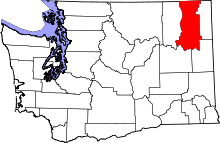 | |
| Towns | ||
| CDPs | ||
| Other unincorporated communities | ||
| Ghost towns | ||