South Amboy, New Jersey
| South Amboy, New Jersey | |
|---|---|
| City | |
| City of South Amboy | |
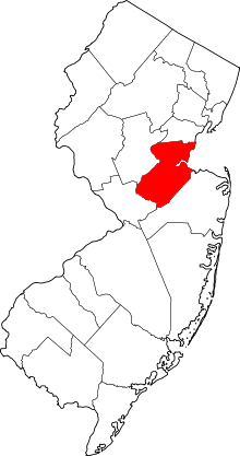
 South Amboy highlighted in Middlesex County. Inset: Location of Middlesex County in New Jersey. | |
 Census Bureau map of South Amboy, New Jersey. | |
| Coordinates: 40°29′12″N 74°16′44″W / 40.486719°N 74.279016°WCoordinates: 40°29′12″N 74°16′44″W / 40.486719°N 74.279016°W[1][2] | |
| Country |
|
| State |
|
| County | Middlesex |
| Incorporated | February 21, 1798 |
| Government[3] | |
| • Type | Faulkner Act (Mayor-Council) |
| • Body | City Council |
| • Mayor | Fred A. Henry (D, term ends December 31, 2018)[4][5] |
| • Administrator | Camille Tooker[6] |
| • Clerk | Laura Kemble-Kalantsis[7] |
| Area[1] | |
| • Total | 2.694 sq mi (6.976 km2) |
| • Land | 1.548 sq mi (4.008 km2) |
| • Water | 1.146 sq mi (2.967 km2) 42.54% |
| Area rank |
364th of 566 in state 19th of 25 in county[1] |
| Elevation[8] | 10 ft (3 m) |
| Population (2010 Census)[9][10][11] | |
| • Total | 8,631 |
| • Estimate (2015)[12] | 8,846 |
| • Rank |
265th of 566 in state 19th of 25 in county[13] |
| • Density | 5,577.1/sq mi (2,153.3/km2) |
| • Density rank |
94th of 566 in state 7th of 25 in county[13] |
| Time zone | Eastern (EST) (UTC-5) |
| • Summer (DST) | Eastern (EDT) (UTC-4) |
| ZIP codes | 08879[14] |
| Area code(s) | 732 and 848[15] |
| FIPS code | 3402368550[1][16][17] |
| GNIS feature ID | 0885399[1][18] |
| Website |
www |
South Amboy is a city in Middlesex County, New Jersey, on the Raritan Bay. As of the 2010 United States Census, the city's population was 8,631,[9][10][11] reflecting an increase of 718 (+9.1%) from the 7,913 counted in the 2000 Census, which had in turn increased by 50 (+0.6%) from the 7,863 counted in the 1990 Census.[19]
South Amboy and Perth Amboy, across the Raritan River, are collectively referred to as The Amboys. Signage for Exit 11 on the New Jersey Turnpike refers to "The Amboys" as a destination.[20][21]
History
The area around Perth Amboy was called "Ompoge" (meaning "level ground") by Lenape Native Americans and became a key port for commerce between Lower New York Bay and Philadelphia, connected first by stagecoach and eventually by railroad.[22][23] When settled in 1684, the city was named New Perth in honor of James Drummond, Earl of Perth, one of the associates of a company of Scottish proprietaries. The Algonquian language name was corrupted to Ambo, or Point Amboy, and eventually a combination of the native and colonial names was used.[24][25][26]
South Amboy has passed through three of the five types of New Jersey municipalities. It was first mentioned on May 28, 1782, in minutes of the Board of chosen freeholders as having been formed from Perth Amboy Township. It was formally incorporated as a township by the Township Act of 1798 on February 21, 1798. Over the next 90 years, portions split off to form Monroe Township (April 9, 1838), Madison Township (March 2, 1869; later renamed Old Bridge Township) and Sayreville Township (April 6, 1876; later Borough of Sayreville). As of February 25, 1888, South Amboy borough was formed, replacing South Amboy Township. On April 11, 1908, South Amboy was incorporated as a city, replacing South Amboy borough, confirmed by a referendum held on July 21, 1908.[27][28]
Ammunition explosions
South Amboy's strategic location as a transportation hub acted to its detriment in 1918 and 1950, when the town was heavily damaged by military explosives. The 1918 explosions occurred during World War I at the Gillespie Shell Loading Plant, just south of the town. The 1950 explosions struck as Healing Lighterage Company dockworkers were transferring ammunition from a freight train onto barges. Both disasters killed dozens and injured hundreds of local victims, damaged hundreds of South Amboy buildings, required emergency declarations of martial law, and scattered wide areas of ammunition remnants that continue to surface occasionally.[29][30][31][32][33][34]
Geography
According to the United States Census Bureau, the city had a total area of 2.694 square miles (6.976 km2), including 1.548 square miles (4.008 km2) of land and 1.146 square miles (2.967 km2) of water (42.54%).[1][2] South Amboy is bordered by land with Sayreville to the south and west, by Perth Amboy to the north (across the Raritan River), and Staten Island to the east (across the Raritan Bay in New York City).[35]
Area codes 732 and 848 are used in South Amboy.[15] The city had been in Area code 908, until January 1, 1997, when 908 was split forming Area code 732. South Amboy has an enclave of apartments near Kohl's in Sayreville, whose residents use a South Amboy mailing address.
Mechanicsville and Thomas J. Dohany Homes are unincorporated communities located within South Amboy.
Demographics
As The New York Times said of South Amboy in 2000: "The population mix has not changed much since the beginning of the 20th century, when Irish and Polish immigrants came to work on the three railroads that crisscrossed the city."[36] South Amboy remains a strong enclave of Polish ethnicity, including 21% of its population in the 2000 census,[37] and the historic Sacred Heart Church and School.[38]
| Historical population | |||
|---|---|---|---|
| Census | Pop. | %± | |
| 1790 | 2,626 | — | |
| 1810 | 3,071 | — | |
| 1820 | 3,406 | 10.9% | |
| 1830 | 3,782 | 11.0% | |
| 1840 | 1,825 | * | −51.7% |
| 1850 | 2,266 | 24.2% | |
| 1860 | 3,652 | 61.2% | |
| 1870 | 4,525 | * | 23.9% |
| 1880 | 3,648 | * | −19.4% |
| 1890 | 4,330 | 18.7% | |
| 1900 | 6,349 | 46.6% | |
| 1910 | 7,007 | 10.4% | |
| 1920 | 7,897 | 12.7% | |
| 1930 | 8,476 | 7.3% | |
| 1940 | 7,802 | −8.0% | |
| 1950 | 8,422 | 7.9% | |
| 1960 | 8,422 | 0.0% | |
| 1970 | 9,338 | 10.9% | |
| 1980 | 8,322 | −10.9% | |
| 1990 | 7,863 | −5.5% | |
| 2000 | 7,913 | 0.6% | |
| 2010 | 8,631 | 9.1% | |
| Est. 2015 | 8,846 | [12][39] | 2.5% |
| Population sources: 1790-1920[40] 1840[41] 1850-1870[42] 1850[43] 1870[44] 1880-1890[45] 1890-1910[46] 1910-1930[47] 1930-1990[48] 2000[49][50] 2010[9][10][11] * = Lost territory in previous decade.[27] | |||
2010 Census
The 2010 United States Census counted 8,631 people, 3,372 households, and 2,256 families residing in the city. The population density was 5,577.1 per square mile (2,153.3/km2). The city contained 3,576 housing units at an average density of 2,310.7 per square mile (892.2/km2). The racial makeup of the city was 86.42% (7,459) White, 4.43% (382) Black or African American, 0.10% (9) Native American, 4.03% (348) Asian, 0.00% (0) Pacific Islander, 2.99% (258) from other races, and 2.03% (175) from two or more races. Hispanics or Latinos of any race were 13.42% (1,158) of the population.[9]
Out of a total of 3,372 households, 28.0% had children under the age of 18 living with them, 46.8% were married couples living together, 14.1% had a female householder with no husband present, and 33.1% were non-families. 26.7% of all households were made up of individuals, and 9.6% had someone living alone who was 65 years of age or older. The average household size was 2.56 and the average family size was 3.11.[9]
In the city, 20.8% of the population were under the age of 18, 8.6% from 18 to 24, 29.8% from 25 to 44, 29.5% from 45 to 64, and 11.3% who were 65 years of age or older. The median age was 39.3 years. For every 100 females the census counted 96.8 males, but for 100 females at least 18 years old, it was 93.2 males.[9]
The Census Bureau's 2006-2010 American Community Survey showed that (in 2010 inflation-adjusted dollars) median household income was $61,566 (with a margin of error of +/- $6,388) and the median family income was $80,815 (+/- $4,285). Males had a median income of $54,000 (+/- $5,767) versus $49,303 (+/- $4,574) for females. The per capita income for the borough was $31,590 (+/- $2,232). About 10.2% of families and 9.0% of the population were below the poverty line, including 15.7% of those under age 18 and 5.5% of those age 65 or over.[51]
2000 Census
As of the 2000 United States Census[16] there were 7,913 people, 2,967 households, and 2,041 families residing in the city. The population density was 5,102.1 people per square mile (1,971.1/km2). There were 3,110 housing units at an average density of 2,005.3 per square mile (774.7/km2). The racial makeup of the city was 94.22% White, 0.86% African American, 0.19% Native American, 1.38% Asian, 0.03% Pacific Islander, 1.71% from other races, and 1.62% from two or more races. Hispanic or Latino of any race were 6.75% of the population.[49][50]
There were 2,967 households out of which 32.2% had children under the age of 18 living with them, 48.8% were married couples living together, 14.5% had a female householder with no husband present, and 31.2% were non-families. 25.9% of all households were made up of individuals and 12.3% had someone living alone who was 65 years of age or older. The average household size was 2.65 and the average family size was 3.22.[49][50]
In the city the population was spread out with 24.3% under the age of 18, 7.7% from 18 to 24, 32.9% from 25 to 44, 21.5% from 45 to 64, and 13.6% who were 65 years of age or older. The median age was 37 years. For every 100 females there were 95.5 males. For every 100 females age 18 and over, there were 92.0 males.[49][50]
The median income for a household in the city was $50,529, and the median income for a family was $62,029. Males had a median income of $42,365 versus $29,737 for females. The per capita income for the city was $23,598. About 6.7% of families and 7.4% of the population were below the poverty line, including 10.6% of those under age 18 and 6.0% of those age 65 or over.[49][50]
Government
Local government
South Amboy is governed within the Faulkner Act, formally known as the Optional Municipal Charter Law, under the Mayor-Council system of municipal government with a mayor elected directly by the voters. The City Council consists of five members, two of whom are elected on an at-large basis while three are elected from wards. All members of the governing body are elected in partisan elections to serve four-year terms of office on a staggered basis as part of the November general election, with the three ward seats up for election together and the two at-large seats and the mayoral seat up for vote together two years later.[3]
As of 2016, the Mayor of South Amboy is Democrat Fred Henry, whose term of office ends December 31, 2018.[4] Members of the City Council are Council President Michael "Mickey" Gross (D, 2018; at-large), Council Vice President Christine Noble (D, 2018; at-large), Donald Applegate (D, 2016; First Ward), Zusette Dato (D, 2016; Third Ward) and Thomas B. Reilly (D, 2016; Second Ward, serving an unexpired term of office).[52][53][54][55][56][57]
In February 2015, the City Council appointed Thomas Reilly to fill the Second Ward expiring in December 2016 that became vacant when Christine Noble took office in an at-large seat.[58] In the 2015 November general election, Reilly was elected to serve the balance of the term of office.[55]
Following the death of Russell Stillwagon in June 2010, after serving nearly two decades on the City Council, Donald Applegate was chosen the following month by council members from among three names proposed to fill the vacancy representing the First Ward.[59]
Federal, state and county representation
South Amboy is located in the 6th Congressional District[60] and is part of New Jersey's 19th state legislative district.[10][61][62]
New Jersey's Sixth Congressional District is represented by Frank Pallone (D, Long Branch).[63] New Jersey is represented in the United States Senate by Cory Booker (D, Newark, term ends 2021)[64] and Bob Menendez (D, Paramus, 2019).[65][66]
For the 2016–2017 session (Senate, General Assembly), the 19th Legislative District of the New Jersey Legislature is represented in the State Senate by Joseph Vitale (D, Woodbridge Township) and in the General Assembly by Craig Coughlin (D, Woodbridge Township) and John Wisniewski (D, Sayreville).[67] The Governor of New Jersey is Chris Christie (R, Mendham Township).[68] The Lieutenant Governor of New Jersey is Kim Guadagno (R, Monmouth Beach).[69]
Middlesex County is governed by a Board of Chosen Freeholders, whose seven members are elected at-large on a partisan basis to serve three-year terms of office on a staggered basis, with either two or three seats coming up for election each year as part of the November general election. At an annual reorganization meeting held in January, the board selects from among its members a Freeholder Director and Deputy Director. As of 2015, Middlesex County's Freeholders (with party affiliation, term-end year, residence and committee chairmanship listed in parentheses) are Freeholder Director Ronald G. Rios (D, term ends December 31, 2015, Carteret; Ex-officio on all committees),[70] Freeholder Deputy Director Carol Barrett Bellante (D, 2017; Monmouth Junction, South Brunswick Township; County Administration),[71] Kenneth Armwood (D, 2016, Piscataway; Business Development and Education),[72] Charles Kenny ( D, 2016, Woodbridge Township; Finance),[73] H. James Polos (D, 2015, Highland Park; Public Safety and Health),[74] Charles E. Tomaro (D, 2017, Edison; Infrastructure Management)[75] and Blanquita B. Valenti (D, 2016, New Brunswick; Community Services).[76][77] Constitutional officers are County Clerk Elaine M. Flynn (D, Old Bridge Township),[78] Sheriff Mildred S. Scott (D, 2016, Piscataway)[79] and Surrogate Kevin J. Hoagland (D, 2017; New Brunswick).[77][80]
Politics
As of March 23, 2011, there were a total of 5,457 registered voters in South Amboy, of which 2,237 (41.0%) were registered as Democrats, 612 (11.2%) were registered as Republicans and 2,605 (47.7%) were registered as Unaffiliated. There were 3 voters registered to other parties.[81]
In the 2012 presidential election, Democrat Barack Obama received 55.6% of the vote (1,790 cast), ahead of Republican Mitt Romney with 42.7% (1,373 votes), and other candidates with 1.7% (54 votes), among the 3,269 ballots cast by the city's 5,491 registered voters (52 ballots were spoiled), for a turnout of 59.5%.[82][83] In the 2008 presidential election, Democrat Barack Obama received 50.8% of the vote (1,875 cast), ahead of Republican John McCain with 46.6% (1,722 votes) and other candidates with 1.7% (64 votes), among the 3,693 ballots cast by the city's 5,382 registered voters, for a turnout of 68.6%.[84] In the 2004 presidential election, Democrat John Kerry received 52.4% of the vote (1,784 ballots cast), outpolling Republican George W. Bush with 46.0% (1,566 votes) and other candidates with 0.7% (37 votes), among the 3,405 ballots cast by the city's 4,971 registered voters, for a turnout percentage of 68.5.[85]
In the 2013 gubernatorial election, Republican Chris Christie received 65.0% of the vote (1,341 cast), ahead of Democrat Barbara Buono with 33.4% (689 votes), and other candidates with 1.6% (33 votes), among the 2,104 ballots cast by the city's 5,486 registered voters (41 ballots were spoiled), for a turnout of 38.4%.[86][87] In the 2009 gubernatorial election, Republican Chris Christie received 52.7% of the vote (1,288 ballots cast), ahead of Democrat Jon Corzine with 35.4% (865 votes), Independent Chris Daggett with 9.2% (226 votes) and other candidates with 1.7% (41 votes), among the 2,445 ballots cast by the city's 5,298 registered voters, yielding a 46.1% turnout.[88]
Education
The South Amboy Public Schools serve students in pre-Kindergarten through twelfth grade. As of the 2011-12 school year, the district's two schools had an enrollment of 1,152 students and 82.0 classroom teachers (on an FTE basis), for a student–teacher ratio of 14.05:1.[89] Schools in the district (with 2011-12 enrollment data from the National Center for Education Statistics[90]) are South Amboy Elementary School[91] (PreK-5, 625 students) and South Amboy Middle High School[92] (6-12, 527 students).[93]
Raritan Bay Catholic Preparatory - Sacred Heart is a parochial elementary school serving PreK-3 to eighth grade that operates under the auspices of the Roman Catholic Diocese of Metuchen.[94] Cardinal McCarrick High School closed at the end of the 2014-15 school year, in the wake of an increasing financial deficit.[95]
Transportation
Roads and highways
As of May 2010, the city had a total of 23.65 miles (38.06 km) of roadways, of which 18.73 miles (30.14 km) were maintained by the municipality, 3.50 miles (5.63 km) by Middlesex County, and 1.42 miles (2.29 km) by the New Jersey Department of Transportation.[96] The town's major roads include portions of US 9, NJ 35, and CR 615, 621, 670, 684, 686, 688, while three Garden State Parkway exits (123–125) are just beyond the city's western border.
Public transportation
The South Amboy station[97] provides frequent service on NJ Transit's North Jersey Coast Line, with most northbound trains heading to Newark Penn Station, Secaucus Junction and Penn Station in Midtown Manhattan and some heading to Hoboken Terminal.[98]
NJ Transit local bus service is available on the 815 and 817 routes.[99]
Notable people
People who were born in, residents of, or otherwise closely associated with South Amboy include:
- Don Campbell (1916–1991), tackle who played for two NFL seasons.[100]
- Allie Clark (1923–2012), former New York Yankee.[101]
- Richard Field Conover (1858–1930), tennis player, lawyer and real estate manager.[102]
- Craig Coughlin (born 1958), New Jersey General Assembly member who has represented the 19th Legislative District since 2010.[103]
- Greg Evigan (born 1953), actor best known for the TV series B. J. and the Bear, then My Two Dads.[104]
- Harold G. Hoffman (1896–1954), mayor, congressman, and governor, for whom South Amboy Elementary School is named.[105]
- Benjamin Franklin Howell (1844–1933), banker and congressman, buried in Christ Church Cemetery.
- Jack McKeon (born 1930), manager of the 2003 World Series Champion Florida Marlins.[106]
- Johnny O'Brien (born 1930) and Eddie O'Brien (1930–2014), twin baseball players for the Pittsburgh Pirates.[107]
- Charles Pettit (1736–1806), lawyer, merchant, and delegate to the Congress of the Confederation.[108]
- Thomas J. Scully (1864–1921), mayor and congressman.[109]
- Elmer Stout (1929–2013), football player.[110]
- Timothy Wiltsey (1985–1991), child murder victim whose mother was convicted 25 years later.[111]
References
- 1 2 3 4 5 6 2010 Census Gazetteer Files: New Jersey County Subdivisions, United States Census Bureau. Accessed May 21, 2015.
- 1 2 US Gazetteer files: 2010, 2000, and 1990, United States Census Bureau. Accessed September 4, 2014.
- 1 2 2012 New Jersey Legislative District Data Book, Rutgers University Edward J. Bloustein School of Planning and Public Policy, March 2013, p. 87.
- 1 2 Mayor's Office, City of South Amboy. Accessed July 13, 2016.
- ↑ 2016 New Jersey Mayors Directory, New Jersey Department of Community Affairs. Accessed June 14, 2016.
- ↑ Business Administrator, City of South Amboy. Accessed July 13, 2016.
- ↑ City Clerk, City of South Amboy. Accessed July 13, 2016.
- ↑ U.S. Geological Survey Geographic Names Information System: City of South Amboy, Geographic Names Information System. Accessed March 14, 2013.
- 1 2 3 4 5 6 DP-1 - Profile of General Population and Housing Characteristics: 2010 for South Amboy city, Middlesex County, New Jersey, United States Census Bureau. Accessed March 1, 2012.
- 1 2 3 4 Municipalities Grouped by 2011-2020 Legislative Districts, New Jersey Department of State, p. 9. Accessed January 6, 2013.
- 1 2 3 Profile of General Demographic Characteristics: 2010 for South Amboy city, New Jersey Department of Labor and Workforce Development. Accessed May 9, 2012.
- 1 2 PEPANNRES - Annual Estimates of the Resident Population: April 1, 2010 to July 1, 2015 - 2015 Population Estimates for New Jersey municipalities, United States Census Bureau. Accessed May 22, 2016.
- 1 2 GCT-PH1 Population, Housing Units, Area, and Density: 2010 - State -- County Subdivision from the 2010 Census Summary File 1 for New Jersey, United States Census Bureau. Accessed November 27, 2012.
- ↑ Look Up a ZIP Code for South Amboy, NJ, United States Postal Service. Accessed May 9, 2012.
- 1 2 Area Code Lookup - NPA NXX for South Amboy, NJ, Area-Codes.com. Accessed October 26, 2014.
- 1 2 American FactFinder, United States Census Bureau. Accessed September 4, 2014.
- ↑ A Cure for the Common Codes: New Jersey, Missouri Census Data Center. Accessed November 27, 2012.
- ↑ US Board on Geographic Names, United States Geological Survey. Accessed September 4, 2014.
- ↑ Table 7. Population for the Counties and Municipalities in New Jersey: 1990, 2000 and 2010, New Jersey Department of Labor and Workforce Development, February 2011. Accessed November 27, 2012.
- ↑ Ingraham, Joseph C. "Jersey Pike to Be Widened; Carrying 1981's Load Now; JERSEY TURNPIKE WILL BE WIDENED", The New York Times December 21, 1954. Accessed October 30, 2016. "A twenty-two mile stretch of the route--between Secaucus, the connection for the Lincoln Tunnel, and Woodbridge-Th Amboys, the interchange for Jersey Shore points--originally was designed for six lanes."
- ↑ EZ Pass Codes, State of New Jersey. Accessed October 30, 2016. "11 - GSP/Woodbridge/The Amboys"
- ↑ City History, City of South Amboy. Accessed June 1, 2014.
- ↑ Cheslow, Jerry. "If You're Thinking of Living In: Perth Amboy; A Waterfront City Planning a Comeback", The New York Times, December 2, 2001. Accessed July 31, 2011. "The name Perth Amboy comes from the Earl of Perth, one of the proprietors of New Jersey under the royal grant, and the Leni Lenape Indian word ompage, meaning level ground."
- ↑ Compiled by the Federal Writers' Project of the Works Project Administration Project for the State of New Jersey New Jersey A Guide to Its Past and Present, p. 362. Works Project Administration, reprinted by US History Publishers, 2007. ISBN 9781603540292. Accessed October 6, 2015.
- ↑ Hutchinson, Viola L. The Origin of New Jersey Place Names, New Jersey Public Library Commission, May 1945. Accessed October 6, 2015.
- ↑ Gannett, Henry. The Origin of Certain Place Names in the United States, p. 243. United States Government Printing Office, 1905. Accessed October 6, 2015.
- 1 2 Snyder, John P. The Story of New Jersey's Civil Boundaries: 1606-1968, Bureau of Geology and Topography; Trenton, New Jersey; 1969. p. 173. Accessed May 9, 2012.
- ↑ Honeyman, Abraham Van Doren. Index-analysis of the Statutes of New Jersey, 1896-1909: Together with References to All Acts, and Parts of Acts, in the 'General Statutes' and Pamphlet Laws Expressly Repealed: and the Statutory Crimes of New Jersey During the Same Period, p. 262. New Jersey Law Journal Publishing Company, 1910. Accessed October 6, 2015.
- ↑ "Great Munition Plant Blown Up; 100 May Be Dead", The New York Times, October 5, 1918. Accessed June 1, 2014.
- ↑ "Day of Explosions and Fire Finishes Shell Plant Ruin", The New York Times, October 6, 1918. Accessed June 1, 2014.
- ↑ Yusko, Frank. The Morgan Explosion of 1918. Visionary Video Studios. Retrieved March 31, 2015.
- ↑ "Martial Law Set; Scene of the Explosion in New Jersey", The New York Times, May 20, 1950. Accessed June 1, 2014.
- ↑ "Jersey Blast Toll 4 Dead, 22 Missing; Loss Is in Millions", The New York Times, May 21, 1950. Accessed June 1, 2014.
- ↑ Yusko, Frank. The Powder Pier Explosion of 1950. Visionary Video Studios. Retrieved March 31, 2015.
- ↑ Areas touching South Amboy, MapIt. Accessed July 13, 2016.
- ↑ Cheslow, Jerry. "If You're Thinking of Living In: South Amboy, N.J.; A Blue-Collar Town Making a Comeback", The New York Times, November 12, 2000. Accessed January 3, 2016.
- ↑ "Polish Ancestry Maps", ePodunk. Accessed January 3, 2016
- ↑ "A Brief History of the Sacred Heart Parish", Polish-American Liturgical Center, 1957. Accessed January 3, 2016.
- ↑ Census Estimates for New Jersey April 1, 2010 to July 1, 2015, United States Census Bureau. Accessed May 22, 2016.
- ↑ Compendium of censuses 1726-1905: together with the tabulated returns of 1905, New Jersey Department of State, 1906. Accessed July 21, 2013.
- ↑ Bowen, Francis. American Almanac and Repository of Useful Knowledge for the Year 1843, p. 231, David H. Williams, 1842. Accessed July 21, 2013.
- ↑ Raum, John O. The History of New Jersey: From Its Earliest Settlement to the Present Time, Volume 1, p. 248, J. E. Potter and company, 1877. Accessed July 21, 2013. "South Amboy township is located on Raritan bay at the mouth of Raritan river and has a population of 4,525. This is the termination of the Camden and Amboy division of the Pennsylvania railroad. There is near this village a superior quality of clay from which stoneware is extensively manufactured."
- ↑ Debow, James Dunwoody Brownson. The Seventh Census of the United States: 1850, p. 139. R. Armstrong, 1853. Accessed July 19, 2013.
- ↑ Staff. A compendium of the ninth census, 1870, p. 260. United States Census Bureau, 1872. Accessed November 27, 2012.
- ↑ Porter, Robert Percival. Preliminary Results as Contained in the Eleventh Census Bulletins: Volume III - 51 to 75, p. 99. United States Census Bureau, 1890. Accessed November 27, 2012.
- ↑ Thirteenth Census of the United States, 1910: Population by Counties and Minor Civil Divisions, 1910, 1900, 1890, United States Census Bureau, p. 337. Accessed May 9, 2012.
- ↑ Fifteenth Census of the United States : 1930 - Population Volume I, United States Census Bureau, p. 717. Accessed May 9, 2012.
- ↑ Table 6. New Jersey Resident Population by Municipality: 1930 - 1990, New Jersey Department of Labor and Workforce Development. Accessed June 28, 2015.
- 1 2 3 4 5 Census 2000 Profiles of Demographic / Social / Economic / Housing Characteristics for South Amboy city, New Jersey, United States Census Bureau. Accessed November 27, 2012.
- 1 2 3 4 5 DP-1: Profile of General Demographic Characteristics: 2000 - Census 2000 Summary File 1 (SF 1) 100-Percent Data for South Amboy city, Middlesex County, New Jersey, United States Census Bureau. Accessed November 27, 2012.
- ↑ DP03: Selected Economic Characteristics from the 2006-2010 American Community Survey 5-Year Estimates for South Amboy city, Middlesex County, New Jersey, United States Census Bureau. Accessed May 9, 2012.
- ↑ City Council, City of South Amboy. Accessed July 13, 2016.
- ↑ 2016 Municipal User Friendly Budget, City of South Amboy. Accessed July 13, 2016.
- ↑ City of South Amboy, Middlesex County, New Jersey. Accessed July 12, 2016.
- 1 2 November 3, 2015 General Election Results, Middlesex County, New Jersey. Accessed July 12, 2016.
- ↑ November 4, 2014 General Election Results, Middlesex County, New Jersey. Accessed July 12, 2016.
- ↑ November 6, 2012 General Election Results, Middlesex County, New Jersey. Accessed July 12, 2016.
- ↑ Staff. "The Big Hurdle: Congratulations All Around", The Amboy Guardian, February 27, 2015. Accessed July 13, 2016.
- ↑ Durett, Jacqueline. "Applegate takes place on South Amboy council: Residents raise concerns about beach, other issues", Sayreville Suburban, July 29, 2010. Accessed May 26, 2011. "There is a new face on the South Amboy City Council. Donald Applegate, a First Ward resident, was joined by his family as he took the oath at the start of the July 21 council meeting. Mayor John O'Leary conducted the swearing-in. Applegate replaces Councilman Russell Stillwagon, who died at age 78 on June 29."
- ↑ Plan Components Report, New Jersey Redistricting Commission, December 23, 2011. Accessed January 6, 2013.
- ↑ 2016 New Jersey Citizen's Guide to Government, p. 64, New Jersey League of Women Voters. Accessed July 20, 2016.
- ↑ Districts by Number for 2011-2020, New Jersey Legislature. Accessed January 6, 2013.
- ↑ Directory of Representatives: New Jersey, United States House of Representatives. Accessed January 5, 2012.
- ↑ About Cory Booker, United States Senate. Accessed January 26, 2015. "He now owns a home and lives in Newark's Central Ward community."
- ↑ Biography of Bob Menendez, United States Senate, January 26, 2015. "He currently lives in Paramus and has two children, Alicia and Robert."
- ↑ Senators of the 114th Congress from New Jersey. United States Senate. Accessed January 26, 2015. "Booker, Cory A. - (D - NJ) Class II; Menendez, Robert - (D - NJ) Class I"
- ↑ Legislative Roster 2016-2017 Session, New Jersey Legislature. Accessed January 17, 2016.
- ↑ "About the Governor". State of New Jersey. Retrieved 2010-01-21.
- ↑ "About the Lieutenant Governor". State of New Jersey. Retrieved 2010-01-21.
- ↑ Ronald G. Rios, Middlesex County, New Jersey. Accessed January 11, 2015.
- ↑ Carol Barrett Bellante, Middlesex County, New Jersey. Accessed January 11, 2015.
- ↑ Kenneth Armwood, Middlesex County, New Jersey. Accessed January 11, 2015.
- ↑ Charles Kenny, Middlesex County, New Jersey. Accessed January 11, 2015.
- ↑ H. James Polos, Middlesex County, New Jersey. Accessed January 11, 2015.
- ↑ Charles E. Tomaro, Middlesex County, New Jersey. Accessed January 11, 2015.
- ↑ Blanquita B. Valenti, Middlesex County, New Jersey. Accessed January 11, 2015.
- 1 2 Elected County Officials, Middlesex County, New Jersey. Accessed January 11, 2015.
- ↑ County Clerk Elaine Flynn, Middlesex County, New Jersey. Accessed January 11, 2015.
- ↑ Sheriff Mildred S. Scott, Middlesex County, New Jersey. Accessed January 11, 2015.
- ↑ Surrogate Kevin J. Hoagland, Middlesex County, New Jersey. Accessed January 11, 2015.
- ↑ Voter Registration Summary - Middlesex, New Jersey Department of State Division of Elections, March 23, 2011. Accessed November 27, 2012.
- ↑ "Presidential General Election Results - November 6, 2012 - Middlesex County" (PDF). New Jersey Department of Elections. March 15, 2013. Retrieved December 24, 2014.
- ↑ "Number of Registered Voters and Ballots Cast - November 6, 2012 - General Election Results - Middlesex County" (PDF). New Jersey Department of Elections. March 15, 2013. Retrieved December 24, 2014.
- ↑ 2008 Presidential General Election Results: Middlesex County, New Jersey Department of State Division of Elections, December 23, 2008. Accessed November 27, 2012.
- ↑ 2004 Presidential Election: Middlesex County, New Jersey Department of State Division of Elections, December 13, 2004. Accessed November 27, 2012.
- ↑ "Governor - Middlesex County" (PDF). New Jersey Department of Elections. January 29, 2014. Retrieved December 24, 2014.
- ↑ "Number of Registered Voters and Ballots Cast - November 5, 2013 - General Election Results - Middlesex County" (PDF). New Jersey Department of Elections. January 29, 2014. Retrieved December 24, 2014.
- ↑ 2009 Governor: Middlesex County, New Jersey Department of State Division of Elections, December 31, 2009. Accessed November 27, 2012.
- ↑ District information for South Amboy School District, National Center for Education Statistics. Accessed November 16, 2014.
- ↑ School Data for the South Amboy Public Schools, National Center for Education Statistics. Accessed November 16, 2014.
- ↑ South Amboy Elementary School, South Amboy Public Schools. Accessed November 16, 2014.
- ↑ South Amboy Middle High School, South Amboy Public Schools. Accessed November 16, 2014.
- ↑ New Jersey School Directory for the South Amboy School District, New Jersey Department of Education. Accessed November 16, 2014.
- ↑ Raritan Bay Catholic Preparatory - Sacred Heart, Roman Catholic Diocese of Metuchen. Accessed November 30, 2016.
- ↑ Milo, Paul. "McCarrick High School in South Amboy closing in June, report says", NJ Advance Media for NJ.com, May 19, 2015. Accessed September 23, 2015. "The Diocese of Metuchen announced that Cardinal McCarrick St. Mary's High School will close due to a cash shortfall, News 12 New Jersey reported Tuesday.... Parents interviewed by the station expressed surprise when they learned the school had been grappling with financial problems for 5 years and now faces a $1.8 million deficit."
- ↑ Middlesex County Mileage by Municipality and Jurisdiction, New Jersey Department of Transportation, May 2010. Accessed July 18, 2014.
- ↑ South Amboy station, NJ Transit. Accessed October 26, 2014.
- ↑ North Jersey Coast Line, NJ Transit. Accessed October 26, 2014.
- ↑ Middlesex County Bus / Rail Connections, NJ Transit, backed up by the Internet Archive as of July 26, 2010. Accessed November 27, 2012.
- ↑ Don Campbell, The Pro Football Archives. Accessed October 6, 2015.
- ↑ Cardinal McCarrick High School Hall of Fame, accessed April 29, 2007. "He resides in South Ambov with his wife, Fran."
- ↑ Richard Field Conover, Tennis Archives. Accessed October 6, 2015.
- ↑ Assemblyman Craig J. Coughlin, New Jersey Legislature. Accessed October 6, 2015.
- ↑ Derek Jacobi Has Role in British Thriller 'Dead Again', Lexington Herald-Leader, November 22, 1991. Accessed January 1, 2016. "Evigan was born in South Amboy, N.J."
- ↑ Harold Giles Hoffman, Biographical Directory of the United States Congress. Accessed April 29, 2007.
- ↑ Reusse, Patrick. "McKeon, young Marlins work magic.", Star Tribune, October 18, 2003. Accessed March 31, 2008. "Tom Kelly and Jack McKeon share the hometown of South Amboy, N.J."
- ↑ Raley, Dan. "Déjà two: A half-century apart, twins light up Seattle courts", Seattle Post-Intelligencer, March 8, 2003. Accessed June 19, 2007. "The O'Briens grew up in South Amboy, N.J., mainly as baseball players. They were cut from the basketball team as sophomores and juniors at St. Mary's High School for one reason: Too darn short.... The O'Briens never made it to the NBA. They were drafted by the old Milwaukee Hawks, but turned to pro baseball instead, as infielders and part-time pitchers. Each accepted a $25,000 signing bonus from the Pittsburgh Pirates and went straight to the majors, becoming the first set of twins to play together on the same big-league team, if not appear together on the same trading card."
- ↑ Charles Willson Peale - Charles Pettit, 1792, Worcester Art Museum. Accessed October 6, 2015. "Pettit moved from Burlington to South Amboy with Franklin, but their relationship was severed when the governor decided to maintain his support of British authority and Pettit sided with the Whigs."
- ↑ Thomas Joseph Scully, Biographical Directory of the United States Congress. Accessed July 25, 2007.
- ↑ "Elmer Stout Obituary", Asbury Park Press, September 24, 2013. Accessed October 6, 2015. "Born in South Amboy, he had resided in South River until his retirement from the former Goodkind & O'Dea Consulting Engineers for whom he worked his entire career."
- ↑ Sherman, Ted; Epstein, Sue. "Michelle Lodzinski guilty of murdering son Timmy Wiltsey", The Star-Ledger, May 18, 2016. Accessed May 18, 2016. "The former South Amboy resident had long denied she had anything to do with her son's death."
External links
| Wikisource has the text of the 1911 Encyclopædia Britannica article South Amboy. |
- Middlesex County webpage for South Amboy
- South Amboy Official Website
- Sadie Pope Dowdell Library
- South Amboy Police Department
- South Amboy Public Schools
- South Amboy Public Schools's 2014–15 School Report Card from the New Jersey Department of Education
- Data for the South Amboy Public Schools, National Center for Education Statistics
- South Amboy First Aid & Safety Squad