Skyline, Alabama
| Skyline, Alabama | |
|---|---|
| Town | |
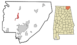 Location in Jackson County and the state of Alabama | |
| Coordinates: 34°48′11″N 86°7′25″W / 34.80306°N 86.12361°W | |
| Country | United States |
| State | Alabama |
| County | Jackson |
| Government | |
| • Mayor | Archie Rice |
| Area | |
| • Total | 3.9 sq mi (10 km2) |
| • Land | 3.9 sq mi (10 km2) |
| • Water | 0 sq mi (0 km2) |
| Elevation | 1,591 ft (485 m) |
| Population (2000) | |
| • Total | 843 |
| • Density | 216.2/sq mi (84.3/km2) |
| Time zone | Central (CST) (UTC-6) |
| • Summer (DST) | CDT (UTC-5) |
| Area code(s) | 256 |
| FIPS code | 01-70896 |
| GNIS feature ID | 0139288 |
Skyline is a town in Jackson County, Alabama, United States. The town incorporated in 1985.[1] As of the 2010 census, the population of the town was 851, up from 843 in 2000.
History
Skyline initially began as Cumberland Farms[2] in 1934, as a cooperative farming experiment under President Franklin Roosevelt's Federal Emergency Relief Agency. This was one of 43 such projects attempted nationally in depressed areas. It was soon renamed Skyline Farms to avoid confusion with another project in neighboring Tennessee. The experiment lasted for a decade before being sold off to private buyers in 1944.
The current town of Skyline is located about a mile north of the original farming colony.
Geography
Skyline is located at 34°48′11″N 86°7′25″W / 34.80306°N 86.12361°W (34.802946, -86.123494).[3]
According to the U.S. Census Bureau, the town has a total area of 3.9 square miles (10 km2), all land.
Demographics
| Historical population | |||
|---|---|---|---|
| Census | Pop. | %± | |
| 1990 | 740 | — | |
| 2000 | 843 | 13.9% | |
| 2010 | 851 | 0.9% | |
| Est. 2015 | 839 | [4] | −1.4% |
| U.S. Decennial Census[5] 2013 Estimate[6] | |||
As of the census[7] of 2000, there were 843 people, 323 households, and 251 families residing in the town. The population density was 217.9 people per square mile (84.1/km²). There were 357 housing units at an average density of 92.3 per square mile (35.6/km²). The racial makeup of the town was 94.90% White, 2.73% Native American, 0.12% Asian, and 2.25% from two or more races. 0.71% of the population were Hispanic or Latino of any race.
There were 323 households out of which 30.3% had children under the age of 18 living with them, 65.6% were married couples living together, 9.6% had a female householder with no husband present, and 22.0% were non-families. 19.8% of all households were made up of individuals and 7.4% had someone living alone who was 65 years of age or older. The average household size was 2.61 and the average family size was 2.98.
In the town the population was spread out with 23.7% under the age of 18, 11.2% from 18 to 24, 27.4% from 25 to 44, 25.7% from 45 to 64, and 12.0% who were 65 years of age or older. The median age was 38 years. For every 100 females there were 98.4 males. For every 100 females age 18 and over, there were 93.7 males.
The median income for a household in the town was $29,250, and the median income for a family was $31,985. Males had a median income of $28,026 versus $20,341 for females. The per capita income for the town was $12,780. About 9.4% of families and 13.7% of the population were below the poverty line, including 12.1% of those under age 18 and 22.0% of those age 65 or over.
References
- ↑ http://www.encyclopediaofalabama.org/article/h-3377
- ↑ http://www.encyclopediaofalabama.org/article/h-1546
- ↑ "US Gazetteer files: 2010, 2000, and 1990". United States Census Bureau. 2011-02-12. Retrieved 2011-04-23.
- ↑ "Annual Estimates of the Resident Population for Incorporated Places: April 1, 2010 to July 1, 2015". Retrieved July 2, 2016.
- ↑ "U.S. Decennial Census". Census.gov. Retrieved June 6, 2013.
- ↑ "Annual Estimates of the Resident Population: April 1, 2010 to July 1, 2013". Retrieved June 3, 2014.
- ↑ "American FactFinder". United States Census Bureau. Retrieved 2008-01-31.
Coordinates: 34°48′11″N 86°07′25″W / 34.802946°N 86.123494°W
Municipalities and communities of Jackson County, Alabama, United States | ||
|---|---|---|
| Cities | 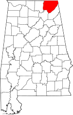 | |
| Towns | ||
| Unincorporated communities | ||
| Ghost towns | ||