Paint Rock, Alabama
| Paint Rock, Alabama | |
|---|---|
| Town | |
 Location in Jackson County and the state of Alabama | |
| Coordinates: 34°39′37″N 86°19′41″W / 34.66028°N 86.32806°W | |
| Country | United States |
| State | Alabama |
| County | Jackson |
| Area | |
| • Total | 0.4 sq mi (1.2 km2) |
| • Land | 0.4 sq mi (1.2 km2) |
| • Water | 0 sq mi (0 km2) |
| Elevation | 610 ft (186 m) |
| Population (2000) | |
| • Total | 185 |
| • Density | 462.5/sq mi (154.2/km2) |
| Time zone | Central (CST) (UTC-6) |
| • Summer (DST) | CDT (UTC-5) |
| ZIP code | 35764 |
| Area code(s) | 256 |
| FIPS code | 01-57696 |
| GNIS feature ID | 0154485 |
Paint Rock is a town in Jackson County, Alabama, United States, along the Paint Rock River, and is included in the Huntsville-Decatur Combined Statistical Area. It was incorporated in July 1894.[1]
As of the 2010 census, the population of the town was 210, up from 185 in 2000. This was the first time in 100 years it increased in population. Out of 13 incorporated communities in Jackson County, it is the least populated. Its peak population was in 1910 when it had 534 people and was the 4th largest town in the county.
Paint Rock is the location where the Scottsboro Boys were arrested.[2]
Geography
Paint Rock is located at 34°39′37″N 86°19′41″W / 34.66028°N 86.32806°W (34.660172, -86.328018).[3]
According to the U.S. Census Bureau, the town has a total area of 0.4 square miles (1.0 km2), all land.
Demographics
| Historical population | |||
|---|---|---|---|
| Census | Pop. | %± | |
| 1880 | 41 | — | |
| 1900 | 394 | — | |
| 1910 | 534 | 35.5% | |
| 1920 | 332 | −37.8% | |
| 1930 | 320 | −3.6% | |
| 1940 | 282 | −11.9% | |
| 1950 | 276 | −2.1% | |
| 1960 | 264 | −4.3% | |
| 1970 | 226 | −14.4% | |
| 1980 | 221 | −2.2% | |
| 1990 | 214 | −3.2% | |
| 2000 | 185 | −13.6% | |
| 2010 | 210 | 13.5% | |
| Est. 2015 | 207 | [4] | −1.4% |
| U.S. Decennial Census[5] 2013 Estimate[6] | |||
As of the census[7] of 2000, there were 185 people, 81 households, and 57 families residing in the town. The population density was 415.9 people per square mile (162.3/km²). There were 94 housing units at an average density of 211.3 per square mile (82.5/km²). The racial makeup of the town was 96.76% White, 0.54% Native American, and 2.70% from two or more races.
There were 81 households out of which 27.2% had children under the age of 18 living with them, 54.3% were married couples living together, 11.1% had a female householder with no husband present, and 29.6% were non-families. 29.6% of all households were made up of individuals and 13.6% had someone living alone who was 65 years of age or older. The average household size was 2.28 and the average family size was 2.77.
In the town the population was spread out with 18.4% under the age of 18, 14.1% from 18 to 24, 24.9% from 25 to 44, 24.9% from 45 to 64, and 17.8% who were 65 years of age or older. The median age was 38 years. For every 100 females there were 92.7 males. For every 100 females age 18 and over, there were 98.7 males.
The median income for a household in the town was $35,521, and the median income for a family was $36,875. Males had a median income of $28,750 versus $16,719 for females. The per capita income for the town was $15,551. About 8.3% of families and 10.8% of the population were below the poverty line, including none of those under the age of eighteen or sixty five or over.
References
- ↑ http://paintrockal.webs.com/historyofpaintrock.htm
- ↑ "Scottsboro Timeline" American Experience. Retrieved 28 August 2013.
- ↑ "US Gazetteer files: 2010, 2000, and 1990". United States Census Bureau. 2011-02-12. Retrieved 2011-04-23.
- ↑ "Annual Estimates of the Resident Population for Incorporated Places: April 1, 2010 to July 1, 2015". Retrieved July 2, 2016.
- ↑ "U.S. Decennial Census". Census.gov. Retrieved June 6, 2013.
- ↑ "Annual Estimates of the Resident Population: April 1, 2010 to July 1, 2013". Retrieved June 3, 2014.
- ↑ "American FactFinder". United States Census Bureau. Retrieved 2008-01-31.
External links
Coordinates: 34°39′37″N 86°19′41″W / 34.660172°N 86.328018°W
Municipalities and communities of Jackson County, Alabama, United States | ||
|---|---|---|
| Cities | 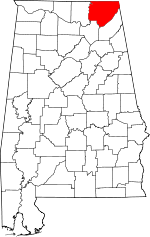 | |
| Towns | ||
| Unincorporated communities | ||
| Ghost towns | ||
