Showell, Maryland
| Showell, Maryland | |
|---|---|
| Unincorporated community | |
 Showell | |
| Coordinates: 38°23′52″N 75°12′54″W / 38.39778°N 75.21500°WCoordinates: 38°23′52″N 75°12′54″W / 38.39778°N 75.21500°W | |
| Country | United States |
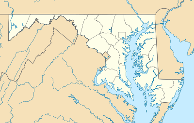
| State | Maryland |
| County | Worcester |
| Elevation | 26 ft (8 m) |
| Time zone | Eastern (EST) (UTC-5) |
| • Summer (DST) | EDT (UTC-4) |
| ZIP code | 21862 |
| Area code(s) | 410, 443, and 667 |
| GNIS feature ID | 591285[1] |
Showell is an unincorporated community in Worcester County, Maryland, United States.[1] Showell is located at the intersection of Worcester Highway and Pitts Road west of U.S. Route 113 to the north of Berlin. It takes its name from Samuel Showell, the owner of the original land grant upon which the town sits. Samuel Showell and his descendants owned several large parcels in the area,of which this was the largest, which were gradually divided among family members and then eventually sold off.
St. Martin's Episcopal Church was listed on the National Register of Historic Places in 1977.[2]
Notable people
- Russell O. Hickman, Maryland legislator and businessman, was born in Stowell.[3]
References
- 1 2 "Showell". Geographic Names Information System. United States Geological Survey.
- ↑ National Park Service (2010-07-09). "National Register Information System". National Register of Historic Places. National Park Service.
- ↑ 'Maryland Manual 1969-1970,' vol. 174. Biographical Sketch of Russell O/ Hickman, pg. 356
Municipalities and communities of Worcester County, Maryland, United States | ||
|---|---|---|
| City | 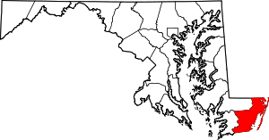 | |
| Towns | ||
| CDPs | ||
| Other communities | ||
| Footnotes | ‡This populated place also has portions in an adjacent county or counties | |
This article is issued from Wikipedia - version of the 10/21/2016. The text is available under the Creative Commons Attribution/Share Alike but additional terms may apply for the media files.