Worcester County, Maryland
| Worcester County, Maryland | ||
|---|---|---|
| ||
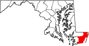 Location in the U.S. state of Maryland | ||
 Maryland's location in the U.S. | ||
| Founded | 1742 | |
| Named for | Family of Marquess of Worcester | |
| Seat | Snow Hill | |
| Largest town | Ocean City | |
| Area | ||
| • Total | 695 sq mi (1,800 km2) | |
| • Land | 468 sq mi (1,212 km2) | |
| • Water | 227 sq mi (588 km2), 33% | |
| Population (est.) | ||
| • (2015) | 51,540 | |
| • Density | 74/sq mi (29/km²) | |
| Congressional district | 1st | |
| Time zone | Eastern: UTC-5/-4 | |
| Website |
www | |

Worcester County /ˈwʊərstər/ is the easternmost county of the U.S. state of Maryland. As of the 2010 census, the population was 51,454.[1] Its county seat is Snow Hill.[2] The county was named for Mary Arundell, the wife of Sir John Somerset, a son of Henry Somerset, 1st Marquess of Worcester. She was sister to Anne Arundell (Anne Arundell County), wife of Cecil Calvert, 2nd Baron Baltimore, the first Proprietor and Proprietary Governor of the Province of Maryland.[2][3]
Worcester County is included in the Salisbury, MD-DE Metropolitan Statistical Area. The county includes the entire length of the state's ocean and tidewater coast along the Intracoastal Waterway bordering Assawoman Bay, Isle of Wight Bay, Sinepuxent Bay, and Chincoteague Bay between the sand barrier islands of Fenwick Island and Assateague Island bordering the Atlantic Ocean coast. It is home to the popular vacation resort area of Ocean City, founded 1875, as well as wild habitats on the primitive wilderness areas on Assateague Island and in the Pocomoke River and Swamp.
History
Worcester County was created by the division of the formerly larger Eastern Shore's Somerset County in 1742. The county seat, which was previously located near the confluence of Dividing Creek with the Pocomoke River, was later transferred to the river port of Snow Hill, at the head of navigation of the Pocomoke, now near the center of the new county.
Both the areas of Somerset and Worcester Counties were divided into old colonial divisions of "hundreds", from south to north: Mattapony, Pocomoke, Boquetenorton, Wicomico, and Baltimore Hundreds. Later subdivisions of these hundreds added Pitts Creek, Acquango, Queponco, and Buckingham & Worcester Hundreds, all of which in turn eventually became election districts for the newly independent state following American independence. Competing territorial claims between the Proprietor family of the Calverts and the Lords Baltimore in the old Province of Maryland and the Penns of the neighboring Province of Pennsylvania to the north and of what later became the state of Delaware to the east led to the surveying of Worcester County's northern border, the "Transpeninsular Line" in 1751, though boundary disputes continued through the rest of the colonial period, not totally settled until the work of the famous Charles Mason and Jeremiah Dixon with their "Mason–Dixon line". In 1779, Stephen Decatur, the famous United States Navy officer and hero of the First Barbary War and the Second Barbary War in the early 1800s, and leading into the War of 1812, was born at Sinepuxent, near what is today the town of Berlin.
Originally settled by European immigrants of British and Irish stock, along with bound laborers of mainly West African descent, Worcester County was divided during the colonial period into several Church of England parishes, though Quakers, Presbyterians, and later Methodists also set up meeting houses. Like the border states in general, Worcester County had a high proportion of free people of color for many decades before the Civil War, due in part to the influence of initially Quakerism, and later Methodism.
Worcester County was primarily an agricultural area from its inception, first planting tobacco, but when the quality produced in the area's sandy soil could not compete with that produced elsewhere, growing wheat, corn, and livestock. Early industrial activity included the smelting of bog iron ore in a brick blast furnace to make pig iron at Furnacetown in the first half of the 19th century. The presence of large bald cypress swamps along the Pocomoke River led to logging, the manufacture of roofing shingles, and shipbuilding along the river at Newtown (later Pocomoke City). The arrival of steam-powered water transport and then the railroad opened urban markets to another of Worcester County's principal products: seafood, particularly shellfish. Oysters, clams, and crabs were shipped to Baltimore, Philadelphia, and New York. Soon after the Civil War (to each side of which Worcester County sent soldiers), parts of both Worcester and Somerset Counties were combined to create, in 1867, Wicomico County. Also in the later 19th century, the seaside resort of Ocean City was founded.
Truck farming and the canning industry came to the fore during the early 20th century. However, both the seafood industry and truck farming declined after mid-century, due to overfishing on the one hand, and the opening of California's Central Valley to irrigated agriculture on the other, but the advent of the large-scale poultry industry filled this gap. The expansion of Ocean City since the 1960s has turned the northern part of the county from a summer resort to an expanding year-round community.
Two major storms influenced the course of Worcester County history in the 20th Century: the hurricane of August 1933, which badly damaged Ocean City and Public Landing, but also cut the Ocean City Inlet and passageway between the inner bays west of the sandy barrier islands of Assawoman Bay, Sinepuxent Bay and Assateague Channel and Bay and the Atlantic Ocean, and the later Ash Wednesday "Nor'easter" of 1962, which destroyed much of the residential development on Assateague Island and led to the creation of the National Seashore and State Park.
The county has a number of properties on the National Register of Historic Places.[4]
Law and government
| Year | Republican | Democratic |
|---|---|---|
| 2016 | 61.3% 16,634 | 34.1% 9,265 |
| 2012 | 58.2% 15,951 | 40.2% 11,014 |
| 2008 | 57.1% 15,607 | 41.6% 11,374 |
| 2004 | 60.8% 15,349 | 38.2% 9,648 |
| 2000 | 51.8% 10,742 | 45.2% 9,389 |
| 1996 | 45.0% 7,621 | 44.8% 7,587 |
| 1992 | 43.7% 7,237 | 36.5% 6,040 |
| 1988 | 63.6% 8,430 | 36.1% 4,787 |
| 1984 | 68.3% 8,208 | 31.4% 3,770 |
| 1980 | 52.4% 5,362 | 41.0% 4,195 |
| 1976 | 53.3% 4,647 | 46.7% 4,076 |
| 1972 | 75.2% 5,584 | 24.1% 1,792 |
| 1968 | 47.5% 3,541 | 27.4% 2,046 |
| 1964 | 44.5% 2,973 | 55.5% 3,713 |
| 1960 | 54.3% 3,976 | 45.7% 3,347 |
Worcester County was granted home rule in 1976 under a state code under the amendments to the fourth Maryland Constitution of 1867. The Circuit Court of Maryland and District Court of Maryland are located in Snow Hill with two district courthouses. The county is governed by a Board of Commissioners elected from seven districts. The current president is Madison James (Jim) Bunting, Jr. (R). Merrill Lockfaw (R) serves as vice president. The remaining commissioners are Diana Purnell (D), James C. (Bud) Church (R), Theodore Elder (R), Anthony W. (Chip) Bertino, Jr. (R) and Joseph Mitrecic (R).
Geography
According to the U.S. Census Bureau, the county has a total area of 695 square miles (1,800 km2), of which 468 square miles (1,210 km2) is land and 227 square miles (590 km2) (33%) is water.[6] It is the third-largest county in Maryland by total area.
The terrain is mostly level and coastal. The lowest elevation is sea level along the Atlantic Ocean and the highest elevation is 49 ft (15 m) in the northwestern part of the county along State Route 12 just south of the Wicomico County line.
National protected area
Adjacent counties
- Accomack County, Virginia (south)
- Somerset County (west)
- Sussex County, Delaware (north)
- Wicomico County (northwest)
Transportation
Freight trains run from Snow Hill north to Berlin and the Delaware border on the Maryland and Delaware Railroad, and the main line (formerly Pennsylvania Railroad) from Philadelphia to Cape Charles, Virginia and Norfolk runs through the southwestern corner of the county, operated by the Norfolk Southern Railway north of Pocomoke City and the Bay Coast Railroad south of Pocomoke City. The Ocean City Municipal Airport is located near Ocean City, but has no scheduled service. The nearest airport with commercial air service is the Salisbury–Ocean City–Wicomico Regional Airport near Salisbury.
Major Highways
Demographics
| Historical population | |||
|---|---|---|---|
| Census | Pop. | %± | |
| 1790 | 11,640 | — | |
| 1800 | 16,370 | 40.6% | |
| 1810 | 16,971 | 3.7% | |
| 1820 | 17,421 | 2.7% | |
| 1830 | 18,273 | 4.9% | |
| 1840 | 18,377 | 0.6% | |
| 1850 | 18,859 | 2.6% | |
| 1860 | 20,661 | 9.6% | |
| 1870 | 16,419 | −20.5% | |
| 1880 | 19,539 | 19.0% | |
| 1890 | 19,747 | 1.1% | |
| 1900 | 20,865 | 5.7% | |
| 1910 | 21,841 | 4.7% | |
| 1920 | 22,309 | 2.1% | |
| 1930 | 21,624 | −3.1% | |
| 1940 | 21,245 | −1.8% | |
| 1950 | 23,148 | 9.0% | |
| 1960 | 23,733 | 2.5% | |
| 1970 | 24,442 | 3.0% | |
| 1980 | 30,889 | 26.4% | |
| 1990 | 35,028 | 13.4% | |
| 2000 | 46,543 | 32.9% | |
| 2010 | 51,454 | 10.6% | |
| Est. 2015 | 51,540 | [7] | 0.2% |
| U.S. Decennial Census[8] 1790-1960[9] 1900-1990[10] 1990-2000[11] 2010-2015[1] | |||
2000 census
As of the census[12] of 2000, there were 46,543 people, 19,694 households, and 13,273 families residing in the county. The population density was 98 people per square mile (38/km²). There were 47,360 housing units at an average density of 100 per square mile (39/km²). The racial makeup of the county was 81.20% White, 16.66% Black or African American, 0.18% Native American, 0.61% Asian, 0.02% Pacific Islander, 0.37% from other races, and 0.97% from two or more races. 1.28% of the population were Hispanic or Latino of any race. 15.7% were of German, 13.3% English, 12.6% Irish, 11.1% American and 6.0% Italian ancestry.
There were 19,694 households out of which 24.50% had children under the age of 18 living with them, 53.20% were married couples living together, 10.80% had a female householder with no husband present, and 32.60% were non-families. 26.30% of all households were made up of individuals and 11.60% had someone living alone who was 65 years of age or older. The average household size was 2.33 and the average family size was 2.79.
In the county the population was spread out with 20.50% under the age of 18, 6.20% from 18 to 24, 26.40% from 25 to 44, 26.90% from 45 to 64, and 20.10% who were 65 years of age or older. The median age was 43 years. For every 100 females there were 95.20 males. For every 100 females age 18 and over, there were 92.30 males.
The median income for a household in the county was $40,650, and the median income for a family was $47,293. Males had a median income of $31,735 versus $24,319 for females. The per capita income for the county was $22,505. About 7.20% of families and 9.60% of the population were below the poverty line, including 17.00% of those under age 18 and 6.40% of those age 65 or over.
2010 census
As of the 2010 United States Census, there were 51,454 people, 22,229 households, and 14,598 families residing in the county.[13] The population density was 109.9 inhabitants per square mile (42.4/km2). There were 55,749 housing units at an average density of 119.1 per square mile (46.0/km2).[14] The racial makeup of the county was 82.0% white, 13.6% black or African American, 1.1% Asian, 0.3% American Indian, 1.2% from other races, and 1.7% from two or more races. Those of Hispanic or Latino origin made up 3.2% of the population.[13] In terms of ancestry,[15]
Of the 22,229 households, 24.2% had children under the age of 18 living with them, 50.9% were married couples living together, 10.9% had a female householder with no husband present, 34.3% were non-families, and 28.0% of all households were made up of individuals. The average household size was 2.28 and the average family size was 2.76. The median age was 48.1 years.[13]
The median income for a household in the county was $55,487 and the median income for a family was $67,408. Males had a median income of $44,986 versus $37,785 for females. The per capita income for the county was $31,520. About 6.2% of families and 10.1% of the population were below the poverty line, including 16.2% of those under age 18 and 6.5% of those age 65 or over.[16]
Education
The following institutions are part of the Worcester County public school system, governed by the Worcester County Board of Education:
- Showell Elementary School
- Buckingham Elementary School
- Ocean City Elementary School
- Snow Hill Elementary School
- Pocomoke Elementary School
- Berlin Intermediate School
- Stephen Decatur Middle School
- Snow Hill Middle School
- Pocomoke Middle School
- Stephen Decatur High School
- Snow Hill High School
- Pocomoke High School
- Worcester Technical High School
- Cedar Chapel Special School
In the fall of 2008 Worcester County has plans to open Worcester Technical High School to all residents of the county, to replace Worcester Career and Technology Center.
The following private schools also operate in Worcester County:
- Worcester Preparatory School
- Seaside Christian Academy
- Most Blessed Sacrament Catholic School
- Snow Hill Mennonite School
- The Tidewater School by the Sea
Communities
This county contains the following incorporated municipalities:
City
Towns
- Berlin
- Ocean City
- Snow Hill (county seat)
Census-designated places
The Census Bureau recognizes the following census-designated places in the county:
Unincorporated communities
- Boxiron
- Cedartown
- Friendship
- Germantown
- Goodwill
- Ironshire
- Klej Grange
- Libertytown
- Nassawango Hills
- Public Landing
- Sinnepuxent
- South Point
- Taylorville
- Whiton
Notable residents
- Spiro Agnew, former vice president
- Stephen Decatur, Naval Officer
- Linda Harrison, actress
See also
References
- 1 2 "State & County QuickFacts". United States Census Bureau. Retrieved August 24, 2013.
- 1 2 "Find a County". National Association of Counties. Archived from the original on May 31, 2011. Retrieved 2011-06-07.
- ↑ Cutter, William Richard, ed. (1908). Genealogical and personal memoirs relating to the families of Boston and eastern Massachusetts. Volume 2. New York: Lewis Historical Publishing Company. p. 877. ISBN 9780806345499. Retrieved 8 February 2015.
- ↑ National Park Service (2008-04-15). "National Register Information System". National Register of Historic Places. National Park Service.
- ↑ http://uselectionatlas.org/RESULTS/
- ↑ "2010 Census Gazetteer Files". United States Census Bureau. August 22, 2012. Retrieved September 14, 2014.
- ↑ "County Totals Dataset: Population, Population Change and Estimated Components of Population Change: April 1, 2010 to July 1, 2015". Retrieved July 2, 2016.
- ↑ "U.S. Decennial Census". United States Census Bureau. Archived from the original on May 11, 2015. Retrieved September 14, 2014.
- ↑ "Historical Census Browser". University of Virginia Library. Retrieved September 14, 2014.
- ↑ "Population of Counties by Decennial Census: 1900 to 1990". United States Census Bureau. Retrieved September 14, 2014.
- ↑ "Census 2000 PHC-T-4. Ranking Tables for Counties: 1990 and 2000" (PDF). United States Census Bureau. Retrieved September 14, 2014.
- ↑ "American FactFinder". United States Census Bureau. Retrieved 2008-01-31.
- 1 2 3 "DP-1 Profile of General Population and Housing Characteristics: 2010 Demographic Profile Data". United States Census Bureau. Retrieved 2016-01-22.
- ↑ "Population, Housing Units, Area, and Density: 2010 - County". United States Census Bureau. Retrieved 2016-01-22.
- ↑ "DP02 SELECTED SOCIAL CHARACTERISTICS IN THE UNITED STATES – 2006-2010 American Community Survey 5-Year Estimates". United States Census Bureau. Retrieved 2016-01-22.
- ↑ "DP03 SELECTED ECONOMIC CHARACTERISTICS – 2006-2010 American Community Survey 5-Year Estimates". United States Census Bureau. Retrieved 2016-01-22.
Sources
- Touart, Paul Baker, Along the Seaboard Side: The Architectural History of Worcester County, Maryland (1994).
External links
- Worcester County Government Website
- Worcester County tourism website
- Your Community Link: A Database of Community, Government, and Non-Profit organizations on the Lower Shore
- 1876 Maps of Worcester County (requires Java)
 Geographic data related to Worcester County, Maryland at OpenStreetMap
 "Worcester. II. A S. E. county of Maryland". The American Cyclopædia. 1879.
Coordinates: 38°14′N 75°17′W / 38.23°N 75.28°W
 |
Wicomico County | Sussex County, Delaware | | |
| Somerset County | |
Atlantic Ocean | ||
| ||||
| | ||||
| Accomack County, Virginia |
Municipalities and communities of Worcester County, Maryland, United States | ||
|---|---|---|
| City | | |
| Towns | ||
| CDPs | ||
| Other communities | ||
| Footnotes | ‡This populated place also has portions in an adjacent county or counties | |
| Counties |  | |
|---|---|---|
| Principal city | ||
| Places 5k-20k | ||
| Places 1k-5k | ||