Klej Grange, Maryland
| Klej Grange, Maryland | |
|---|---|
| Unincorporated community | |
 Klej Grange | |
| Coordinates: 38°05′52″N 75°27′16″W / 38.09778°N 75.45444°WCoordinates: 38°05′52″N 75°27′16″W / 38.09778°N 75.45444°W | |
| Country | United States |
| State | Maryland |
| County | Worcester |
| Elevation | 30 ft (9 m) |
| Time zone | Eastern (EST) (UTC-5) |
| • Summer (DST) | EDT (UTC-4) |
| ZIP code | 21851 |
| Area code(s) | 410, 443, and 667 |
| GNIS feature ID | 585326[1] |
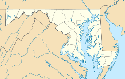
Klej Grange /ˌklɛdʒ ˈɡreɪndʒ/ is a small unincorporated community 3 miles (5 km) northwest of Stockton in Worcester County, Maryland. It is located at the intersection of Klej Grange, Betheden Church, and Ward Roads.
Origin of name
The acronym "Klej" was coined by Joseph William Drexel from the initials of the names of his four daughters (Katherine, Lucy, Elizabeth, and Josephine),[2] and was combined with "Grange", perhaps a reference to the National Grange.
History
First known as Trap, or Traptown, then for many years in the nineteenth century as Lindseyville, the community originally arose at the crossing of the roads leading from Mattapony Landing on the Pocomoke River to Sandy Hill (later Stockton) and from Snow Hill to Stevens Landing (now Pocomoke City).[3] In 1878, Drexel purchased a substantial part of the estate of Matthias Lindsey, after whose family the crossroads had been known, to create a planned community where low cost farmland would be offered to benefit the poor. Drexel named Austin Thomas Byrne[4] as superintendent of the project; Byrne surveyed and platted Drexel's agrarian-industrial experiment.[5]
Drexel and his brother Anthony, the founder of Drexel University, were sons of Francis Martin Drexel, founder of the banking house of Drexel & Co. A "Famous Americans" biographical capsule notes of Joseph W. Drexel:
Among his philanthropic interests is a 200-acre (0.81 km2) farm near New York, where persons without work are lodged, clothed, fed, and taught agriculture until places are procured for them. He owns a large tract of land Klej Grange in Maryland, which has been divided into lots, and houses, mills, etc., erected upon them. These farms are sold to poor persons at cost. About 7,000 acres (28 km2) in Michigan is destined for the same purpose.
Drexel's project was cut short by his death in 1888. His widow and daughters had other interests and soon sold the property, much of it eventually deeded to the Worcester Realty Co. As with many similar projects, the community has today relapsed into the rural obscurity from which Drexel briefly roused it.
References
- ↑ "Klej Grange". Geographic Names Information System. United States Geological Survey.
- ↑ Gannett, Henry (1905). The Origin of Certain Place Names in the United States. Government Printing Office. p. 177.
- ↑ Map from 1877 Atlas showing Lindseyville
- ↑ Byrne webpage
- ↑ Democratic Messenger newspaper article
External links
Municipalities and communities of Worcester County, Maryland, United States | ||
|---|---|---|
| City | 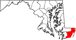 | |
| Towns | ||
| CDPs | ||
| Other communities | ||
| Footnotes | ‡This populated place also has portions in an adjacent county or counties | |