Sandcut, Indiana
| Sandcut | |
|---|---|
| Unincorporated community | |
| Nickname(s): Meltonville | |
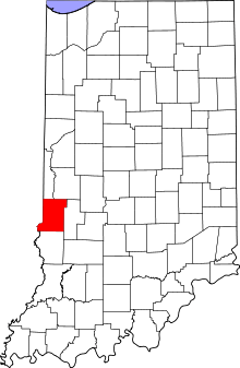 Vigo County's location in Indiana | |
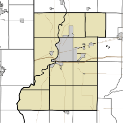 Sandcut location in Vigo County, Indiana | |
| Coordinates: 39°33′53″N 87°19′25″W / 39.56472°N 87.32361°WCoordinates: 39°33′53″N 87°19′25″W / 39.56472°N 87.32361°W | |
| Country |
|
| State |
|
| County | Vigo County |
| Township | Otter Creek Township |
| Elevation[1] | 160 m (525 ft) |
| Time zone | Eastern |
| ZIP code | 47805 |
| Area code(s) | 812 |
| GNIS feature ID | 442993 |
Sandcut is an unincorporated community in Otter Creek Township, Vigo County, Indiana, United States.[2] It is part of the Terre Haute metropolitan area. It is located at the intersection of Rio Grande Ave. and Rosedale Rd. Little Gundy Creek flows on the southeastern side of Sandcut. Sandcut also has a volunteer fire department.
Geography
Sandcut is located at 39°33′53″N 87°19′25″W / 39.56472°N 87.32361°W at an elevation of 525 feet.
References
- ↑ "US Board on Geographic Names". United States Geological Survey. October 25, 2007. Retrieved 2016-07-14.
- ↑ "Sandcut, Indiana". Geographic Names Information System. United States Geological Survey. Retrieved 2010-06-24.
Municipalities and communities of Vigo County, Indiana, United States | ||
|---|---|---|
| City | ||
| Towns | ||
| Townships | ||
| CDPs | ||
| Other unincorporated communities |
| |
| Footnotes | ‡This populated place also has portions in an adjacent county or counties | |
This article is issued from Wikipedia - version of the 7/14/2016. The text is available under the Creative Commons Attribution/Share Alike but additional terms may apply for the media files.
