Tabertown, Indiana
| Tabertown | |
|---|---|
| Unincorporated community | |
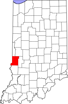 Vigo County's location in Indiana | |
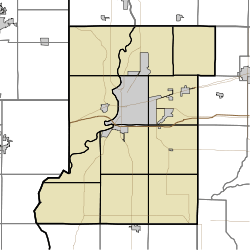 Tabertown location in Vigo County, Indiana | |
| Coordinates: 39°29′41″N 87°15′11″W / 39.49472°N 87.25306°WCoordinates: 39°29′41″N 87°15′11″W / 39.49472°N 87.25306°W | |
| Country |
|
| State |
|
| County | Vigo County |
| Township | Lost Creek Township |
| Elevation[1] | 180 m (591 ft) |
| ZIP code | 47878 |
| Area code(s) | 812 |
| GNIS feature ID | 444535 |
Tabertown is an unincorporated community in Lost Creek Township, Vigo County, Indiana, United States.[2]
Now within the boundaries of the town of Seelyville, it is also part of the Terre Haute metropolitan area.
Geography
Tabertown is located at 39°29′41″N 87°15′11″W / 39.49472°N 87.25306°W at an elevation of 591 feet.
References
- ↑ "US Board on Geographic Names". United States Geological Survey. October 25, 2007. Retrieved 2016-07-14.
- ↑ "Tabertown, Indiana". Geographic Names Information System. United States Geological Survey. Retrieved 2010-06-24.
Municipalities and communities of Vigo County, Indiana, United States | ||
|---|---|---|
| City | ||
| Towns | ||
| Townships | ||
| CDPs | ||
| Other unincorporated communities |
| |
| Footnotes | ‡This populated place also has portions in an adjacent county or counties | |
This article is issued from Wikipedia - version of the 7/15/2016. The text is available under the Creative Commons Attribution/Share Alike but additional terms may apply for the media files.