Rapides Parish, Louisiana
| Rapides Parish, Louisiana | ||
|---|---|---|
|
Upper portion of the Rapides Parish Courthouse in Alexandria | ||
| ||
 Location in the U.S. state of Louisiana | ||
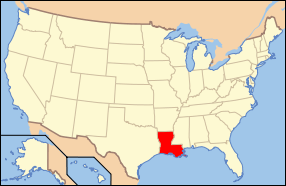 Louisiana's location in the U.S. | ||
| Founded | 1807 | |
| Named for | The local river rapids | |
| Seat | Alexandria | |
| Largest city | Alexandria | |
| Area | ||
| • Total | 1,362 sq mi (3,528 km2) | |
| • Land | 1,318 sq mi (3,414 km2) | |
| • Water | 44 sq mi (114 km2), 3.2% | |
| Population | ||
| • (2010) | 131,613 | |
| • Density | 100/sq mi (39/km²) | |
| Congressional district | 5th | |
| Time zone | Central: UTC-6/-5 | |
| Website |
www | |


_IMG_4268.JPG)

Rapides Parish (French: Paroisse des Rapides) is a parish located in the U.S. state of Louisiana. As of the 2010 census, the population was 131,613.[1] The parish seat is Alexandria.[2] Rapides is the French spelling of "rapids". The parish was created in 1807.[3]
Rapides Parish is included in the Alexandria, LA Metropolitan Statistical Area.
History

In 1763, the land that is now Rapides Parish became the new home of the Apalachee tribe, who were settled there with the permission of Governor Kerlerec. The Native Americans had come after fleeing the British and their Creek Indian allies from what is now from Leon County, Florida. Many of their descendants remain in Natchitoches Parish.
The first French settler was Vincent Porei, who was granted a small tract of land in July 1764 by the Civil and Military Commander of Natchitoches. Nicolas Etienne Marafret Layssard arrived in December 1766, with the permission of Aubrey and Foucault, to establish a "tar works" in the pineries of Rapides, for naval stores. He was later appointed the first Civil Commander of Rapides Parish. During the 1760s, the area was still a dependency of Natchitoches Parish [AGI, PPC, Legajo 187a, 384-384v].
Alexander Fulton had a Spanish land grant within Rapides Parish in the 1790s, where he laid out the future city of Alexandria in 1805.[4] Rapides Parish was formed in 1807 by the government of the Territory of Orleans.
When the Union occupied Alexandria, elections were held on April 1, 1863, in Rapides Parish to select delegates for a pending state constitutional convention. According to Maj. Gen. Nathaniel P. Banks, the election was held at Alexandria "by the request of citizens of the parish of Rapides. No officer or soldier interfered with or had any part whatever in this matter. It was left exclusively to the loyal citizens" in Rapides Parish.[5] The election dates varied within the Federally occupied areas. New Orleans held its contests for delegates on March 28. Marksville and Grand Ecore soon followed. According to the historian John D. Winters, "none of these elections in any way impeded the progress nor materially affected the outcome of the [Union's] Red River campaign.[6]
Parts of Catahoula Parish, Grant Parish, Vernon Parish, and Winn Parish were initially part of Rapides Parish territory, but they eventually separated and obtained land from neighboring parishes.
Though Alexandria is heavily Democratic Rapides Parish as a whole frequently votes Republican in competitive elections. In 2012, Republican Mitt Romney carried the parish with 37,193 votes (64.1 percent), compared to Democrat U.S. President Barack Obama's 20,045 (34.6 percent) tabulation.[7] The 2008 returns in Rapides Parish were similar to those of 2012. U.S. Senator John McCain of Arizona won the parish with 36,611 votes (63.6 percent) to President Obama's 20,127 (35 percent).[8]
With 58.8 percent and 63.8 percent, respectively, George W. Bush carried Rapides Parish in both 2000 and 2004 over the Democrats, Vice President Al Gore[9] and John F. Kerry.[10] The last Democrat to win at the presidential level in Rapides Parish was Bill Clinton, who in 1996 received 23,004 votes (46.1 percent) to Robert J. Dole's 21,548 (43.2 percent). Ross Perot, founder of his Reform Party, received 4,670 ballots (9.4 percent).[11]
Geography
According to the U.S. Census Bureau, the parish has a total area of 1,362 square miles (3,530 km2), of which 1,318 square miles (3,410 km2) is land and 44 square miles (110 km2) (3.2%) is water.[12] It is the second-largest parish in Louisiana by land area.
Water features
Major highways
 Interstate 49
 U.S. Highway 71
 U.S. Highway 165
 U.S. Highway 167
 Louisiana Highway 1
 Louisiana Highway 28
Adjacent parishes
- Grant Parish (north)
- La Salle Parish (northeast)
- Avoyelles Parish (east)
- Evangeline Parish (southeast)
- Allen Parish (southwest)
- Vernon Parish (west)
- Natchitoches Parish (northwest)
National protected area
- Kisatchie National Forest (part)
Military Installations
- Camp Beauregard (LA Army National Guard)
- Esler Airfield (LA Army National Guard)
- England Air Force Base (defunct)
- Camp Claiborne (defunct)
- Camp Livingston (defunct)
National Guard
Demographics
| Historical population | |||
|---|---|---|---|
| Census | Pop. | %± | |
| 1820 | 6,065 | — | |
| 1830 | 7,575 | 24.9% | |
| 1840 | 14,132 | 86.6% | |
| 1850 | 16,561 | 17.2% | |
| 1860 | 25,360 | 53.1% | |
| 1870 | 18,015 | −29.0% | |
| 1880 | 23,563 | 30.8% | |
| 1890 | 27,642 | 17.3% | |
| 1900 | 39,578 | 43.2% | |
| 1910 | 44,545 | 12.5% | |
| 1920 | 59,444 | 33.4% | |
| 1930 | 65,455 | 10.1% | |
| 1940 | 73,370 | 12.1% | |
| 1950 | 90,648 | 23.5% | |
| 1960 | 111,351 | 22.8% | |
| 1970 | 118,078 | 6.0% | |
| 1980 | 135,282 | 14.6% | |
| 1990 | 131,556 | −2.8% | |
| 2000 | 126,337 | −4.0% | |
| 2010 | 131,613 | 4.2% | |
| Est. 2015 | 132,141 | [13] | 0.4% |
| U.S. Decennial Census[14] 1790-1960[15] 1900-1990[16] 1990-2000[17] 2010-2013[1] | |||
As of the 2010 United States Census, there were 131,613 people residing in the parish. 63.3% were White, 25.0% Black or African American, 1.83% Asian, 2.15% Native American, 1.56% of some other race and 1.88% of two or more races. 6.85% were Hispanic or Latino (of any race).
As of the census[18] of 2000, there were 126,337 people, 47,120 households, and 33,125 families residing in the parish. The population density was 93 people per square mile (37/km²). There were 52,038 housing units at an average density of 39 per square mile (15/km²). The racial makeup of the parish was 66.51% White, 30.43% Black or African American, 0.74% Native American, 0.86% Asian, 0.04% Pacific Islander, 0.42% from other races, and 1.01% from two or more races. 1.38% of the population were Hispanic or Latino of any race.
There were 47,120 households out of which 34.60% had children under the age of 18 living with them, 49.70% were married couples living together, 16.80% had a female householder with no husband present, and 29.70% were non-families. 26.00% of all households were made up of individuals and 10.30% had someone living alone who was 65 years of age or older. The average household size was 2.56 and the average family size was 3.09.
In the parish the population was spread out with 27.20% under the age of 18, 9.50% from 18 to 24, 27.90% from 25 to 44, 22.40% from 45 to 64, and 13.10% who were 65 years of age or older. The median age was 36 years. For every 100 females there were 91.70 males. For every 100 females age 18 and over, there were 88.00 males.
The median income for a household in the parish was $29,856, and the median income for a family was $36,671. Males had a median income of $29,775 versus $20,483 for females. The per capita income for the parish was $16,088. About 16.40% of families and 20.50% of the population were below the poverty line, including 26.30% of those under age 18 and 16.30% of those age 65 or over.
Government and infrastructure
The Louisiana Department of Public Safety & Corrections formerly operated the J. Levy Dabadie Correctional Center on property adjacent to Camp Beauregard in Pineville in Rapides Parish.[19][20] The facility closed in July 2012.[21]
Education
Rapides Parish School Board operates public schools.
Communities

Cities
- Alexandria (parish seat)
- Pineville
Towns
Villages
Unincorporated communities
Gallery
 A view of the Alexandria museum in Rapides Parish, Louisiana, USA
 Rapides Parish Library at Alexandria
 Red River at Alexandria
See also
- National Register of Historic Places listings in Rapides Parish, Louisiana
- Renaissance Home for Youth
- Jay Chevalier
- Bill Cleveland
- U. T. Downs, sheriff from 1924-1940
- David Theophilus Stafford, sheriff from 1888-1904
- Grove Stafford, state senator from 1940-1948
- Ed Ware, district attorney from 1967-1984
References
- 1 2 "State & County QuickFacts". United States Census Bureau. Retrieved August 18, 2013.
- ↑ "Find a County". National Association of Counties. Retrieved 2011-06-07.
- ↑ "Rapides Parish". Center for Cultural and Eco-Tourism. Retrieved September 6, 2014.
- ↑ "Fulton, Alexander". lahistory.org (Louisiana Historical Association). Retrieved October 9, 2010.
- ↑ John D. Winters, The Civil War in Louisiana, Baton Rouge: Louisiana State University Press, 1963, ISBN 0-8071-0834-0, p. 333
- ↑ Winters, p. 333
- ↑ "Rapides Parish election returns, November 6, 2012". staticresults.sos.la.gov. Retrieved November 17, 2012.
- ↑ "Rapides Parish election returns, November 4, 2008". staticresults.sos.la.gov. Retrieved November 17, 2012.
- ↑ "Rapides Parish election returns, November 7, 2000". staticresults.sos.la.gov. Retrieved November 17, 2012.
- ↑ "Rapides Parish election returns, November 2, 2004". staticresults.sos.la.gov. Retrieved November 17, 2012.
- ↑ "Rapides Parish election returns, November 5, 1996". staticresults.sos.la.gov. Retrieved November 17, 2012.
- ↑ "2010 Census Gazetteer Files". United States Census Bureau. August 22, 2012. Retrieved September 1, 2014.
- ↑ "County Totals Dataset: Population, Population Change and Estimated Components of Population Change: April 1, 2010 to July 1, 2015". Retrieved July 2, 2016.
- ↑ "U.S. Decennial Census". United States Census Bureau. Retrieved September 1, 2014.
- ↑ "Historical Census Browser". University of Virginia Library. Retrieved September 1, 2014.
- ↑ "Population of Counties by Decennial Census: 1900 to 1990". United States Census Bureau. Retrieved September 1, 2014.
- ↑ "Census 2000 PHC-T-4. Ranking Tables for Counties: 1990 and 2000" (PDF). United States Census Bureau. Retrieved September 1, 2014.
- ↑ "American FactFinder". United States Census Bureau. Retrieved 2008-01-31.
- ↑ "Time in Prison." Louisiana Department of Public Safety & Corrections. 28/40. September 23, 2010.
- ↑ "J. Levy Dabadie Correctional Center." Louisiana Department of Public Safety and Corrections. Retrieved on September 23, 2010.
- ↑ "J. Levy Dabadie Correctional Center." (Archive) Louisiana Department of Public Safety & Corrections. Retrieved on October 23, 2012.
External links
| Wikimedia Commons has media related to Rapides Parish, Louisiana. |
Geology
- Snead, J., P. V. Heinrich, and R. P. McCulloh, 2002, Ville Platte 30 x 60 minute geologic quadrangle. Louisiana Geological Survey, Baton Rouge, Louisiana.
 |
Natchitoches Parish | Grant Parish | La Salle Parish | |
| Vernon Parish | |
Avoyelles Parish | ||
| ||||
| | ||||
| Allen Parish | Evangeline Parish |
Municipalities and communities of Rapides Parish, Louisiana, United States | ||
|---|---|---|
| Cities | | |
| Towns | ||
| Villages | ||
| CDP | ||
| Other unincorporated communities | ||
Coordinates: 31°12′N 92°32′W / 31.20°N 92.54°W
