Richland Parish, Louisiana
| Richland Parish, Louisiana | |
|---|---|
|
Richland Parish Courthouse in Rayville | |
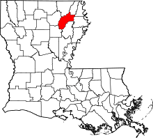 Location in the U.S. state of Louisiana | |
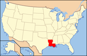 Louisiana's location in the U.S. | |
| Founded | September 29, 1868 |
| Named for | Rich fertile land |
| Seat | Rayville |
| Largest town | Rayville |
| Area | |
| • Total | 565 sq mi (1,463 km2) |
| • Land | 559 sq mi (1,448 km2) |
| • Water | 5.5 sq mi (14 km2), 1.0% |
| Population | |
| • (2010) | 20,725 |
| • Density | 37/sq mi (14/km²) |
| Congressional district | 5th |
| Time zone | Central: UTC-6/-5 |

Richland Parish (French: Paroisse de Richland) is a parish located in the U.S. state of Louisiana. As of the 2010 census, the population was 20,725.[1] The parish seat is Rayville.[2] The parish was founded in 1868.[3]
History
Richland Parish is home to the first parishwide public library in the State of Louisiana. The library was built in 1925 by the Lambda Kappa Club of Rayville. R.R. Rhymes donated the original building in memory of his wife, Nonnie Roark Rhymes. In 2008, Governor Bobby Jindal appointed Bibb Ingram, a granddaughter to Nonnie Rhymes, as a member of the Louisiana State Library Board.
Geography
According to the U.S. Census Bureau, the parish has a total area of 565 square miles (1,460 km2), of which 559 square miles (1,450 km2) is land and 5.5 square miles (14 km2) (1.0%) is water.[4]
Major highways
Adjacent parishes
- Morehouse Parish (north)
- West Carroll Parish (northeast)
- East Carroll Parish (northeast)
- Madison Parish (east)
- Franklin Parish (southeast)
- Caldwell Parish (southwest)
- Ouachita Parish (west)
Demographics
| Historical population | |||
|---|---|---|---|
| Census | Pop. | %± | |
| 1870 | 5,110 | — | |
| 1880 | 8,440 | 65.2% | |
| 1890 | 10,230 | 21.2% | |
| 1900 | 11,116 | 8.7% | |
| 1910 | 15,769 | 41.9% | |
| 1920 | 20,860 | 32.3% | |
| 1930 | 26,374 | 26.4% | |
| 1940 | 28,829 | 9.3% | |
| 1950 | 26,672 | −7.5% | |
| 1960 | 23,824 | −10.7% | |
| 1970 | 21,774 | −8.6% | |
| 1980 | 22,187 | 1.9% | |
| 1990 | 20,629 | −7.0% | |
| 2000 | 20,981 | 1.7% | |
| 2010 | 20,725 | −1.2% | |
| Est. 2015 | 20,523 | [5] | −1.0% |
| U.S. Decennial Census[6] 1790-1960[7] 1900-1990[8] 1990-2000[9] 2010-2013[1] | |||
As of the census[10] of 2000, there were 20,981 people, 7,490 households, and 5,482 families residing in the parish. The population density was 38 people per square mile (15/km²). There were 8,335 housing units at an average density of 15 per square mile (6/km²). The racial makeup of the parish was 60.96% White, 38.01% Black or African American, 0.13% Native American, 0.18% Asian, 0.20% from other races, and 0.52% from two or more races. 1.08% of the population were Hispanic or Latino of any race.
There were 7,490 households out of which 34.30% had children under the age of 18 living with them, 50.20% were married couples living together, 18.80% had a female householder with no husband present, and 26.80% were non-families. 24.00% of all households were made up of individuals and 12.40% had someone living alone who was 65 years of age or older. The average household size was 2.65 and the average family size was 3.14.
In the parish the population was spread out with 27.30% under the age of 18, 9.90% from 18 to 24, 26.80% from 25 to 44, 21.00% from 45 to 64, and 15.00% who were 65 years of age or older. The median age was 36 years. For every 100 females there were 88.70 males. For every 100 females age 18 and over, there were 84.30 males.
The median income for a household in the parish was $23,668, and the median income for a family was $29,075. Males had a median income of $28,471 versus $18,587 for females. The per capita income for the parish was $12,479. About 23.10% of families and 27.90% of the population were below the poverty line, including 39.50% of those under age 18 and 20.90% of those age 65 or over.
Education
Public schools in Richland Parish are operated by the Richland Parish School Board.
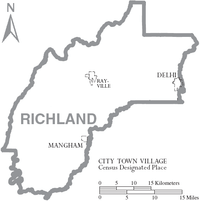
Communities
Notable people
- Jamar Adcock, a politician and banker in Monroe, born in Richland Parish
- Benny Gay Christian, state representative for Richland Parish, 1964 to 1974
- Elvin Hayes, NBA Hall of Fame basketball player, born in Rayville
- Fred W. Jones, Jr., city, district, and state court judge, born in Rayville; resided in Ruston, Louisiana
- Ralph E. King, Winnsboro physician who represented Richland Parish in the Louisiana State Senate from 1944 to 1952 and again from 1956 to 1960
- Ernie Ladd, a football player/professional wrestler, born in Rayville
- Charles McConnell, politician in Springhill, Louisiana; a native of Richland Parish
- Keith Munyan, Jr., commercial photographer in North Hollywood, California
- Tim McGraw, Country musician, born in Start
- Darryl Riser, editor of the Delhi Dispatch and Richland Beacon-News and, formerly, the Richland Journal.
- Francis C. Thompson served in the Louisiana House of Representatives from 1975 until 2008; since in the Louisiana State Senate
- Arlene Howell, Miss Louisiana USA 1958, Miss USA 1958
Gallery
 Former Rayville High School, operated by the Richland Parish School Board and originally designed by the Shreveport architect Edward F. Neild, was renovated into an apartment complex.
 Holly Ridge High School in Holly Ridge in rural Richland Parish
 Rhymes Memorial Library in Rayville is the first parishwide public library in Louisiana.
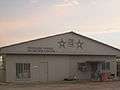 Richland Parish Detention Center near Alto, Louisiana
See also
References
- 1 2 "State & County QuickFacts". United States Census Bureau. Retrieved August 18, 2013.
- ↑ "Find a County". National Association of Counties. Archived from the original on May 31, 2011. Retrieved 2011-06-07.
- ↑ "Richland Parish". Center for Cultural and Eco-Tourism. Retrieved September 5, 2014.
- ↑ "2010 Census Gazetteer Files". United States Census Bureau. August 22, 2012. Retrieved September 1, 2014.
- ↑ "County Totals Dataset: Population, Population Change and Estimated Components of Population Change: April 1, 2010 to July 1, 2015". Retrieved July 2, 2016.
- ↑ "U.S. Decennial Census". United States Census Bureau. Archived from the original on May 11, 2015. Retrieved September 1, 2014.
- ↑ "Historical Census Browser". University of Virginia Library. Retrieved September 1, 2014.
- ↑ "Population of Counties by Decennial Census: 1900 to 1990". United States Census Bureau. Retrieved September 1, 2014.
- ↑ "Census 2000 PHC-T-4. Ranking Tables for Counties: 1990 and 2000" (PDF). United States Census Bureau. Retrieved September 1, 2014.
- ↑ "American FactFinder". United States Census Bureau. Archived from the original on September 11, 2013. Retrieved 2008-01-31.
External links
 |
Morehouse Parish | West Carroll Parish and East Carroll Parish | | |
| Ouachita Parish | |
Madison Parish | ||
| ||||
| | ||||
| Caldwell Parish | Franklin Parish |
Municipalities and communities of Richland Parish, Louisiana, United States | ||
|---|---|---|
| Towns | | |
| Village | ||
| CDP | ||
| Other unincorporated communities | ||
Coordinates: 32°25′N 91°46′W / 32.42°N 91.76°W
