Rancho de los Californios, California
| Rancho de los Californios | |
|---|---|
| Locale | |
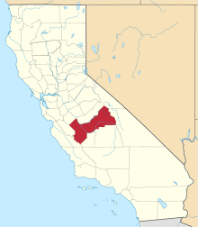
 Rancho de los Californios Location in California | |
| Coordinates: 36°47′34.98″N 120°07′57.68″W / 36.7930500°N 120.1326889°W | |
| Country | United States |
| State | California |
| County | Fresno County |
| Elevation[1] | 210 ft (60 m) |
Rancho de los Californios is a former settlement in Fresno County, California.[2] It was located east of Pueblo de las Juntas on high ground near the south bank of the San Joaquin River.[2] Its site is near the corner of Ashlan and North Lake Avenues, 4miles north of the Whitesbridge Road and 6 miles west of Biola, California.[3]
Located on the Eastern route of El Camino Viejo, the place was used as a hideout for horse thieves during Spanish and Mexican rule, and continued to be a place of relative safety for outlaws during American rule.[2]
References
- ↑ U.S. Geological Survey Geographic Names Information System: Rancho de los Californios, California
- 1 2 3 Durham, David L. (1998). California's Geographic Names: A Gazetteer of Historic and Modern Names of the State. Clovis, Calif.: Word Dancer Press. p. 1071. ISBN 1-884995-14-4.
- ↑ William N. Abeloe, Mildred Brooke Hoover, H. E. Rensch, E. G. Rensch, Historic spots in California, 3rd Edition., Stanford University Press, Stanford, 1966 William N. Abeloe, Mildred Brooke Hoover, H. E. Rensch, E. G. Rensch, Historic spots in California, 3rd Edition, Stanford University Press, Stanford, 1966; p.91
Coordinates: 36°47′35″N 120°07′58″W / 36.79305°N 120.13269°W
This article is issued from Wikipedia - version of the 3/27/2016. The text is available under the Creative Commons Attribution/Share Alike but additional terms may apply for the media files.
