Pike River, Quebec
This article is about the municipality. For the river, see Pike River (Quebec).
| Pike River | |
|---|---|
| Municipality | |
 | |
 Location within Brome-Missisquoi RCM. | |
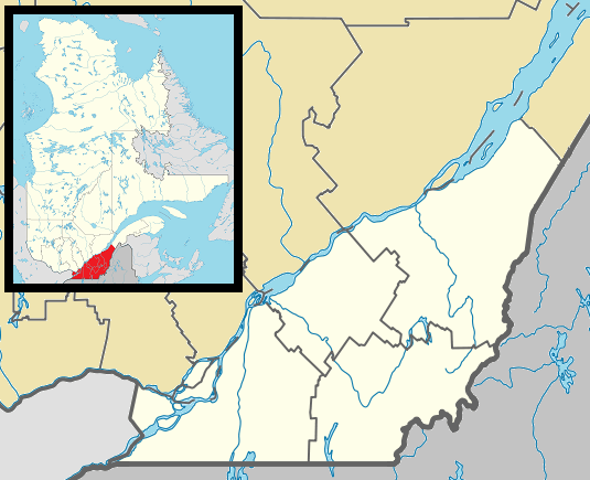 Pike River Location in southern Quebec. | |
| Coordinates: 45°07′N 73°04′W / 45.117°N 73.067°WCoordinates: 45°07′N 73°04′W / 45.117°N 73.067°W[1] | |
| Country |
|
| Province |
|
| Region | Montérégie |
| RCM | Brome-Missisquoi |
| Constituted | April 3, 1912 |
| Government[2][3] | |
| • Mayor | Martin Bellefroid |
| • Federal riding | Brome—Missisquoi |
| • Prov. riding | Brome-Missisquoi |
| Area[2][4] | |
| • Total | 41.80 km2 (16.14 sq mi) |
| • Land | 40.79 km2 (15.75 sq mi) |
| Population (2011)[4] | |
| • Total | 525 |
| • Density | 12.9/km2 (33/sq mi) |
| • Pop 2006-2011 |
|
| • Dwellings | 252 |
| Time zone | EST (UTC−5) |
| • Summer (DST) | EDT (UTC−4) |
| Postal code(s) | J0J 1P0 |
| Area code(s) | 450 and 579 |
| Highways |
|
| Website |
www |
Pike River is a municipality in Brome-Missisquoi Regional County Municipality in the Montérégie region of Quebec, Canada. The population as of the Canada 2011 Census was 525.
Until May 5, 2012 it was known as Saint-Pierre-de-Véronne-à-Pike-River.[5]
Demographics
Population
Population trend:[6]
| Census | Population | Change (%) |
|---|---|---|
| 2011 | 525 | |
| 2006 | 542 | |
| 2001 | 600 | |
| 1996 | 614 | |
| 1991 | 639 | N/A |
Language
Mother tongue language (2006)[7]
| Language | Population | Pct (%) |
|---|---|---|
| French only | 465 | 86.92% |
| English only | 35 | 6.54% |
| Both English and French | 0 | 0.00% |
| Other languages | 35 | 6.54% |
Photo Gallery
.jpg) Pike River, Montérégie gateway sign on Quebec Route 133
Pike River, Montérégie gateway sign on Quebec Route 133.jpg) St-Pierre-de-Vérone Catholic Church
St-Pierre-de-Vérone Catholic Church
See also
References
- ↑ Reference number 57523 of the Commission de toponymie du Québec (French)
- 1 2 Ministère des Affaires municipales, des Régions et de l'Occupation du territoire: Pike River
- ↑ Parliament of Canada Federal Riding History: BROME--MISSISQUOI (Quebec)
- 1 2 2011 Statistics Canada Census Profile: Saint-Pierre-de-Véronne-à-Pike-River, Quebec
- ↑ "Modifications aux municipalités du Québec" (PDF). Institut de la statistique du Québec. May 2012. ISSN 1715-6408.
- ↑ Statistics Canada: 1996, 2001, 2006, 2011 census
- ↑ 2006 Statistics Canada Community Profile: Saint-Pierre-de-Véronne-à-Pike-River, Quebec
 |
Notre-Dame-de-Stanbridge | | ||
| Saint-Sébastien Venise-en-Québec |
|
Stanbridge Station | ||
| ||||
| | ||||
| Lake Champlain | Saint-Armand |
| Cities & Towns |
|
|---|---|
| Municipalities | |
| Townships | |
| Villages | |
| |
This article is issued from Wikipedia - version of the 11/4/2015. The text is available under the Creative Commons Attribution/Share Alike but additional terms may apply for the media files.