Pennsville Township, New Jersey
| Pennsville Township, New Jersey | |
|---|---|
| Township | |
| Township of Pennsville | |
|
| |
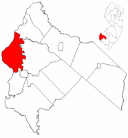 Pennsville Township highlighted in Salem County. Inset map: Salem County highlighted in the State of New Jersey. | |
 map of Pennsville Township, New Jersey | |
| Coordinates: 39°37′34″N 75°30′11″W / 39.626°N 75.503°WCoordinates: 39°37′34″N 75°30′11″W / 39.626°N 75.503°W[1][2] | |
| Country |
|
| State |
|
| County | Salem |
| Formed | July 10, 1721 as Lower Penns Neck Township |
| Incorporated | February 21, 1798 |
| Renamed | November 2, 1965 as Pennsville Township |
| Named for | William Penn |
| Government[3] | |
| • Type | Township |
| • Body | Township Committee |
| • Mayor | Richard D. Barnhart (R, term ends December 31, 2016)[4][5] |
| • Administrator | Jack Lynch[6] |
| • Clerk | Angela Foote[7] |
| Area[1] | |
| • Total | 24.588 sq mi (63.683 km2) |
| • Land | 21.277 sq mi (55.108 km2) |
| • Water | 3.311 sq mi (8.575 km2) 13.47% |
| Area rank |
110th of 566 in state 7th of 15 in county[1] |
| Elevation[8] | 16 ft (5 m) |
| Population (2010 Census)[9][10][11] | |
| • Total | 13,409 |
| • Estimate (2015)[12] | 12,827 |
| • Rank |
186th of 566 in state 1st of 15 in county[13] |
| • Density | 630.2/sq mi (243.3/km2) |
| • Density rank |
422nd of 566 in state 5th of 15 in county[13] |
| Time zone | Eastern (EST) (UTC-5) |
| • Summer (DST) | Eastern (EDT) (UTC-4) |
| ZIP code | 08070[14][15] |
| Area code(s) | 856[16] |
| FIPS code | 3403357870[1][17][18] |
| GNIS feature ID | 0882134[19] |
| Website |
www |

Pennsville Township is a township in Salem County, in the U.S. state of New Jersey. As of the 2010 United States Census, the township's population was 13,409,[9][10][11] reflecting an increase of 215 (+1.6%) from the 13,194 counted in the 2000 Census, which had in turn declined by 600 (-4.3%) from the 13,794 counted in the 1990 Census.[20] The township is named for William Penn.[21] The township includes the state's westernmost point.[22]
Lower Penns Neck Township was formed on July 10, 1721, when Penn's Neck Township was subdivided and Upper Penns Neck Township (now Carneys Point Township) was also formed. The township was incorporated by an act of the New Jersey Legislature on February 21, 1798, as one of New Jersey's original group of 104 townships. The township was renamed Pennsville Township based on the results of a referendum held on November 2, 1965.[23]
Geography
According to the United States Census Bureau, the township had a total area of 24.588 square miles (63.683 km2), including 21.277 square miles (55.108 km2) of land and 3.311 square miles (8.575 km2) of water (13.47%).[1][2]
Pennsville CDP (with a 2010 Census population of 11,888[24]) is a unincorporated community and census-designated place (CDP) area located within Pennsville Township.[25][26][27]
Other unincorporated communities, localities and place names located partially or completely within the township include Cedar Point, Church Landing, Churchtown, Cobbs Island, Deepwater, Deepwater Point, Finns Point, Fort Mott, Goose Island Flats, Harrisonville, Kellys Point, Marsh Point, Penn Brick Beach, Salem Cove and Travis Cove.[28]
The Salem River flows along the township's eastern and southern boundaries.[29]
The township borders the Salem County municipalities of Carneys Point Township, Elsinboro Township, Mannington Township and Salem. Pennsville Township also borders a section of New Castle County, Delaware, which is one of only two points of land east of the Delaware River that are within the state of Delaware, the other being on Artificial Island in Lower Alloways Creek Township.[30]
Demographics
| Historical population | |||
|---|---|---|---|
| Census | Pop. | %± | |
| 1810 | 1,163 | — | |
| 1820 | 1,158 | −0.4% | |
| 1830 | 993 | −14.2% | |
| 1840 | 1,219 | 22.8% | |
| 1850 | 1,429 | 17.2% | |
| 1860 | 1,506 | 5.4% | |
| 1870 | 1,472 | −2.3% | |
| 1880 | 1,334 | −9.4% | |
| 1890 | 1,280 | −4.0% | |
| 1900 | 1,424 | 11.3% | |
| 1910 | 1,544 | 8.4% | |
| 1920 | 2,149 | 39.2% | |
| 1930 | 2,933 | 36.5% | |
| 1940 | 5,113 | 74.3% | |
| 1950 | 7,376 | 44.3% | |
| 1960 | 10,417 | 41.2% | |
| 1970 | 13,296 | 27.6% | |
| 1980 | 13,848 | 4.2% | |
| 1990 | 13,794 | −0.4% | |
| 2000 | 13,194 | −4.3% | |
| 2010 | 13,409 | 1.6% | |
| Est. 2015 | 12,827 | [12][31] | −4.3% |
| Population sources: 1810-2000[32] 1810-1920[33] 1840[34] 1850-1870[35] 1850[36] 1870[37] 1880-1890[38] 1890-1910[39] 1910-1930[40] 1930-1990[41] 2000[42][43] 2010[9][10][11] | |||
Census 2010
The 2010 United States Census counted 13,409 people, 5,491 households, and 3,706 families residing in the township. The population density was 630.2 per square mile (243.3/km2). The township contained 5,914 housing units at an average density of 278.0 per square mile (107.3/km2). The racial makeup of the township was 94.68% (12,696) White, 1.54% (206) Black or African American, 0.23% (31) Native American, 1.42% (190) Asian, 0.01% (2) Pacific Islander, 0.92% (124) from other races, and 1.19% (160) from two or more races. Hispanics or Latinos of any race were 3.07% (411) of the population.[9]
Out of a total of 5,491 households, 27.4% had children under the age of 18 living with them, 50.6% were married couples living together, 11.9% had a female householder with no husband present, and 32.5% were non-families. 27.3% of all households were made up of individuals, and 11.6% had someone living alone who was 65 years of age or older. The average household size was 2.44 and the average family size was 2.97.[9]
In the township, 21.9% of the population were under the age of 18, 7.9% from 18 to 24, 25.0% from 25 to 44, 29.6% from 45 to 64, and 15.6% who were 65 years of age or older. The median age was 41.8 years. For every 100 females the census counted 95.1 males, but for 100 females at least 18 years old, it was 92.1 males.[9]
The Census Bureau's 2006-2010 American Community Survey showed that (in 2010 inflation-adjusted dollars) median household income was $58,153 (with a margin of error of +/- $4,425) and the median family income was $71,327 (+/- $6,934). Males had a median income of $53,166 (+/- $4,370) versus $42,054 (+/- $3,006) for females. The per capita income for the borough was $29,275 (+/- $1,740). About 7.0% of families and 9.8% of the population were below the poverty line, including 13.4% of those under age 18 and 5.9% of those age 65 or over.[44]
Census 2000
As of the 2000 United States Census[17] there were 13,194 people, 5,317 households, and 3,711 families residing in the township. The population density was 571.1 people per square mile (220.5/km2). There were 5,623 housing units at an average density of 243.4 per square mile (94.0/km2). The racial makeup of the township was 96.68% White, 0.96% African American, 0.16% Native American, 0.96% Asian, 0.02% Pacific Islander, 0.39% from other races, and 0.83% from two or more races. Hispanic or Latino of any race were 1.60% of the population.[42][43]
There were 5,317 households out of which 29.7% had children under the age of 18 living with them, 55.3% were married couples living together, 10.2% had a female householder with no husband present, and 30.2% were non-families. 26.0% of all households were made up of individuals and 11.6% had someone living alone who was 65 years of age or older. The average household size was 2.47 and the average family size was 2.98.[42][43]
In the township the population was spread out with 23.2% under the age of 18, 7.7% from 18 to 24, 28.2% from 25 to 44, 25.4% from 45 to 64, and 15.5% who were 65 years of age or older. The median age was 39 years. For every 100 females there were 92.4 males. For every 100 females age 18 and over there were 90.1 males.[42][43]
The median income for a household in the township was $47,250, and the median income for a family was $57,340. Males had a median income of $45,523 versus $29,629 for females. The per capita income for the township was $22,717. About 3.1% of families and 4.9% of the population were below the poverty line, including 5.2% of those under age 18 and 5.1% of those age 65 or over.[42][43]
Government
Local government
Pennsville Township is governed under the Township form of government. The five-member Township Committee is elected directly by the voters at-large in partisan elections to serve three-year terms of office on a staggered basis, with either one or two seats coming up for election each year as part of the November general election in a three-year cycle.[3][45] At an annual reorganization meeting, the Township Committee selects one of its members to serve as Mayor and another as Deputy Mayor.
As of 2016, the members of the Pennsville Township committee are Mayor Richard D. Barnhart (R, term on township committee and as mayor ends December 31, 2016), Deputy Mayor Robert McDade (R, term on committee ends 2017; term as deputy mayor ends 2016), Marc Chastain (R, 2017), John J. Crawford (D, 2016) and Richie G. Raine (D, 2018).[4][46][47][48][49][50][51]
Federal, state and county representation
Pennsville Township is located in the 2nd Congressional District[52] and is part of New Jersey's 3rd state legislative district.[10][53][54]
New Jersey's Second Congressional District is represented by Frank LoBiondo (R, Ventnor City).[55] New Jersey is represented in the United States Senate by Cory Booker (D, Newark, term ends 2021)[56] and Bob Menendez (D, Paramus, 2019).[57][58]
For the 2016–2017 session (Senate, General Assembly), the 3rd Legislative District of the New Jersey Legislature is represented in the State Senate by Stephen M. Sweeney (D, West Deptford Township) and in the General Assembly by John J. Burzichelli (D, Paulsboro) and Adam Taliaferro (D, Woolwich Township).[59] The Governor of New Jersey is Chris Christie (R, Mendham Township).[60] The Lieutenant Governor of New Jersey is Kim Guadagno (R, Monmouth Beach).[61]
Salem County is governed by a seven-member Board of Chosen Freeholders who are elected at-large to serve three-year terms of office on a staggered basis, with either two or three seats coming up for election each year. At an annual reorganization meeting held in the beginning of January, the board selects a Director and a Deputy Director from among its members. As of 2014, Salem County's Freeholders (with party, residence, term-end year and committee chairmanship listed in parentheses) are Director Julie A. Acton (R, Pennsville Township, 2016; Administration), Deputy Director Dale A. Cross (R, Pennsville Township, 2014; Public Safety), Bruce L. Bobbitt (D, Pilesgrove Township, 2014; Public Services), Ben Laury (R, Elmer, 2015; Public Works) Beth E. Timberman (D, Woodstown, 2015; Social Services), Robert J. Vanderslice (R, Pennsville Township, 2014; Health and Human Services) Lee R. Ware (D, Elsinboro Township, 2016; Transportation, Agriculture and Cultural Affairs).[62][63] Constitutional officers elected on a countywide basis are County Clerk Gilda T. Gill (2014),[64] Sheriff Charles M. Miller (2015)[65] and Surrogate Nicki A. Burke (2015).[66][67]
Politics
As of March 23, 2011, there were a total of 9,062 registered voters in Pennsville Township, of which 2,572 (28.4% vs. 30.6% countywide) were registered as Democrats, 1,797 (19.8% vs. 21.0%) were registered as Republicans and 4,686 (51.7% vs. 48.4%) were registered as Unaffiliated. There were 7 voters registered to other parties.[68] Among the township's 2010 Census population, 67.6% (vs. 64.6% in Salem County) were registered to vote, including 86.5% of those ages 18 and over (vs. 84.4% countywide).[68][69]
In the 2012 presidential election, Republican Mitt Romney received 53.4% of the vote (3,175 cast), ahead of Democrat Barack Obama with 44.6% (2,651 votes), and other candidates with 2.0% (116 votes), among the 5,999 ballots cast by the township's 9,285 registered voters (57 ballots were spoiled), for a turnout of 64.6%.[70][71] In the 2008 presidential election, Republican John McCain received 3,204 votes (48.7% vs. 46.6% countywide), ahead of Democrat Barack Obama with 3,129 votes (47.6% vs. 50.4%) and other candidates with 153 votes (2.3% vs. 1.6%), among the 6,576 ballots cast by the township's 9,291 registered voters, for a turnout of 70.8% (vs. 71.8% in Salem County).[72] In the 2004 presidential election, Republican George W. Bush received 3,547 votes (54.3% vs. 52.5% countywide), ahead of Democrat John Kerry with 2,859 votes (43.8% vs. 45.9%) and other candidates with 81 votes (1.2% vs. 1.0%), among the 6,528 ballots cast by the township's 9,041 registered voters, for a turnout of 72.2% (vs. 71.0% in the whole county).[73]
In the 2013 gubernatorial election, Republican Chris Christie received 72.2% of the vote (2,848 cast), ahead of Democrat Barbara Buono with 25.5% (1,007 votes), and other candidates with 2.3% (89 votes), among the 3,979 ballots cast by the township's 9,134 registered voters (35 ballots were spoiled), for a turnout of 43.6%.[74][75] In the 2009 gubernatorial election, Republican Chris Christie received 1,959 votes (46.9% vs. 46.1% countywide), ahead of Democrat Jon Corzine with 1,688 votes (40.4% vs. 39.9%), Independent Chris Daggett with 424 votes (10.1% vs. 9.7%) and other candidates with 75 votes (1.8% vs. 2.0%), among the 4,181 ballots cast by the township's 9,259 registered voters, yielding a 45.2% turnout (vs. 47.3% in the county).[76]
Education
Students in public school for pre-Kindergarten through twelfth grade attend the Pennsville School District. As of the 2012-13 school year, the district's five schools had an enrollment of 1,830 students and 165.6 classroom teachers (on an FTE basis), for a student–teacher ratio of 11.05:1.[77] Schools in the district (with 2012-13 enrollment data from the National Center for Education Statistics[78]) are Valley Park Elementary School[79] with 296 students in grades preK-1, Central Park Elementary School[80] with 305 students in grades 2-3, Penn Beach Elementary School[81] with 276 students in grades 4-5, Pennsville Middle School[82] with 467 students in grades 6 - 8 and Pennsville Memorial High School[83] with 486 students in grades 9 - 12.[84][85]
Transportation
Roads and highways
As of May 2010, the township had a total of 90.71 miles (145.98 km) of roadways, of which 73.02 miles (117.51 km) were maintained by the municipality, 7.33 miles (11.80 km) by Salem County, 8.99 miles (14.47 km) by the New Jersey Department of Transportation and 1.37 miles (2.20 km) by the Delaware River and Bay Authority or the New Jersey Turnpike Authority.[86]
Pennsville houses county, state, U.S., Interstates and toll expressways which all converge at the northern part of the township near the hamlet of Deepwater.[87] The southern terminus of U.S. Route 130 is in the township.[88] Route 49 begins at the converging point and travels south for about 8.2 miles (13.2 km) through the center of town.[89] Interstate 295 and U.S. Route 40 (multiplexed together) also pass through the north which houses Exit 1 along I-295 and which is also the Delaware Memorial Bridge that connects to the state of Delaware.[90] In addition, the New Jersey Turnpike begins where Routes 49, 40, 130 and 295 all intersect with one another, with the creation of a roadway from Pennsville to Woodbridge Township being the initial goal when the New Jersey Turnpike Authority was created in 1948.[91] Despite the Turnpike's southern end being in the township,[92] Exit 1 is officially located in neighboring Carneys Point Township.[93] The only major county road that travels through is County Road 551.[94]
Public transportation
NJ Transit offers bus service to and from Philadelphia on the 402 route, and local service on the 468 routes.[95]
Notable people
People who were born in, residents of, or otherwise closely associated with Pennsville Township include:
- Paul Anthony Ciancia (born c. 1990), suspected shooter in the 2013 Los Angeles International Airport shooting.[96]
- Gene Foster (born 1942), professional football linebacker who played for the San Diego Chargers from 1965 to 1970.[97]
- Daniel Garrison (1782-1851), member of the United States House of Representatives from New Jersey from 1823 to 1827.[98]
- Van Homan (born 1980) profession BMX rider.[99]
- Thomas A. Pankok (born 1931), politician who served in the New Jersey General Assembly from 1982 to 1986, where he represented the 3rd Legislative District.[100]
- Dave Romansky (born 1938), Olympic race walker.[101]
- Ritch Shydner (born 1951), writer, producer and actor.[102]
- Chris Widger (born 1971), Major League Baseball catcher and World Series Champion.[103]
- Mike Widger (born 1948), linebacker who played in the Canadian Football League for the Montreal Alouettes and Ottawa Rough Riders.[104]
- Norm Willey (1927–2011), defensive lineman who played in the National Football League for the Philadelphia Eagles and then taught and coached football at Pennsville Memorial High School after retiring.[105]
References
- 1 2 3 4 5 2010 Census Gazetteer Files: New Jersey County Subdivisions, United States Census Bureau. Accessed May 21, 2015.
- 1 2 US Gazetteer files: 2010, 2000, and 1990, United States Census Bureau. Accessed September 4, 2014.
- 1 2 2012 New Jersey Legislative District Data Book, Rutgers University Edward J. Bloustein School of Planning and Public Policy, April 2006, p. 19.
- 1 2 Township Committee, Township of Pennsville. Accessed July 30, 2016.
- ↑ 2016 New Jersey Mayors Directory, New Jersey Department of Community Affairs. Accessed June 14, 2016.
- ↑ Township Administrator, Township of Pennsville. Accessed July 30, 2016.
- ↑ Office of Clerk, Township of Pennsville. Accessed July 30, 2016.
- ↑ U.S. Geological Survey Geographic Names Information System: Township of Pennsville, Geographic Names Information System. Accessed March 11, 2013.
- 1 2 3 4 5 6 DP-1 - Profile of General Population and Housing Characteristics: 2010 for Pennsville township, Salem County, New Jersey, United States Census Bureau. Accessed January 17, 2013.
- 1 2 3 4 Municipalities Grouped by 2011-2020 Legislative Districts, New Jersey Department of State, p. 2. Accessed January 6, 2013.
- 1 2 3 Profile of General Demographic Characteristics: 2010 for Pennsville township, New Jersey Department of Labor and Workforce Development. Accessed January 17, 2013.
- 1 2 PEPANNRES - Annual Estimates of the Resident Population: April 1, 2010 to July 1, 2015 - 2015 Population Estimates for New Jersey municipalities, United States Census Bureau. Accessed May 22, 2016.
- 1 2 GCT-PH1 Population, Housing Units, Area, and Density: 2010 - State -- County Subdivision from the 2010 Census Summary File 1 for New Jersey, United States Census Bureau. Accessed January 17, 2013.
- ↑ Look Up a ZIP Code for Pennsville, NJ, United States Postal Service. Accessed January 17, 2013.
- ↑ Zip Codes, State of New Jersey. Accessed October 31, 2013.
- ↑ Area Code Lookup - NPA NXX for Pennsville, NJ, Area-Codes.com. Accessed October 31, 2013.
- 1 2 American FactFinder, United States Census Bureau. Accessed September 4, 2014.
- ↑ A Cure for the Common Codes: New Jersey, Missouri Census Data Center. Accessed October 29, 2012.
- ↑ US Board on Geographic Names, United States Geological Survey. Accessed September 4, 2014.
- ↑ Table 7. Population for the Counties and Municipalities in New Jersey: 1990, 2000 and 2010, New Jersey Department of Labor and Workforce Development, February 2011. Accessed January 17, 2013.
- ↑ Welcome to the Township Website!, Pennsville Township. Accessed May 30, 2007.
- ↑ Nova Cæsarea: A Cartographic Record of the Garden State 1666-1888 - Salem County, Princeton University. Accessed September 17, 2015. "2013: The westernmost point of Pennsville Township, which is also the westernmost point of New Jersey."
- ↑ Snyder, John P. The Story of New Jersey's Civil Boundaries: 1606-1968, Bureau of Geology and Topography; Trenton, New Jersey; 1969. p. 216. Accessed October 23, 2012.
- ↑ DP-1 - Profile of General Population and Housing Characteristics: 2010 Demographic Profile Data for Pennsville CDP, New Jersey, United States Census Bureau. Accessed January 17, 2013.
- ↑ GCT-PH1 - Population, Housing Units, Area, and Density: 2010 - County -- County Subdivision and Place from the 2010 Census Summary File 1 for Salem County, New Jersey, United States Census Bureau. Accessed January 17, 2013.
- ↑ 2006-2010 American Community Survey Geography for New Jersey, United States Census Bureau. Accessed January 17, 2013.
- ↑ New Jersey: 2010 - Population and Housing Unit Counts - 2010 Census of Population and Housing (CPH-2-32), United States Census Bureau, August 2012. Accessed January 17, 2013.
- ↑ Locality Search, State of New Jersey. Accessed May 21, 2015.
- ↑ DeLorme (2005). New Jersey Atlas & Gazetteer. Yarmouth, Maine: DeLorme. ISBN 0-89933-324-9.
- ↑ Schoonejongen, John. "How Delaware got on Jersey's side of the river", Asbury Park Press, September 10, 2010. Accessed September 17, 2015. "Over the years, dumping grounds for dredge spoils have actually expanded the land mass in New Jersey, but the old border holds fast, meaning that in areas of Salem County, for example, someone can walk from New Jersey to Delaware without getting his or her feet wet. A part of Lower Alloways Creek's Artificial Island, upon which three nuclear generators sit, is one of those areas. Killcohook, in Pennsville Township, is another."
- ↑ Census Estimates for New Jersey April 1, 2010 to July 1, 2015, United States Census Bureau. Accessed May 22, 2016.
- ↑ Barnett, Bob. Population Data for Salem County Municipalities, 1810 - 2000, WestJersey.org, January 6, 2011. Accessed January 17, 2013.
- ↑ Compendium of censuses 1726-1905: together with the tabulated returns of 1905, New Jersey Department of State, 1906. Accessed October 31, 2013.
- ↑ Bowen, Francis. American Almanac and Repository of Useful Knowledge for the Year 1843, p. 232, David H. Williams, 1842. Accessed October 31, 2013.
- ↑ Raum, John O. The History of New Jersey: From Its Earliest Settlement to the Present Time, Volume 1, p. 254, J. E. Potter and company, 1877. Accessed January 17, 2013. "Lower Penn's Neck in 1850 contained 1,429 inhabitants; in 1860, 1,506; and in 1870, 1,472."
- ↑ Debow, James Dunwoody Brownson. The Seventh Census of the United States: 1850, p. 140. R. Armstrong, 1853. Accessed January 17, 2013.
- ↑ Staff. A compendium of the ninth census, 1870, p. 260. United States Census Bureau, 1872. Accessed January 17, 2013.
- ↑ Porter, Robert Percival. Preliminary Results as Contained in the Eleventh Census Bulletins: Volume III - 51 to 75, p. 99. United States Census Bureau, 1890. Accessed January 17, 2013.
- ↑ Thirteenth Census of the United States, 1910: Population by Counties and Minor Civil Divisions, 1910, 1900, 1890, United States Census Bureau, p. 338. Accessed January 17, 2013.
- ↑ Fifteenth Census of the United States : 1930 - Population Volume I, United States Census Bureau, p. 718. Accessed January 17, 2013.
- ↑ Table 6. New Jersey Resident Population by Municipality: 1930 - 1990, New Jersey Department of Labor and Workforce Development. Accessed June 28, 2015.
- 1 2 3 4 5 Census 2000 Profiles of Demographic / Social / Economic / Housing Characteristics for Pennsville township, New Jersey, United States Census Bureau. Accessed October 31, 2016.
- 1 2 3 4 5 DP-1: Profile of General Demographic Characteristics: 2000 - Census 2000 Summary File 1 (SF 1) 100-Percent Data for Pennsville township, Salem County, New Jersey, United States Census Bureau. Accessed January 17, 2013.
- ↑ DP03: Selected Economic Characteristics from the 2006-2010 American Community Survey 5-Year Estimates for Pennsville township, Salem County, New Jersey, United States Census Bureau. Accessed January 17, 2013.
- ↑ "Forms of Municipal Government in New Jersey", p. 7. Rutgers University Center for Government Studies. Accessed June 3, 2015.
- ↑ 2016 Municipal User Friendly Budget for Pennsville Township, New Jersey Department of Community Affairs. Accessed July 30, 2016.
- ↑ The Official Salem County Directory, Salem County, New Jersey, February 4, 2016. Accessed July 29, 2016.
- ↑ Municipalities in Salem County, Salem County, New Jersey Clerk. Accessed July 29, 2016.
- ↑ November 3, 2015 Summary Report Salem County Official Results, Salem County, New Jersey Clerk, updated January 13, 2016. Accessed July 29, 2016.
- ↑ November 4, 2014 Summary Report Salem County Official Results, Salem County, New Jersey Clerk, updated November 24, 2014. Accessed July 29, 2016.
- ↑ November 5, 2013 Summary Report Salem County Unofficial Results, Salem County, New Jersey, updated November 5, 2013. Accessed July 29, 2016.
- ↑ Plan Components Report, New Jersey Redistricting Commission, December 23, 2011. Accessed January 6, 2013.
- ↑ 2016 New Jersey Citizen's Guide to Government, p. 62, New Jersey League of Women Voters. Accessed July 20, 2016.
- ↑ Districts by Number for 2011-2020, New Jersey Legislature. Accessed January 6, 2013.
- ↑ Directory of Representatives: New Jersey, United States House of Representatives. Accessed January 5, 2012.
- ↑ About Cory Booker, United States Senate. Accessed January 26, 2015. "He now owns a home and lives in Newark's Central Ward community."
- ↑ Biography of Bob Menendez, United States Senate, January 26, 2015. "He currently lives in Paramus and has two children, Alicia and Robert."
- ↑ Senators of the 114th Congress from New Jersey. United States Senate. Accessed January 26, 2015. "Booker, Cory A. - (D - NJ) Class II; Menendez, Robert - (D - NJ) Class I"
- ↑ Legislative Roster 2016-2017 Session, New Jersey Legislature. Accessed January 17, 2016.
- ↑ "About the Governor". State of New Jersey. Retrieved 2010-01-21.
- ↑ "About the Lieutenant Governor". State of New Jersey. Retrieved 2010-01-21.
- ↑ Board of Chosen Freeholders, Salem County, New Jersey. Accessed July 27, 2014.
- ↑ 2014 County Data Sheet, Salem County, New Jersey. Accessed July 27, 2014.
- ↑ County Clerk, Salem County Clerk's Office . Accessed July 27, 2014.
- ↑ Sheriff's Office, Salem County, New Jersey. Accessed July 27, 2014.
- ↑ Surrogate's Court, Salem County, New Jersey. Accessed July 27, 2014.
- ↑ The Official 2013 Salem County Directory, Salem County, New Jersey. Accessed July 27, 2014.
- 1 2 Voter Registration Summary - Salem, New Jersey Department of State Division of Elections, March 23, 2011. Accessed January 17, 2013.
- ↑ GCT-P7: Selected Age Groups: 2010 - State -- County Subdivision; 2010 Census Summary File 1 for New Jersey, United States Census Bureau. Accessed January 17, 2013.
- ↑ "Presidential General Election Results - November 6, 2012 - Salem County" (PDF). New Jersey Department of Elections. March 15, 2013. Retrieved December 24, 2014.
- ↑ "Number of Registered Voters and Ballots Cast - November 6, 2012 - General Election Results - Salem County" (PDF). New Jersey Department of Elections. March 15, 2013. Retrieved December 24, 2014.
- ↑ 2008 Presidential General Election Results: Salem County, New Jersey Department of State Division of Elections, December 23, 2008. Accessed January 17, 2013.
- ↑ 2004 Presidential Election: Salem County, New Jersey Department of State Division of Elections, December 13, 2004. Accessed January 17, 2013.
- ↑ "Governor - Salem County" (PDF). New Jersey Department of Elections. January 29, 2014. Retrieved December 24, 2014.
- ↑ "Number of Registered Voters and Ballots Cast - November 5, 2013 - General Election Results - Salem County" (PDF). New Jersey Department of Elections. January 29, 2014. Retrieved December 24, 2014.
- ↑ 2009 Governor: Salem County, New Jersey Department of State Division of Elections, December 31, 2009. Accessed January 17, 2013.
- ↑ District information for Pennsville Township School District, National Center for Education Statistics. Accessed March 5, 2015.
- ↑ Statistical data for the Pennsville School District, National Center for Education Statistics. Accessed March 5, 2015.
- ↑ Valley Park Elementary School, Pennsville School District. Accessed March 5, 2015.
- ↑ Central Park Elementary School, Pennsville School District. Accessed March 5, 2015.
- ↑ Penn Beach Elementary School, Pennsville School District. Accessed March 5, 2015.
- ↑ Pennsville Middle School, Pennsville School District. Accessed March 5, 2015.
- ↑ Pennsville Memorial High School, Pennsville School District. Accessed March 5, 2015.
- ↑ Schools, Pennsville School District. Accessed March 5, 2015.
- ↑ New Jersey School Directory for the Pennsville School District, New Jersey Department of Education. Accessed March 5, 2015.
- ↑ Salem County Mileage by Municipality and Jurisdiction, New Jersey Department of Transportation, May 2010. Accessed October 31, 2013.
- ↑ ENLARGED VIEW 26 (Carneys Point Township, Pennsville Township and Mannington Township, Salem County), New Jersey Department of Transportation, June 2009. Accessed October 31, 2013.
- ↑ U.S. Route 130 Straight Line Diagram, New Jersey Department of Transportation, February 2006. Accessed October 31, 2013.
- ↑ Route 49 Straight Line Diagram, New Jersey Department of Transportation, January 2009. Accessed October 31, 2013.
- ↑ U.S. Interstate 295 Straight Line Diagram, New Jersey Department of Transportation, February 2008. Accessed October 31, 2013.
- ↑ Staff. "Turnpike Authority is Created in New Jersey", The New York Times, October 28, 1948. Accessed October 31, 2013. "A New Jersey turnpike authority was created today with Gov. Alfred E. Driscoll designating as its first project an express toll road from Pennsville on the Delaware River to a junction with main routes at Woodbridge, near Elizabeth."
- ↑ U.S. New Jersey Turnpike Straight Line Diagram, New Jersey Department of Transportation, January 1997. Accessed October 31, 2013.
- ↑ NJ Turnpike Interchange No.1 Construction Management and Inspection, TRC. Accessed October 31, 2013.
- ↑ County Route 551 Straight Line Diagram, New Jersey Department of Transportation, August 2006. Accessed October 31, 2013.
- ↑ Salem County Bus / Rail Connections, NJ Transit, backed up by the Internet Archive as of January 28, 2010. Accessed January 16, 2013.
- ↑ "LAX Shooter Paul Anthony Ciancia's Personal Details Emerge". Mediaite. Retrieved November 1, 2013.
- ↑ Narducci, Marc. "Pennsville Bringing Back Some Football Memories The School Also Is Bringing Back Lou D'angelo And Naming The Stadium After The Former Coach.", The Philadelphia Inquirer, November 24, 1994. Accessed October 20, 2014. "During that span, Pennsville won three overall Tri-County Conference championships and was named Group 2 champion twice, in 1965 and 1974. He had two undefeated teams - 1960, led by future NFL running back Gene Foster, and 1974."
- ↑ GARRISON, Daniel, Biographical Directory of the United States Congress. Accessed October 31, 2013. "born in Lower Penns Neck Township, near Salem, N.J., April 3, 1782"
- ↑ Van Homan. GrindTV.com. Accessed June 17, 2010.
- ↑ Candidates for the Offices of State Senate and General Assembly 1983, New Jersey Department of State Division of Elections. Accessed August 25, 2016.
- ↑ Gross, Jane. "Blue-collar Walker", Sports Illustrated, November 23, 1970. Accessed December 16, 2008.
- ↑ Staff. "Comedian Ritch Shydner, a Pennsville native, returning home for New Year's Eve performance", Today's Sunbeam, December 19, 2010. Accessed May 12, 2011. "Though Shydner currently resides in Los Angeles, he was born and raised in Pennsville and says the town is still special to him."
- ↑ Minnick, Kevin. "A story straight out of Hollywood: S.J. Sports Figure of the Year", Courier-Post, December 30, 2005. Accessed August 18, 2007. "Chicago White Sox catcher Chris Widger remains true to his Pennsville roots.... And now, after proving not only to himself but the Chicago White Sox organization that he could still play the game he loves, the Pennsville High School graduate can take a look at his professional resume and see World Series champion at the top."
- ↑ Burke, Tim. "In the Widgers' household, it's like mother, like son", The Montreal Gazette, August 9, 1974. Accessed October 31, 2013. "Third-born son Mike Widger took the bait and through those fog-bound specs of his, there was a momentary glint... 'Sis' Widger (née Sullivan) was up in Montreal on one of her two or three excursions from Pennsville, New Jersey, 35 miles on the other side of the Delaware River from Philadelphia, to see how the big lad was doing in his current role of Allouette linebacker."
- ↑ Pawling, Chris. "Norm Willey passes with great reputation left behind", South Jersey Times, August 20, 2011. Accessed November 4, 2013. "Pennsville legend and former Philadelphia Eagles Pro-Bowler Norm Willey passed away earlier this week — just a few days before his 84th birthday — but leaves behind a reputation that will live on for many more years. Willey had the annual Thanksgiving Day trophy — the Norm Willey Boot, which is given to the winner of the Pennsville-Penns Grove football game — named after him."
External links
| Wikimedia Commons has media related to Pennsville Township, New Jersey. |
- Pennsville Township website
- Pennsville page on Salem County website
- Pennsville School District
- Pennsville School District's 2014–15 School Report Card from the New Jersey Department of Education
- School Data for the Pennsville School District, National Center for Education Statistics
| Wikivoyage has a travel guide for Pennsville. |

