Pearsonville, California
| Pearsonville | |
|---|---|
| Census-designated place | |
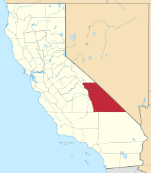
 Location in Inyo County and the state of California | |
 Pearsonville Location in the United States | |
| Coordinates: 35°48′35″N 117°52′23″W / 35.80972°N 117.87306°WCoordinates: 35°48′35″N 117°52′23″W / 35.80972°N 117.87306°W | |
| Country |
|
| State |
|
| County | Inyo |
| Area[1] | |
| • Total | 4.222 sq mi (10.935 km2) |
| • Land | 4.141 sq mi (10.724 km2) |
| • Water | 0.081 sq mi (0.211 km2) 1.93% |
| Elevation | 2,513 ft (766 m) |
| Population (2010) | |
| • Total | 17 |
| • Density | 4.0/sq mi (1.6/km2) |
| Time zone | Pacific (PST) (UTC-8) |
| • Summer (DST) | PDT (UTC-7) |
| ZIP code | 93527 |
| Area codes | 442/760 |
| FIPS code | 06-56294 |
| GNIS feature ID | 1666984 |
Pearsonville is a census-designated place (CDP) in Inyo County, California, United States. The population was 17 at the 2010 census, down from 27 at the 2000 census. Pearsonville has been dubbed the "Hubcap Capital of the World" because of resident Lucy Pearson's collection of hubcaps, which are rumored to number over 80,000.
Geography
According to the United States Census Bureau, the CDP has a total area of 4.2 square miles (11 km2), over 98% of which is land and 1.93% is water.
Demographics
2010
The 2010 United States Census[2] reported that Pearsonville had a population of 17. The population density was 4.0 people per square mile (1.6/km²). The racial makeup of Pearsonville was 16 (94.1%) White, 0 (0.0%) African American, 0 (0.0%) Native American, 0 (0.0%) Asian, 0 (0.0%) Pacific Islander, 1 (5.9%) from other races, and 0 (0.0%) from two or more races. Hispanic or Latino of any race were 1 persons (5.9%).
The Census reported that 17 people (100% of the population) lived in households, 0 (0%) lived in non-institutionalized group quarters, and 0 (0%) were institutionalized.
There were 9 households, out of which 0 (0%) had children under the age of 18 living in them, 3 (33.3%) were opposite-sex married couples living together, 1 (11.1%) had a female householder with no husband present, 1 (11.1%) had a male householder with no wife present. There were 0 (0%) unmarried opposite-sex partnerships, and 0 (0%) same-sex married couples or partnerships. 4 households (44.4%) were made up of individuals and 2 (22.2%) had someone living alone who was 65 years of age or older. The average household size was 1.89. There were 5 families (55.6% of all households); the average family size was 2.40.
The population was spread out with 0 people (0%) under the age of 18, 2 people (11.8%) aged 18 to 24, 1 people (5.9%) aged 25 to 44, 8 people (47.1%) aged 45 to 64, and 6 people (35.3%) who were 65 years of age or older. The median age was 59.8 years. For every 100 females there were 70.0 males. For every 100 females age 18 and over, there were 70.0 males.
There were 16 housing units at an average density of 3.8 per square mile (1.5/km²), of which 7 (77.8%) were owner-occupied, and 2 (22.2%) were occupied by renters. The homeowner vacancy rate was 12.5%; the rental vacancy rate was 0%. 15 people (88.2% of the population) lived in owner-occupied housing units and 2 people (11.8%) lived in rental housing units.
2000
As of the census[3] of 2000, there were 27 people, 12 households, and 8 families residing in the CDP. The population density was 6.4 people per square mile (2.5/km²). There were 22 housing units at an average density of 5.2 per square mile (2.0/km²). The racial makeup of the CDP was 88.89% White, 7.41% from other races, and 3.70% from two or more races. Hispanic or Latino of any race were 14.81% of the population.
There were 12 households out of which 25.0% had children under the age of 18 living with them, 58.3% were married couples living together, 8.3% had a female householder with no husband present, and 33.3% were non-families. 33.3% of all households were made up of individuals and 25.0% had someone living alone who was 65 years of age or older. The average household size was 2.25 and the average family size was 2.88.
In the CDP the population was spread out with 25.9% under the age of 18, 22.2% from 25 to 44, 40.7% from 45 to 64, and 11.1% who were 65 years of age or older. The median age was 46 years. For every 100 females there were 125.0 males. For every 100 females age 18 and over, there were 81.8 males.
Politics
In the state legislature, Pearsonville is in the 8th Senate District, represented by Republican Tom Berryhill,[4] and the 26th Assembly District, represented by Republican Devon Mathis.[5]
Federally, Pearsonville is in California's 8th congressional district, represented by Republican Paul Cook.[6]
References
- ↑ "2010 Census U.S. Gazetteer Files – Places – California". United States Census Bureau.
- ↑ "2010 Census Interactive Population Search: CA - Pearsonville CDP". U.S. Census Bureau. Retrieved July 12, 2014.
- ↑ "American FactFinder". United States Census Bureau. Retrieved 2008-01-31.
- ↑ "Senators". State of California. Retrieved April 11, 2013.
- ↑ "Members Assembly". State of California. Retrieved April 11, 2013.
- ↑ "California's 8th Congressional District - Representatives & District Map". Civic Impulse, LLC. Retrieved April 11, 2013.