Deep Springs, California
| Deep Springs | |
|---|---|
| Unincorporated community | |
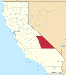
 Deep Springs Location in California | |
| Coordinates: 37°22′18″N 117°59′06″W / 37.37167°N 117.98500°WCoordinates: 37°22′18″N 117°59′06″W / 37.37167°N 117.98500°W | |
| Country | United States |
| State | California |
| County | Inyo County |
| Elevation[1] | 5,194 ft (1,583 m) |
Deep Springs (formerly, Deep Spring) is an unincorporated community in Inyo County, California.[1] It is located in the northeastern section of Deep Springs Valley, 22 miles (35 km) east of Bishop,[2] 2.6 km (1.6 mi) north of Soldier Pass, and 6.4 km (4 mi) southwest of Chocolate Mountain (formerly Piper Mountain),[3] at an elevation of 5194 feet (1583 m).[1]
Deep Springs College is located in Deep Springs Valley, although not at the site of the springs. The Deep Springs post office operated from 1881 to 1883[2] and from 1920 to 1953.[2] The springs, after which the town was named, are now called Buckhorn Springs.[2]
References
- 1 2 3 "Deep Springs". Geographic Names Information System. United States Geological Survey.
- 1 2 3 4 Durham, David L. (1998). California's Geographic Names: A Gazetteer of Historic and Modern Names of the State. Clovis, Calif.: Word Dancer Press. p. 1159. ISBN 1-884995-14-4.
- ↑ "Chocolate Mountain". Geographic Names Information System. United States Geological Survey.
This article is issued from Wikipedia - version of the 11/24/2015. The text is available under the Creative Commons Attribution/Share Alike but additional terms may apply for the media files.