Keeler, California
| Keeler | |
|---|---|
| census-designated place | |
|
Abandoned Carson and Colorado Railroad train depot in Keeler, CA | |
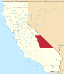
 Location in Inyo County and the state of California | |
 Keeler Location in the United States | |
| Coordinates: 36°29′14″N 117°52′26″W / 36.48722°N 117.87389°WCoordinates: 36°29′14″N 117°52′26″W / 36.48722°N 117.87389°W | |
| Country |
|
| State |
|
| County | Inyo |
| Area[1] | |
| • Total | 1.302 sq mi (3.373 km2) |
| • Land | 1.302 sq mi (3.373 km2) |
| • Water | 0 sq mi (0 km2) 0% |
| Elevation[2] | 3,602 ft (1,098 m) |
| Population (2010) | |
| • Total | 66 |
| • Density | 51/sq mi (20/km2) |
| Time zone | Pacific (PST) (UTC-8) |
| • Summer (DST) | PDT (UTC-7) |
| ZIP code | 93530 |
| Area codes | 442/760 |
| FIPS code | 06-37918 |
| GNIS feature ID | 0244213 |

Keeler is a census-designated place (CDP) in Inyo County, California, United States.[2] Keeler is located on the east shore of Owens Lake 11.5 miles (19 km) south-southeast of New York Butte,[3] at an elevation of 3602 feet (1098 m).[2] The population was 66 at the 2010 census, unchanged from the 2000 census.
Geography
According to the United States Census Bureau, the CDP has a total area of 1.3 square miles (3.4 km2), all land.
Keeler is located along the eastern shores of Owens Lake (a dry lakebed) along State Route 136.
History
When the 1872 Lone Pine earthquake rendered the pier in nearby Swansea inaccessible by uplifting the shoreline, a new pier was constructed to the south at a community named Hawley. In 1880 a new mill was constructed at Hawley by the Owens Lake Mining and Milling Company for processing ore from the Cerro Gordo Mines in the mountains to the east. A town was laid out by the company agent Julius M. Keeler, for whom the town of Hawley was later renamed.
The steamship "Bessie Brady" brought ore from Keeler across the lake to the town of Cartago, however in 1882 the Bessie Brady was destroyed by fire. There was a 300-foot wharf at Keeler, and the steamship route cut days off the time for a freight wagon to circle the lake. She carried 700 ingots at a time in a three-hour crossing.[4] The Carson and Colorado Railroad constructed a narrow gauge railway to Keeler in 1883. The success of the Cerro Gordo mines caused Keeler to boom until silver prices plummeted in the late 1800s.
A second boom of zinc mining in the early 1900s brought new life to the town and a tramway was built to bring the ore from Cerro Gordo to Keeler. There were small surges in the mining of silver, lead, zinc, and limestone; however, by the 1950s all mining had ceased. Train service was stopped in 1960 and the tracks were removed in 1961. Water exports from the Owens Valley to the City of Los Angeles in the 1920s led the Owens Lake to eventually dry up, causing alkali dust storms to blow through Keeler, driving many residents away. Dust remediation efforts in the early 21st century reduced this problem, but few residents remain.
A post office operated at Keeler from 1883 to 1898[3] and is still operating today.
Demographics

2010
The 2010 United States Census[5] reported that Keeler had a population of 66. The population density was 50.7 people per square mile (19.6/km²). The racial makeup of Keeler was 63 (96%) White, 0 African American, 0 Native American, 2 (3%) Asian, 0 Pacific Islander, 0 from other races, and 1 (2%) from two or more races. Hispanic or Latino of any race were 6 persons (9%).
The Census reported that 66 people (100% of the population) lived in households, 0 lived in non-institutionalized group quarters, and 0 were institutionalized.
There were 40 households, out of which 4 (10%) had children under the age of 18 living in them, 13 (33%) were opposite-sex married couples living together, 2 (5%) had a female householder with no husband present, 2 (5%) had a male householder with no wife present. There were 0 unmarried opposite-sex partnerships, and 0 same-sex married couples or partnerships. 23 households (58%) were made up of individuals and 12 (30%) had someone living alone who was 65 years of age or older. The average household size was 1.7. There were 17 families (43% of all households); the average family size was 2.5.
The population was spread out with 9 people (14%) under the age of 18, 1 people (2%) aged 18 to 24, 1 people (2%) aged 25 to 44, 33 people (50%) aged 45 to 64, and 22 people (33%) who were 65 years of age or older. The median age was 59.3 years. For every 100 females there were 120.0 males. For every 100 females age 18 and over, there were 147.8 males.
There were 67 housing units at an average density of 51.5 per square mile (19.9/km²), of which 33 (83%) were owner-occupied, and 7 (18%) were occupied by renters. The homeowner vacancy rate was 3%; the rental vacancy rate was 22%. 55 people (83% of the population) lived in owner-occupied housing units and 11 people (17%) lived in rental housing units.
2000
As of the census[6] of 2000, there were 66 people, 36 households, and 19 families residing in the CDP. The population density was 54.9 people per square mile (21.2/km²). There were 67 housing units at an average density of 55.7 per square mile (21.6/km²). The racial makeup of the CDP was 97% White, 1% from other races, and 1% from two or more races. 12% of the population were Hispanic or Latino of any race.
There were 36 households out of which 11% had children under the age of 18 living with them, 39% were married couples living together, 6% had a female householder with no husband present, and 47% were non-families. 39% of all households were made up of individuals and 22% had someone living alone who was 65 years of age or older. The average household size was 1.8 and the average family size was 2.4.
In the CDP the population was spread out with 14% under the age of 18, 2% from 18 to 24, 11% from 25 to 44, 36% from 45 to 64, and 38% who were 65 years of age or older. The median age was 57 years. For every 100 females there were 112.9 males. For every 100 females age 18 and over, there were 111.1 males.
The median income for a household in the CDP was $19,625, and the median income for a family was $26,250. The per capita income for the CDP was $18,621. There were no families and 9% of the population living below the poverty line, including no under eighteens and none of those over 64.
Politics
In the state legislature, Keeler is in the 8th Senate District, represented by Republican Tom Berryhill,[7] and the 26th Assembly District, represented by Republican Devon Mathis.[8]
Federally, Keeler is in California's 8th congressional district, represented by Republican Paul Cook.[9]
Reference in fiction
Keeler is mentioned in the final chapters of Frank Norris' novel, McTeague (1899).
References
- ↑ "2010 Census U.S. Gazetteer Files – Places – California". United States Census Bureau.
- 1 2 3 U.S. Geological Survey Geographic Names Information System: Keeler, California
- 1 2 Durham, David L. (1998). California's Geographic Names: A Gazetteer of Historic and Modern Names of the State. Clovis, Calif.: Word Dancer Press. p. 1175. ISBN 1-884995-14-4.
- ↑ Roberta Starry, "Dirty Sock and Beyond", Desert magazine, November 1970.
- ↑ "2010 Census Interactive Population Search: CA - Keeler CDP". U.S. Census Bureau. Retrieved July 12, 2014.
- ↑ "American FactFinder". United States Census Bureau. Retrieved 2008-01-31.
- ↑ "Senators". State of California. Retrieved April 11, 2013.
- ↑ "Members Assembly". State of California. Retrieved April 11, 2013.
- ↑ "California's 8th Congressional District - Representatives & District Map". Civic Impulse, LLC. Retrieved April 11, 2013.
External links
- Keeler Post Office: http://stampcollectingroundup.blogspot.com/2007/06/save-keeler-post-office.html