Naogaon District
| Naogaon District নওগাঁ জেলা | |
|---|---|
| District | |
|
Clockwise from top: Balihar Royal Palace, Jogoddol Bihar, Dubalhati Royal Palace, Gaza Society Office, Shadhinota Monument. | |
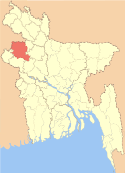 Location of Naogaon District in Bangladesh | |
| Coordinates: BD 24°54′N 88°45′E / 24.90°N 88.75°ECoordinates: BD 24°54′N 88°45′E / 24.90°N 88.75°E | |
| Country |
|
| Division | Rajshahi Division |
| Area | |
| • Total | 3,435.65 km2 (1,326.51 sq mi) |
| Population (2011 census) | |
| • Total | 2,600,157 |
| • Density | 760/km2 (2,000/sq mi) |
| Time zone | BST (UTC+6) |
| Postal code | 6500 |
| Website |
www |

Naogaon (Bengali: নওগাঁ জেলা Nôogã Jela) is a district in northern Bangladesh. It is a part of the Rajshahi Division.[1] Naogaon is a city of the same name in the district.
Upazilas
The district is divided into 11 upazilas:
- Atrai Upazila
- Badalgachhi Upazila
- Dhamoirhat Upazila
- Manda Upazila
- Mohadevpur Upazila
- Naogaon Sadar Upazila
- Niamatpur Upazila
- Patnitala Upazila
- Porsha Upazila
- Raninagar Upazila
- Sapahar Upazila
Administration
_Bangladesh.svg.png)
Administrator of District Council:' Adv. Fozley Rabbi [2]
Deputy Commissioner (DC): Md. Enamul Haque [3]
History
Paharpur

Paharpur is a small village 5 km west of Jamalganj in the Naogaon district where the remains of the most important and the largest known monastery south of the Himalayas have been excavated, Somapura Mahavihara. This 7th century archaeological find covers an area of approximately 27 acres (110,000 m2) of land. The entire establishment, occupying a quadrangular court, measures more than 900 ft (270 m) and is from 12 to 15 ft (3.7 to 4.6 m) in height. With an elaborate gateway complex on the north, there are 45 cells on the north and 44 in each of the other three sides, for a total number of 177 rooms. The architecture of the pyramidal cruciform temple is profoundly influenced by those of South-East Asia, especially Myanmar and Java. It takes its name from a high mound, which looked like a pahar, or hillock.
A site museum built recently houses the representative collection of objects recovered from the area. The excavated findings have also been preserved at the Varendra Research Museum at Rajshahi. The antiquities of the museum include terracotta plaques, images of different gods and goddesses, pottery, coin inscriptions, ornamental bricks and other minor clay objects.
Nine miles west-southwest of Somapura Mahavihara is the archaeological site of Halud Vihara, which has been tentatively listed as a UNESCO World Heritage Site.
Kusumba Mosque
Kusumba Mosque is on the west bank of the Atrai River in Manda Upazila. It was built in 1558-59 during the period of Afgan rule in Bangladesh by a high-ranking official named Sulaiman. It was constructed with a Bengal style.
Patisar
Patisar village is associated with Rabindranath Tagore . It is situated on the banks of the river Nagor, 12 kilometres south-east of the Atrai railway station and 26 kilometers from the district town. The headquarters of the Tagore family's zamindari in Kaligram Pargana was located at Patisar. Dwarkanath Tagore, the grandfather of Rabindranath Tagore, purchased this zamindari in 1830. Rabindranath Tagore first came to Patisarin January 1891. The architectural design of the two-storied Kuthibari of Patisar is similar to that of Shilaidaha-Shahjadpur. The buildings, adjacent to the main mansion, are now reduced to ruins. A pond, named Rabindrasarobar, is now a silted up marsh. During his stay at Patisar, Tagore composed various poems, stories, novels, essays and the verse-play Biday Abhishap . He also established many primary schools, a school named Rathindranath High School,charitable dispensaries, and Patisar Krishi Bank (1905). He introduced tractors in Patisar and formed co-operative societies for the development of agriculture, handloom, andpottery. In 1921, when the zamindari was divided, Patisar was included in Tagore's share. When the poet was awarded the Nobel Prize, the tenants of Patisar gave him an address of honour (1913). On the request of his tenants, Tagore visited Patisar in 1937 for the last time on the occasion of Punya. Every year many devotees of Tagore come from home and abroad to visit Patisar. On the occasions of Tagore's birth and death anniversaries,Govt. arrange and give all facilities to make discussion meetings and cultural functions that held at Patisar.
Dubalhati
Dubalhati is an ancient site in the south-western part of the district. The road to Dubalhati passes through the wide body of water known as “Dighli beel” (a beel is a large shallow lake or marsh). There is a large well in the center of the road for providing travelers with water. Today the road is becoming a recreational place for the town dwellers because of its natural beauty.
The most notable feature of Dubalhati is the "Raja's Mansion" (Jomidar Bari or Rajbari). The house has two parts; the main part, Darbar Hall, is residential and used for holding seminars, while the other part, Natto Shalla, is for prayers. The rajbari is a three-story building standing on wide and long masonry slender spiral columns. There are four large dighi (small lakes) around the site.
The rajbari was first built by Raja Horandro Ray Choudhory during the Pala Dynasty (781–1124). About 53 rajas have held the title, beginning with Jogotram, and ending with Haranath Ray Bahadur II in 1971. Raja Horonath Ray Bahadur I was notable for his construction of schools in Rajshahi and Naogaon district, including Natto Shala, Baganbari, Dubalhati High school, Naogaon K.D. School. He contributed sums of money to the Rajshahi Government College. He founded Dubalhati Raja Horonuth High School, only the second high school in the Rajshahi Division, in 1864. He had many wells and dhighis (small lakes) dug for providing drinking and irrigation water, and provided food to the populace during the famine of 1874.
Economy
Today Naogaon District is considered the bread basket of Bangladesh. It is the central part of Borendra Region, with an area of about 3,435.67 square kilometres (1,326.52 sq mi), about 80% of which is under cultivation. The soil of the area is a fertile inorganic clay called loam.
The total population of the area is about 25 lac, and most of the people of the district are farmers. The literacy rate is 44.39%.[1] Crops grown in the district include paddy, jute, wheat, maize, sugar cane, potatoes, pulses, oil seeds, brinjal, onions, and garlic. The total production of paddy and wheat in 2009-2010 was 13,58,432 metric tons, including a surplus of 8,26,835 metric tons. Today it is the top listed district in the side of rice production and has the highest number of rice processing mills of any district.[4]
Religion
The district of Naogaon has 3864 mosques, 1018 temples, 96 churches and 51 Buddhist churches. Kusumba mosque is the famous mosque in this district.
Notable residents
- Mohammad Baitullah (First Deputy Speaker of Bangladesh Parliament || Most Popular Leader of Bangladesh Awamileague)
- James (Nagar Baul) (singer)
- Politician Awami activist and Mercantile Bank owner Abdul Jolil
- Shishir Nag (Journalist & Communist)

Educational institutes
- Usti Zakeria Senior Fazil Madrasah,Patnitala ,Naogaon-6561
- Usti Govt. Primary School,Patnitala,Naogaon-6561
- Usti B.S High School,Patnitala,Naogaon-6561
- Rahimapur Fazil Madrasah,Akborpur,Patnitala,Naogaon
- Barakhol govt. Primary School, Raninagar
- Barakhol High School, Raninagar
- Barakhol Technical and Business Management College, Raninagar
- Chak Simla High School,Atrai
- Fatepur (2nd) High School
- Chalkmuli High School
- Badalgachi Pilot High School
- Patnitala high school, Patnitala
- Gaganpur Oyajedia Fajil (Degree) Madrasha
- Gaganpur Shahid Zia Technical College
- Gaganpur High School
- Gaganpur Govt. Primary School
- Fatepur (1st) High School
- Kaya para kamar kuri high school, manda
- Manda thana girls scoool and college, manda
- Chalk sumra government primary school.
- Sapahar Technical and Business Management College, Sapahar, Naogaon.
- Chowdhury Chand Mohammad Women's Degree College, sapahar,naogaon
- Jahangirpur Govt. College, Mohadevpur
- Deul Duargpur Alarabia Dakhil Madrasha,Manda, Naogaon.
- Alalpur Hagi Shek Alam High School,Manda, Naogaon.
- Khirshin S.K. High School,Patnitola
- Nazipur Government College
- Nazipur High School, Patnitala, Naogaon
- Nazipur Institute of Engineering Technology(Polytechnic Institute),Nazipur Bazar,Patnitala.
- Shihara High School, Patnitala, Naogaon
- Amanta M.L High School, Patnitala, Naogaon
- Chakuli high School,Manda,Naogoan.
- Modhail BL high School, Akborpur, Potnital, Naogoan
- Kola Bijlee High School, Badal Gachi, Naogaon
- Dubalhati Govt. Primary School, dubalhati, Naogaon
- Dubalhati Hafezia and Forkanea Madrasha, Dubalhati, Naogaon
- Chalkenayet Model Government Primary School
- Naogaon Government Girls High School, Naogaon
- Naogaon Government College, Naogaon.
- Naogaon B. M.C. Government Mohila College, Naogaon
- Naogaon Polytechnic Institute, Dubalhati Road, Naogaon
- Uttarbongo Polytechnic Institute,Dubalhati, Naogaon.
- Dynamic Polytechnic Institute,Chak-Deb, Naogaon.
- Matrix Institute of Health Technology[Paramedical college], Naogaon.
- Momen Shana College, Manda, Naogaon
- Naogaon K.D. Government High School-1884
- Naogaon Zilla School
- Kirttipur High School-1921
- Tilakpur Government Primary School, Tilakpur, Naogaon
- Tilakpur Moslim High School, Tilakpur, Naogaon
- Naogaon Janakallan Model High School
- Gobindapur High School
- Bangal Para Government Primary School
- Hapania High School
- Ratowal Bishwo Kabi Rabindranath Tagore Dimukhi High School
- Paharpur G. M. High School, Established in 1936
- Paharpur Government Primary School
- Best Link Future Development Foundation (Computer Education), Manda
- Jahangirpur Model High School, Mohadavpur
- Saraswatipur High School
- Rasulpur High School
- Kushadanga High School
- Pirojpur High School
- Bilkorilla B.M. High School
- Katkhoir High School
- Pakuria High School
- P.M Girls High School
- Shaluka High School
- M.P, J.N.V. School, a polytechnic college
- Primary Teacher's Training Institute
- Bandaikhara High School
- Katkhoir High School
- Al-Helal Islami Academy & College, Sapahar, Naogaon
- Sapahar Pilot High School, Naogaon
- Sapahar KG School
- Sapahar Government College
- Sapahar Govt. Model Primary School
- Sapahar Govt. Girls School
- Teghoria High School, Sapahar
- Potishor Rothindra Nath Institute,Potishor, Atrai.
- Chandipur High School, Dhamoirhat
- Chalkmoiram Model High School, Dhamoirhat
- Got Gari Shahid Mamun High School & College
- Raigaon High School
- Raigaon College
- Paschim Naogaon High School,Bus Terminal, Naogaon
- Bolihar Dwi-Mukhi High School,Bolihar,Naogaon
- Bolihar College,Bolihar,Naogaon
- Engr. Ahsan Habib School and College,Patari,Shapahar.
- Soguna High School,Niamatpur,Naogaon.
- Barunkandi Primary School, Barunkandi, Naogaon
- Agradigun M.L High School, Dhamairhat, Naogaon
- Bharaduba Akther Hamid Siddique High School(1993),Safapur Union, Mohadevpur.
- Bakharabad Government Primary School(1984),Safapur Union, Mohadevpur.
- Mallickpur High School, Patnitala
- Ilshabari High School,Raninagar Road, Naogaon.
- Ilshabari Govt.Primari School,Raninagar Road, Naogaon.
- Porsha High School, Porsha
- Porsha College, Porsha
- Chak-Atitha High School(1914),Naogaon
- Paik Banda Junior High School
- Katkhoir Govt. Primary School, Sadar, Naogaon- 6510.
- Katkhoir High School, Sadar, Naogaon- 6510.
- Bandaikhara Technical & BM College,Atrai
Newspapers and weekly periodicals
- Azker Khobor[Online Newspaper]
- Rupantor[Monthly]
- Nabajug
- Nabadiganta
- Saptahik Bangabani
- Bakachand
- Nababarta
- Banglar Kantha
- Little Magazine
- Sapahar Barta
- Sangkalon
- Tolpar
- Protichhabi
- Kalbela
- Eisomoy
- Calantika
- Anjali Loho Mor
- Gonomanushar Kotha
- Foring (juvenile magazine)
- Desh news (Online Newspaper)
See also
- Gaganpur
- Al-Helal Islami Academy & College, Sapahar, Naogaon (A Famous Institution)
- Sapahar Pilot High School, Naogaon
- Sapahar Government College
References
- 1 2 Rezaul Karim (2012). "Naogaon District". In Sirajul Islam and Ahmed A. Jamal. Banglapedia: National Encyclopedia of Bangladesh (Second ed.). Asiatic Society of Bangladesh.
- ↑ জেলা পরিষদ [District Commission] (in Bengali).
- ↑ জেলা প্রশাসকের প্রোফাইল [Profile of Deputy Commissioner] (in Bengali). Dcnaogaon.gov.bd.
- ↑ Dali Kalar Kontho, General Knowledge Book
External links
| Wikimedia Commons has media related to Naogaon District. |
-
 Naogaon District travel guide from Wikivoyage
 - http://whc.unesco.org/en/list/322
| Barisal Division | 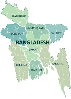 | |
|---|---|---|
| Chittagong Division | ||
| Dhaka Division | ||
| Khulna Division | ||
| Mymensingh Division | ||
| Rajshahi Division | ||
| Rangpur Division | ||
| Sylhet Division | ||